Traumpfad Bergheidenweg
- start: 56729 Arft car park at Raßberg
- destination: 56729 Arft car park at Raßberg
- medium
- 10,28 km
- 3 hours
- 289 m
- 649 m
- 409 m
- 100 / 100
- 40 / 100
The Bergheidenweg is a hiking trail along magnificent paths through mixed forest, along the Nette and with wonderful views of the Eifel. Due to the good connection with the Wacholderweg, it is also possible to really enjoy the juniper heaths.
Highlights at Traumpfad
- Mountain and juniper heaths
- Nette valley
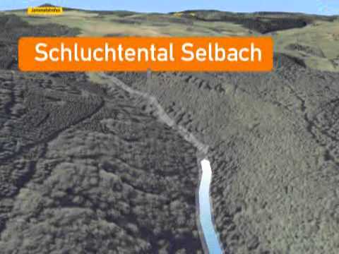
- Canyon valley of the Selbach valley
- Raßberg mountain
- Nature Reserve Heidbüchel
- Dr. Heinrich Menke Park


General information
Directions
This approx. 10 km long cîrcular path has southern flair between juniper heathland and pine woods. Magnificent paths through mixed forest, along the Nette and the Selbach, wonderful views of the Eifel. Whoever would like to really enjoy the juniper heathland can take the connecting path to the Wacholderweg.
The tour starts at the car park of the winter sports centre, not far from Arft, and goes through open heathland into the nature reserve Heidbüchel. Original pine trees line the footpath through the typical sandy and heath vegetation. Having reached the peak of Heidbüchel, a unique view rewards the climb. On the descent through the forest, the footpath forks and one path joins the neighbouring Traumpfad “Wacholderweg“. At the edge of the forest, the path turns left towards Nette valley. After the little village of Netterhöfe, the trail crosses the Nette and then follows the stream into the valley.
Over a wooden bridge the path again crosses the river. In the Selbach valley that follows, high forest surrounds the hiker, impressive cliff walls give the valley a canyon-like character. Upwards along the rippling brook through the forest and later along footpaths up to a refuge hut from where there is a breathtaking panoramic view. The trail continues slightly downhill over open fields. After crossing the L10, the path continues to the Dr. Heinrich Menke Park. After crossing the L10 again, past the Konrad Adenauer Monument, the path goes round the Raßberg mountain. Soon the starting point of the Traumpfad is reached again.
Safety Guidelines
Safety guidance – stay safe whilst hiking on the Traumpfade/Traumpfädchen
Hikers like narrow pathways, unspoilt natural trails (leading over the forest floor, across the grass or alongside streams) and rocky climbs which lead to spectacular views. It goes without saying that particular care should be exercised when taking such routes.
Things to bear in mind when preparing for your hike
- Wear proper clothing that is appropriate to the weather conditions and that will protect you against the cold and the wet or the heat and the sun.
- Schedule suitable breaks during your hike and make sure that you conserve energy.
- Take sufficient liquids with you. Establishments selling refreshments are not available everywhere.
- When hiking on the Traumpfade, please wear appropriate hiking boots which provide a sufficient foothold on slippery, steep, rocky and uneven paths.
- If you do not feel that you are able to negotiate certain parts of the route, then you should avoid such sections or else turn back. Natural pathways may become muddy and treacherous, especially in unfavourable weather.
- In autumn in particular, please remember that leaves lying on the ground may be concealing bumps, routes, stones or holes in the path.
- You will need to expect route impairments of this kind if you are intending to undertake a hike.
- Before setting out, visit https://www.traumpfade.info/traumpfade/wege-status/ in order to find out whether the route you intend to hike is closed or whether diversions are in place. Construction works, timber felling or other disruptions may also be planned.
- Recommended hiking season: April to October
Equipment
Surefootedness and a head for heights are required in some sections.
You should not embark upon the tours in icy conditions.
Robust footwear is recommended!
Details of route closures can be found at: http://www.traumpfade.info/wegemanagement/
Getting there
A 61 Exit Wehr/Nürburgring - B 412 towards Weibern - L 10 towards Arft (1 km before Arft – car park Raßberg/winter sports area) - 56729 Arft, car park at Raßberg
Parking
56729 Arft, car park at Raßberg
Public transit
Destination stop: Arft, Dorfstraße
Line: 388 leisure bus: Mayen - Langenfeld - Arft - Herresbach - Kürrenberg - Mayen (01.04. to 01.11.)
Destination Stop: Netterhöfe Abzw.
Line: 820 Kempenich - Rieden - Mayen
Literature
- Traumpfade & Traumpfädchen Band 2: Die 19 besten Premium-Rundwanderungen in der Vordereifel, Ulrike Poller & Wolfgang Todt ISBN: 978-3-934342-61-3
- 27 Premium-Rundwege Traumpfade, Jubiläumsausgabe 10 Jahre Traumpfade, Ulrike Poller & Wolfgang Todt, ISBN: 978-3-942779-43-2
Maps
- Osteifel mit Laacher-See-Gebiet Wanderkarte 1:25.000 ISBN: 978-3-921805-63-3
Additional Information
Touristik-Büro Vordereifel, Tel.: +49 (0)2651/800995, tourismus@vordereifel.de, www.naturerlebnis-vordereifel.de
Projektbüro Traumpfade, Tel. +49 (0)261/108419, info@traumpfade.info, www.traumpfade.info
Traumpfade-App
Traumpfade-App iOS: App iTunes download
Traumpfade-App Android: App Google play download
Weather


This tour is presented by: Traumpfade im Rhein-Mosel-Eifel-Land, Author: Nicole Pfeifer