Traumpfad Waldschluchtenweg
- start: 56179 Vallendar car park Feisternachbachtal (L309)
- destination: 56179 Vallendar car park Feisternachbachtal (L309)
- medium
- 11,11 km
- 3 hours 30 minutes
- 296 m
- 278 m
- 110 m
- 80 / 100
- 40 / 100
Hiking along the Waldschluchtenweg means the enjoyment of idyllic brook valleys, unspoilt alluvial. Along narrow paths, the trail goes through fairytale forests, past Roman relics.
Highlights at Traumpfad
- Feisternachtbach valley
- World Heritage Site Limes
- Idyllic brook valleys


General information
Directions
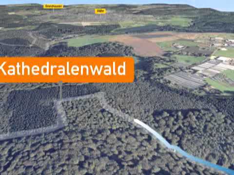
The starting point of this circular hiking trail is the car park Feisternachtbach valley. The trail crosses over the L309 and the Hillscheider brook, and above the brook goes through moderately high mixed woodland, past steep cliffs and the Tannenhof’s fish ponds. The trail again crosses over the L309. In serpentines uphill and then further on at Hirzbach up the valley. Through old high forests the path is first gentle and later goes steeply uphill to round the Kuckucksberg.
At once it goes past the waterworks to the Bember mill. The climb that follows leads to the Limes wall, hidden in the forest, a relic of Roman times that is on UNESCO’s list of World Heritage sites since 2005. Already before the first houses of Höhr-Grenzhausen, at almost a parallel height, the path goes round the side of the Puschenkopf and goes on to the Saustallkopf. In wide serpentines the path now goes downwards into the Feisternachtbach valley, crosses the brook and goes along the left bank downhill to a little lake with a lodge and onwards, back to the starting point.
Safety Guidelines
Safety guidance – stay safe whilst hiking on the Traumpfade/Traumpfädchen
Hikers like narrow pathways, unspoilt natural trails (leading over the forest floor, across the grass or alongside streams) and rocky climbs which lead to spectacular views. It goes without saying that particular care should be exercised when taking such routes.
Things to bear in mind when preparing for your hike
- Wear proper clothing that is appropriate to the weather conditions and that will protect you against the cold and the wet or the heat and the sun.
- Schedule suitable breaks during your hike and make sure that you conserve energy.
- Take sufficient liquids with you. Establishments selling refreshments are not available everywhere.
- When hiking on the Traumpfade, please wear appropriate hiking boots which provide a sufficient foothold on slippery, steep, rocky and uneven paths.
- If you do not feel that you are able to negotiate certain parts of the route, then you should avoid such sections or else turn back. Natural pathways may become muddy and treacherous, especially in unfavourable weather.
- In autumn in particular, please remember that leaves lying on the ground may be concealing bumps, routes, stones or holes in the path.
- You will need to expect route impairments of this kind if you are intending to undertake a hike.
- Before setting out, visit https://www.traumpfade.info/traumpfade/wege-status/ in order to find out whether the route you intend to hike is closed or whether diversions are in place. Construction works, timber felling or other disruptions may also be planned.
- Recommended hiking season: April to October
Equipment
Sturdy shoes are recommended for the tour!
Trail closure can be found at: https://www.traumpfade.info/traumpfade/wege-status/
Tip
+++Der Weg ist mit einer Umleitung wieder wanderbar! (Stand: 22.02.2024)+++
Getting there
B 42 to Vallendar - L 308 towards Höhr-Grenzhausen - L 309 towards Hillscheid - 56179 Vallendar car park Feisternachbachtal (L309)
Parking
56179 Vallendar, car park Feisternachbachtal (L309)
Public transit
Destination stop: Vallendar Schönstatt
Line: Linie 437 Vallendar (Bahnhof) - Höhr-Grenzhausen
from Koblenz main station (bus platform B):
Line 150 (direction Höhr-Grenzhausen) to stop: Schillerstraße Höhr-Grenzhausen - change to line 437 (direction Vallendar) - destination stop: Schönstatt
Line 8 (direction Bendorf - Sayn) to stop: Bahnhof, Vallendar - change to line 437 (direction Höhr-Grenzhausen) - destination stop: Schönstatt
Literature
- Traumpfade & Traumpfädchen Band 1: Die 18 besten Premium-Rundwanderungen an Rhein und Mosel, Ulrike Poller & Wolfgang Todt ISBN: 978-3-942779-64-7
- 27 Premium-Rundwege Traumpfade, Jubiläumsausgabe 10 Jahre Traumpfade, Ulrike Poller & Wolfgang Todt, ISBN: 978-3-942779-43-2
Maps
Top. Karte "Oberes Mittelrheintal/Koblenz (1:25.000) ISBN: 978-3-89637-363-2
Additional Information
Verbandsgemeinde Vallendar, Rathausplatz 13, Tel.: +49 (0)261/6503155, www.vg-vallendar.de
Projektbüro Traumpfade, Tel.: +49 (0)261/108419, info@traumpfade.info, www.traumpfade.info
Traumpfade-App
Traumpfade-App für iOS: App bei iTunes download
Traumpfade-App für Android: App bei Google play download
Weather


This tour is presented by: Traumpfade im Rhein-Mosel-Eifel-Land