Bernkasteler Schweiz - Hiking in Bernkastel-Kues on the Mosel
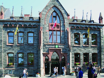
- start: Mosel-Gäste-Zentrum, Gestade 6, 54470 Bernkastel-Kues
- destination: Mosel-Gäste-Zentrum, Gestade 6, 54470 Bernkastel-Kues
- medium
- 11,31 km
- 3 hours 45 minutes
- 365 m
- 419 m
- 108 m
- 60 / 100
- 60 / 100
The "Bernkasteler Schweiz" is perhaps the smallest Switzerland in Germany, if not in the whole world. It is correspondingly unknown and untouched but idyllic and picturesque, located in the Tiefenbach valley.
The starting point of this hike is Bernkastel-Kues. The old town image around the market square has a special charm – one of the most magnificent medieval half-timbered ensembles in the region can be admired here.
Insights into the hiking tour:
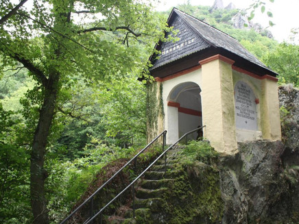
The "Bernkasteler Schweiz" is perhaps the smallest "Switzerland" in Germany. The Tiefenbach flows right through it. At the height of the Tinkel chapel, shortly before the stream flows through Bernkastel's old town, there is a small waterfall. Steeply above the waterfall, the Tinkeler little shrine rises on a rock outcrop. Hinkel stones have always referred to the isolated stones and boulders in the forest. In colloquial speech, the rock in the Tiefenbach valley was called "det Hinkel"; for convenience, the article disappeared and Hinkel became Thinkel and later Tinkel. With climbs and jagged paths, the well over 11 km long route is rather suitable for experienced hikers. Especially the beginning of the route lives up to its name: it goes up and down through the forest, on narrow paths that are, however, very easy to hike.
General information
Directions
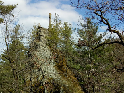
At the tourist information, the "Mosel-Gäste-Zentrum" of Bernkastel-Kues, the hiking trail into the "Bernkasteler Schweiz" starts. Via Karlsbader Platz, you enter through the medieval old town and the elongated Römerstraße into the suburb. After walking through Burgstraße to the end, you cross the traffic light intersection at the Burgberg tunnel. On the other side of the street, you follow the paths and trails into the Tiefenbach valley, mostly parallel to the stream and the federal highway B50 towards Longkamp. The forest trail initially leads to the Tinkel chapel. Those who wish can make a short detour shortly before to the waterfall of the Tiefenbach, which plunges thunderously into the depths here. A few meters behind the chapel, the path branches off to the right and leads over a wooden bridge onto a narrow serpentine path. Only for a short time do you leave the valley to reach it again at the end of the winding path. Along a shaded path along the Tiefenbach, the hiking trail steadily climbs uphill. It ends at the so-called "Bärenhalde", where there is a parking lot and a hiking information board provides orientation. You cross the B50 and turn left onto a forest path on the opposite side of the street. Uphill it goes through the Krauwald to the rock with the "Golden Cross". This wooden cross with gilded beam ends stands on a slate rock and is a reminder of a carpenter. It is said that he had to give up his profession because of his age and had this large beam cross erected. It was probably the fulfillment of a promise made in times of need.
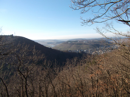
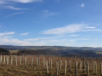
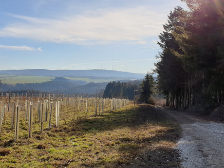
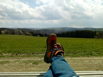
Slightly ascending, you briefly follow the forest path, then turn onto a narrow path leading to the viewing rock Bresgensruh. The viewpoint is named after the district court councilor Hermann Bresgen, who was active at the Bernkastel district court from 1879 to 1897. He had a significant influence on the city's tourism development. After that, you reach a small clearing and the path leads through beech trees to the forest edge, where a sensory bench invites you to rest. From the meadows, you have a wide view into the Hunsrück. Along the forest edge, you soon reach a crossroads with a resting place. You cross the meadow area and follow the path to the track of the "B50 new". Shortly after, keep right twice and hike downhill again to the "Bärenhalde". Either you now take the same path back along the Tiefenbach, or you decide for the forest path and another ascent leading to the "Stone Cross". The cross can then be reached via a small path that branches off from the forest trail. This path also leads you back down to the Tiefenbach, to the Tinkel chapel, and back to the starting point.
Safety Guidelines
Sure-footedness is essential, especially at the beginning. Stable footwear is recommended!
Equipment
Sturdy footwear and packed provisions (no dining facilities on the way).
Tip
There are no dining facilities on the way. It's best to buy a proper snack for the journey – there are several places with great views of the town and the Mosel.
Getting there
From Wittlich via L 52 and K 57. Pass through Platten, past Wehlen, Zeltingen, and Graach.
Parking
Parking is available at the large Mosel parking lot on both the Bernkastel and Kues sides, directly on the Mosel. Parking is free here in the winter months; from April 1 to December 31 parking fees apply.
Public transit
Bernkastel-Kues: Taxi Edringer: 06531 - 8149, Taxi Priwitzer: 06531 - 96970, Taxi Reitz: 06531 - 6455
Nearest/primary stop: Bernkastel Tourist Information; Bernkastel Deinhard's
Literature
WanderGuide - the hiking guide in the Bernkastel-Kues holiday region. With description and map
Maps
WanderGuide - the hiking guide in the Bernkastel-Kues holiday region. With description and map.
Additional Information
Holiday Region Bernkastel-Kues
Gestade 6
54470 Bernkastel-Kues
Tel. 06531/50019-0
Pavings
- Asphalt Coating (6%)
- Street (11%)
- Hiking Trail (57%)
- Path (22%)
- Unknown (4%)
Weather
This tour is presented by: Ferienland Bernkastel-Kues, Author: Lisa Gerber
