Chapel Trail - Hike N4 Nittel
- start: Nittel, corner of Weinstraße/In der Gessel
- destination: Nittel, corner of Weinstraße/In der Gessel
- medium
- 6,28 km
- 1 hour 55 minutes
- 211 m
- 314 m
- 143 m
- 100 / 100
- 60 / 100
Somewhat more demanding circular hike to the scenic Saint Rochus Chapel.
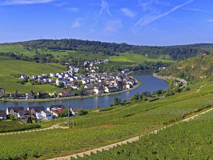
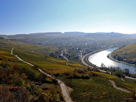
The somewhat demanding hike begins in the Nittel "mountain landscape" from the town centre towards the new development area "Wiesengraben". After a somewhat steep climb, you will soon reach the vineyards, which you accompany for a short time. Now you hike uphill through the forest to the "Kölliger Fels", where you then pass through the Köllig district and are sometimes on the Moselsteig through the forest. At the end of the forest, the tour continues through the vineyards and in the distance you can already see the impressive "Saint Rochus Chapel" located in the Köllig vineyards. The chapel, first mentioned in documents in 1432, is open to visitors on Sundays and public holidays. The further route leads steeply down through the Nittel vineyards back to the town.
General information
Directions
The path marked in blue starts at the village square and leads via the streets "Pflanzgarten" and "Auf dem Wiesengraben" to the cemetery. There it turns right and runs bordered by vineyards towards Rehlingen, before turning left into the forest at the signpost to Elblinglaube and then follows the forest edge with enchanting views of the Luxembourg Moselle side.
After some time, it sharply turns left onto a cosy forest path and then climbs up the forest hill until a beautiful view of the district of Köllig opens up from the ridge.
From there it goes left downhill again into the enchanting, overgrown forest below the spectacular natural monument Kölliger Fels.
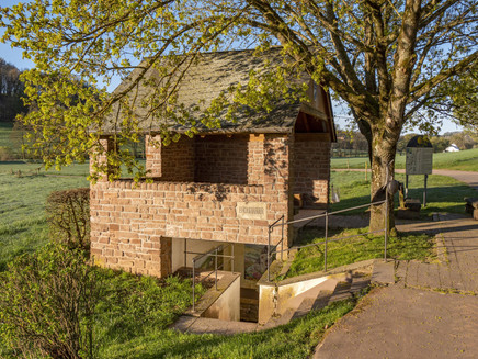
Upon reaching the forest edge, the path follows the course of the Moselsteig to the left and runs along the edge of a meadow until it reaches the forest again at a wider farm track. Shortly after, it turns right into a hollow way towards the Broudermännchesbur fountain, which was created by the so-called Nittel young retirees and equipped with a table and benches to form a nice rest area with a magnificent view into the valley. The story surrounding the fountain (Moselle Franconian "Bur") is told on an information board next to the fountain.
From there, it goes steeply uphill to the Rochus Chapel with once again a great view over Nittel and the neighbouring village Machtum on the other Moselle side. After a short rest and possibly a visit to the chapel, the route follows the Nittel Way of the Cross back to the cemetery and then returns on the already known streets to the village square.
The path runs on different surfaces, from asphalted farm roads through field paths to small forest and meadow trails. It has considerable inclines below the Kölliger Fels and can be very slippery in this section after rainfall. Firm footwear, taking hiking poles, and wearing long trousers due to the risk of ticks when walking through tall grass are definitely recommended.
The hike is consistently signed with the marking "N4".
Equipment
Firm footwear!
Getting there
You can reach Nittel from Perl or Konz via the B 419. From Saarburg, you reach Nittel via the L 135.
Parking
Some free parking spaces are available at the sports ground in Nittel (on L 135 in the Windhof district).
Public transit
DB route Trier - Perl with RB 82 to Nittel station.
Information on current public transport timetables is available at www.bahn.de or www.vrt-info.de/busnetz.
Literature
Tips and information as well as free brochure and map material for the Saar-Obermosel holiday region are available from Saar-Obermosel-Touristik at the tourist information offices in Konz (tel. 06501-6018040) and Saarburg (tel. 06581-995980).
Or order the desired brochures directly from our online brochure shop.
Tip: Saar-Obermosel guest newspaper, Saar-Obermosel leisure map.
Maps
The local hiking map with the exact route guidance is available free of charge at accommodation businesses in Nittel, the village bakery, and the Moselle pharmacy in Nittel.
The map is also available at Saar-Obermosel-Touristik in the tourist information offices in Konz and Saarburg.
The hiking map "Holiday Region Saar-Obermosel" at a scale of 1:35,000 is available for €8.95 at the tourist information offices in Konz and Saarburg.
Or order the map directly from our online brochure shop.
Additional Information
Saar-Obermosel-Touristik, Tourist Information Saarburg, Graf-Siegfried-Str. 32, 54439 Saarburg, Tel. 06581-995980.
Saar-Obermosel-Touristik, Tourist Information Konz, Saarstr. 1, 54329 Konz, Tel. 06501-6018040.
Email: info@saar-obermosel.de
Visit our website with exclusive tips and information about the Saar-Obermosel holiday region and follow us on social media channels:
https://www.saar-obermosel.de/
https://www.facebook.com/saarobermosel
https://www.instagram.com/saarobermosel
https://www.youtube.com/@saarobermosel4183
More information about a stay in Nittel can be found at: https://www.nittel-mosel.de/
Pavings
- Asphalt Coating (25%)
- Crushed Rock (39%)
- Hiking Trail (14%)
- Path (21%)
Weather

This tour is presented by: Saar-Obermosel-Touristik e.V , Author: Saar-Obermosel-Touristik e.V.


