Enkirch Viticultural Trail / Weinbau-Lehrpfad Enkirch
- start: Tourist-Office
- destination: Tourist-Office
- easy
- 3,91 km
- 1 hour 30 minutes
- 110 m
- 208 m
- 99 m
- 80 / 100
- 20 / 100
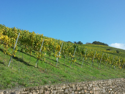
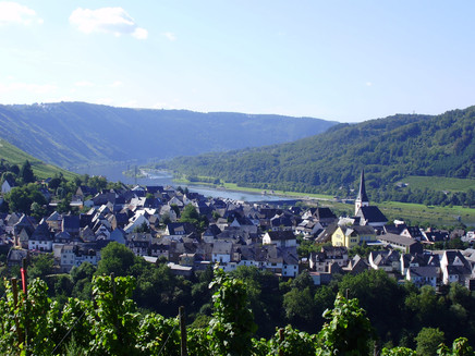
For all wine lovers and those who want to become one, the municipality of Enkirch, one of the largest winegrowing communities in the Moselle, has set up this educational trail in the well-known wine location "Steffensberg".
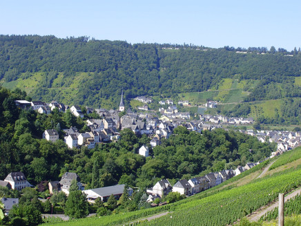
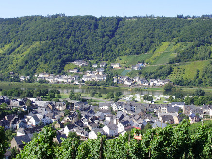
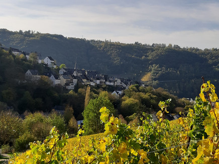
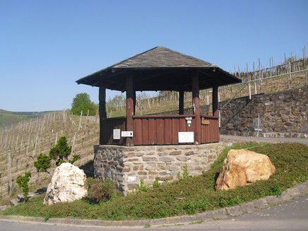
The Steffensberg site is a 70-hectare, pure south-facing slope, and is mainly planted with vines of the "Riesling" variety. Due to the angle of incidence of the sun's rays, soil heating is much cheaper than in the plain. The steepest slope is 70%. On a length of approx. 3.5 km, the nature trail offers interesting information and information about the cultivation and growing of the vine, as well as the annual work processes of the winemaker in the vineyards on a variety of information boards. In addition, the circular hiking trail offers wonderful views of the town, the Moselle valley and the charming side valleys. The starting point is the Marble Bridge. From here it goes up the street "Im Bungert". From here, follow the mark with the grape on the way. At the pavilion take a short breather from the steep climb, (at the front of the pavilion two old cult stones) continue straight to the wine barrel. (Rest area) Downhill past the sundial, back to the starting point.
General information
Directions
From the tourist information office, crossing the pizzeria and into the street "Im Bungert". Then straight on to the vineyards, from here the wine-growing trail begins. Now it goes to the left. At the end of the street on the right past the "Druckkelter". After the second "pressure cell" it goes to the right. At the pavilion straight up to a large wooden barrel. At this barrel on the right down the path, keep going straight past the sundial to the gravel path.
Equipment
The "viticulture educational trail" leads mostly over paved roads, but also over normal vineyard trails - it is recommended to take trekking poles with you.
Tip
To enjoy the view from the pavilion even better, it is recommended to take binoculars with you.
Getting there
By car via the B53, L192 or L193 main roads to Enkirch on the Moselle. Park at the Mosel car park in Enkirch. Approx. 150m to the starting point.
Parking
Parking at the Mosel car park in Enkirch - free of charge. Approx. 150m to the starting point
Public transit
By train (Easter to October): with Mosel-Wein-Bahn to the Kövenig stop, then by ferry to Enkirch. To the starting point approx. 150m from the ferry.
By bus with line 333 (Moselbahn, Trier-Bullay) or line 720 (Bullay-Traben-Trabach) to the Enkirch stop. Approx. 150m to the starting point
Maps
Topographic hiking map "Moselle region Traben-Trarbach Kröv" ISBN 978-3-944620-24-4 - available at the tourist information, Brunnenplatz 2, Enkirch "Panorama hiking map" - available at the Tourist Information, Brunnenplatz 2, Enkirch
Additional Information
Tourist-Information Enkirch
Brunnenplatz 2
56850 Enkirch
www.enkirch.de
Pavings
- Unknown (1%)
- Street (3%)
- Asphalt Coating (10%)
- Crushed Rock (38%)
- Hiking Trail (48%)
Weather
This tour is presented by: Moselregion Traben-Trarbach Kröv, Author: Birgit Immich
