Mertesdorf Panorama Route (ME 1)
- start: Start at Grünhaus Mertesdorf / outdoor pool car park
- destination: Start at Grünhaus Mertesdorf / outdoor pool car park
- medium
- 8,00 km
- 2 hours 30 minutes
- 188 m
- 309 m
- 133 m
- 60 / 100
- 60 / 100
A scenic route with information and rest stops around the oldest wine village in the Ruwer valley.
The 8 km long panorama route takes you mostly on natural and vineyard paths past renowned wineries and to wonderful views of the wine villages Mertesdorf and Kasel. Along the route, you will learn interesting facts about the historical water supply of Mertesdorf and the promotion of biodiversity through orchards and flowering strips. Combined with the Ruwer-Riesling experience route, the path can be extended to approx. 16 km.
The start and end point of the circular route is at the Mertesdorf Grünhaus junction, where the Ruwer-Riesling experience route also starts and ends. Parking is available in the large car park opposite the Mertesdorf outdoor pool, where signposts are already set up. The path is continuously marked in both directions with the logo ME1. In addition, you will find distance information to prominent points on the route as well as kilometer markings at various locations.
Combined with the Ruwer-Riesling experience route, the path can be extended to approx. 16 km.
General information
Directions
The start of the path is at the entrance to Mertesdorf, where also the start of the Ruwer-Riesling experience route is. Sufficient parking spaces can be found about 100 m further on the left side at the Ruwer valley outdoor pool. It is possible to walk the path in both directions.
At the starting point, there is a start board with all useful information about the path. If we then follow the path clockwise, we have our first rather steep ascent right in front of us. We follow the main road, then go through Eitelsbacher Weg into Wenigbach street and follow the markings. A first short rest can be taken at "Ewischboor". The fountain in the old village center at the end of Oberstraße is a fountain that emerged from a water source when Mertesdorf was still a small settlement. One might assume that the name “Ewischboor” refers to the fact that the fountain always supplies water and the spring never runs dry. But the spelling “Ewischboor” shows that the uppermost fountain (in the dialect: ewischte Boor) is probably meant here.
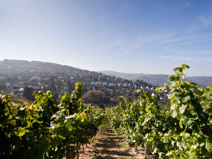
Continuing along the statue of the Virgin Mary, which can be found in a niche of the steeply rising vineyard wall of Herrenberg, into the vineyard site Mertesdorfer Herrenberg. At the next rest stop, there is information about cross terracing, which was created in the neighboring vineyards as part of land consolidation in 2022.
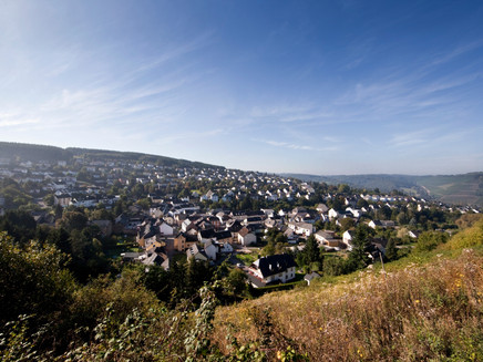
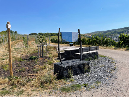
Above the vineyards, the path continues and offers a fantastic view of the wine village Mertesdorf. It leads past information points with a bee showcase and orchard meadow. These rest stops are not only important habitats for insects and birds but also a place of learning for young and old regarding wine, fruit, and agriculture. Here one can observe the blooming, growing, and thriving of fruit according to the seasonal rhythm; grandparents can tell grandchildren when and how harvesting is done, how fruit is processed into juice, or that the worm in the fruit has its justification.
The path then leads through a shady deciduous forest to the station on the topic "wild herbs and flowering strips." The newly created flowering strip here is an easy-to-implement contribution to preserving biodiversity in the local plant and animal world.
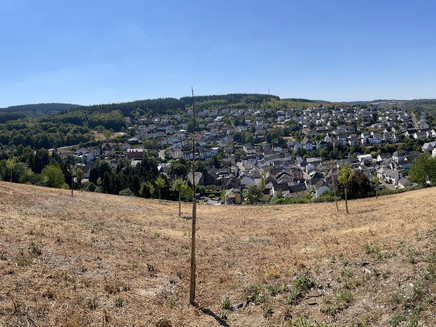
On the further route, we cross K77 and K140 towards Kasel and walk along the uppermost vineyard path towards Johannishütte. Here we enjoy the best views far into the Ruwer valley and to the heights of Hochwald, to the neighboring communities Kasel, Waldrach, and Morscheid. Then it goes towards Mertesdorf, where we meet the rest stop of the Ruwer-Riesling experience route at Lorenzberg. Here we learn everything about the formation of the Ruwer valley and the terroir and climate on the Ruwer. At this point, it is also possible to extend the hike by following the signage of the Ruwer-Riesling experience route towards Kasel. Staying on our ME1 route, the path now leads back into the village via the street “Auf Krein” down, where we turn left and take a short idyllic detour across the Ruwer. At Karlsmühle, an information board still informs about the Roman heritage in the Ruwer valley. The path then leads back to the starting point via the Ruwer-Hochwald cycle path.
Safety Guidelines
The 8 km long path can be walked all year round, considering possible restrictions due to force majeure such as ice, snow or storm damage. The path is classified as medium difficulty due to some inclines. Walking time is approx. 2.5 hours.
Equipment
Sturdy footwear is required.
Tip
Enjoy and experience - Treat yourself to an excellent Ruwer wine at one of the wineries along the roadside.
Getting there
Coming from Trier, into the Ruwer valley via L149 to Mertesdorf. Coming from BAB 602, exit Kenn to Trier-Ruwer and then via L149 to Mertesdorf.
Parking
Free parking at the outdoor pool Ruwer valley car park (49°46'21.0"N 6°43'15.4"E). Alternatively, at the entrance in Waldrach, car park at the family center/Kegelbungert (49°44'58.5"N 6°44'32.7"E) or at the entrance in Kasel car park Main street/village square (49°45'45.3"N 6°43'37.2"E)
Public transit
www.vrt-info.de
Stadtwerke Trier Verkehrs GmbH lines 30 and 86
Pavings
- Asphalt Coating (21%)
- Street (6%)
- Path (1%)
- Crushed Rock (19%)
- Hiking Trail (53%)
Weather

This tour is presented by: Mosel. Faszination Urlaub, Author: Touristinformation Ruwer


