Mosel bike tour to the heart of the parish
- start: Raiffeisenbank in Kleinich
- destination: Starting point (Raiffeisenbank Kleinich)
- medium
- 26,89 km
- 3 hours 25 minutes
- 358 m
- 564 m
- 379 m
- 80 / 100
- 60 / 100
27 km circular route through the parish of Kleinich. Besides beautiful views of the Hunsrück, the Belginum Archaeological Park is one of the sights.
Insights into the bike tour:
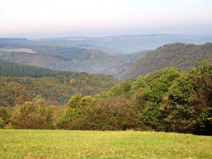
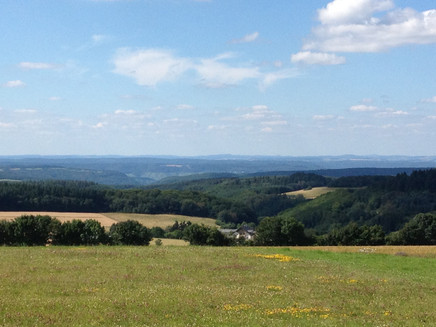
On about 27 km, you can discover the most beautiful spots of the parish of Kleinich, which consists of eight different villages, on the bike circuit, including unique and fascinating views. Each village offers interesting sights such as the Belginum Archaeological Park (the highest point of the route), the cultural barn in Oberkleinich, or various chapels. The bike path leads through forests and open paths, over field paths and asphalted farm roads. You encounter impressive natural highlights such as the Halsterweiher, the 220-year-old oak, or ancient lindens and mighty walnut trees. Another highlight is the magnificent views of the Hunsrück-Eifel landscape, including three Hunsrück peaks Haardtkopf (658 m), Erbeskopf (818 m), and Idarkopf (746 m). Cyclists can refresh at various guesthouses in the individual districts of Kleinich.
General information
Directions
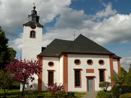
The starting point of the bike path is directly at the Raiffeisenbank in Kleinich. In the immediate vicinity is the Protestant parish church, newly built in 1790. You first start uphill through the village and turn left before the transformer towards the new development area. Passing the development area, turn left onto the "Schulweg" to Oberkleinich (visit to the cultural barn possible with prior registration). In Oberkleinich, turn right, leaving the pretty chapel behind you on the left and cycle on the district road towards the Hunsrück high road. Once in the forest area, turn right onto a narrow path into the "Hochgerichtsheide", to the so-called Poststraße (gravel). After about 1.5 km you reach the shelter. Here a detour to the left to the Halsterweiher, a biotope at 601 m altitude, is recommended. A few meters further on, you can turn right off the bike path and refresh yourself at the spring water of the old Götzeroth water supply (Wilhelmsbrunnen).
Continue along the Poststraße towards Wederath and after about 3 km reach the Belginum Archaeological Park, the highest point of the route (570 m above sea level). Here you can gain insights into the Celtic past of this region. The signs lead you downhill via the K 106 to Wederath, which belongs to the municipality of Morbach. At the village exit, you will rejoin the K 106 and cycle uphill to Ilsbach, the smallest village in the multi-local municipality of Kleinich. In Ilsbach, turn right at the village lime tree and reach the wind turbine built in 1998. From there, continue to Götzeroth. Ancient linden and mighty walnut trees shape the village landscape here. Turning left in the village, cycle zigzag northwest through fields and meadows on a paved farm road to Pilmeroth (please be careful crossing the K 103).
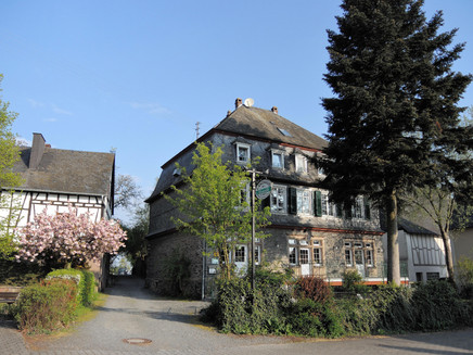
After a circuit through Pilmeroth, you come via the district road to Emmeroth, a village with picturesque farmhouses. In Emmeroth, cycle further to Fronhofen. Here you will find a village street paved with natural basalt stones and a chapel worth seeing.
Alternatively, cycle left by the former school and then straight ahead into the Fronhofen fields. On an asphalted circular route about 6 km long, you can be fascinated by magnificent views of the Hunsrück-Eifel landscape. From the plateau of the 220-year-old oak, you can see three Hunsrück peaks in good visibility: Haardtkopf 658 m, Erbeskopf 818 m and Idarkopf 746 m.
Typically, from Fronhofen, continue on the district road to the eighth district of the municipality of Thalkleinich. This district is reached via a field path branching off on the valley side at the height of Idarhof. In Thalkleinich, stay on the priority road and pass the beautiful village fountain on the right. Now you have to cycle on the rising K 106 towards the Hunsrück high road (B 327). After about 800 meters, turn right onto a initially sandy field path to Oberkleinich for the second time. Upon reaching the village, it is only a stone's throw downhill via the district road to reach the starting point Kleinich in a few minutes and end the circuit.
Safety Guidelines
The circular route is marked (signs in green/white).
Equipment
The route should be well manageable with an eBike (fully charged). For sporty cyclists, a trekking bike or MTB bike is recommended.
Tip
You can refresh yourself with excellent cuisine at Landhaus Arnoth in Kleinich. You should allow 1-2 hours to visit the Belginum Archaeological Park.
Getting there
Coming from Bernkastel, follow the B53 towards Trier through Andel to Mülheim, then turn left in Mülheim towards Mainz/Monzelfeld/Mülheim (L158). Near Kommen at the roundabout take the third exit (B269), then turn right (B50). Then take the third exit again at the roundabout (B327/B50), then turn right towards Kleinich.
Parking
In the center of Kleinich at the Raiffeisenbank.
Public transit
Bernkastel-Kues: Taxi Edringer: 06531 - 8149, Taxi Priwitzer: 06531 - 96970, Taxi Reitz: 06531 - 6455
Literature
All bike paths in the Bernkastel-Kues holiday region are in "aufgestattelt". This brochure is available at all tourist information offices of the holiday region. Also online: aufgestattelt and Radrouten
Maps
aufgestattelt - the bike guide in the Bernkastel-Kues holiday region. Includes description and map.
Topographic map "Bernkastel-Kues" 1:25,000 by LVermGeo.
Additional Information
Bernkastel-Kues Wine and Holiday Region GmbH
Gestade 6
54470 Bernkastel-Kues
Tel. 06531/50019-0
www.bernkastel.de
Pavings
- Unknown (58%)
- Street (25%)
- Asphalt Coating (5%)
- Crushed Rock (11%)
- Hiking Trail (1%)
Weather
This tour is presented by: Ferienland Bernkastel-Kues, Author: Lisa Gerber
