Moselsteig side route Würzlaysteig
- start: Lehmen sports park
- destination: Lehmen sports park
- difficult
- 9,31 km
- 3 hours
- 293 m
- 242 m
- 93 m
- 40 / 100
- 100 / 100
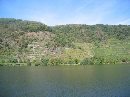
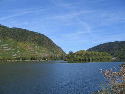
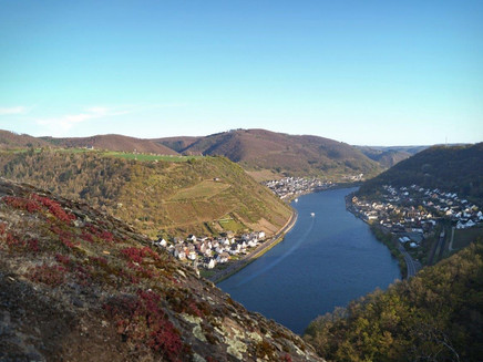
After breathtaking viewpoints on alpine trails above the eponymous Würzlay vineyard, the route continues leisurely over the fields of the Maifeld before you return to the starting point at the Hubertushöhe viewpoint.
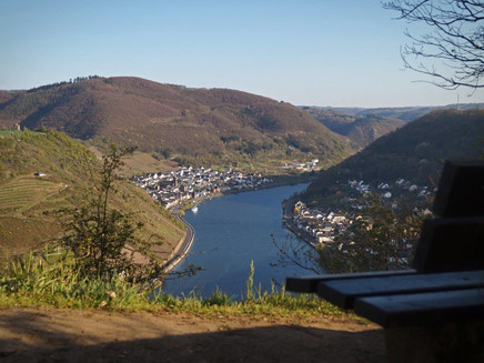
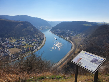
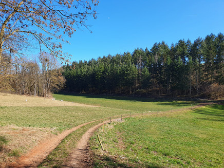
On the first half of the route, the hiker encounters a wild mix of quick landscape changes with vineyards and forest. From the Lehmen sports park, the route initially goes over a wooded natural path. Please observe the recommended direction of travel after starting! Parallel to the town area, after about 1 km you enter the alpine trail above the Würzlay vineyard. Breathtaking viewpoints on the alpine trail with many partly longer ascents and descents above the eponymous Würzlay vineyard reward the hiker. Larger viewing plateaus at the end of the path and at the Ausoniusstein lead into the Flachsbach valley through the Ausoniusstein nature reserve. Then it continues leisurely over the fields of the Maifeld before returning to the starting point at the Hubertushöhe viewpoint.
General information
Directions
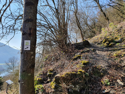
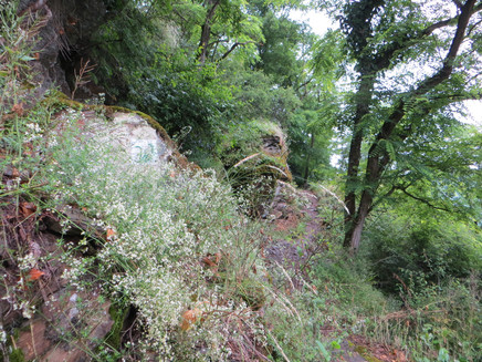
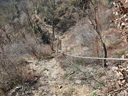
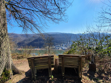
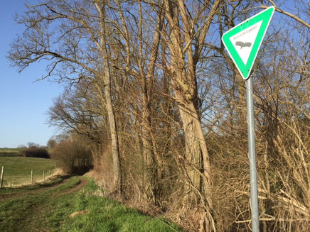
From the Lehmen sports park, the route initially goes over a wooded natural path. Please observe the recommended direction of travel after starting! Parallel to the town area, after about 1 km you enter the alpine trail above the Würzlay vineyard. Here you will experience many changes between Mediterranean climate and shaded deciduous trees. These changes are accompanied by sometimes very steep ascents and descents and many changes in direction. On longer sections, it is difficult for two people to pass each other, hence the recommended direction of travel. You will be rewarded with many breathtaking viewpoints. Benches and rest areas are available at several points. There are also signs indicating rescue points. The alpine section ends at a small viewing plateau. Via a short detour along the Maifeld, you reach the area of the Ausonius hut. There is a side path to the Ausoniusstein, an overhanging rock above the Mosel, on which the famous Roman poet and tutor Decimus Magnus Ausonius (310–393) never set foot 😉. Afterwards, you descend into the Flachsbach valley, cross a small ford, and go back up before the Maifeld village Moselsürsch. The path continues through the Ausoniusstein nature reserve until you finally reach the Maifeld plateau again. Since good conditions exist here for the endangered lark, the path makes a detour via an asphalted path before continuing along the forest edge parallel to the Mosel. The return route is rewarded with another spectacular view at Hubertushöhe. After a short steep descent, it goes back to the starting point.
Safety Guidelines
For your own safety and to protect the flora and fauna, please always stay on the marked paths. The hiking trail has partly steep, difficult, and slippery sections in rainy or winter weather. Therefore, surefootedness and good fitness are essential prerequisites.
NOTE:
We strive to announce all closures due to forestry work or hunting groups on this platform. Nevertheless, there are situations where hiking trails are closed and we may not have been informed. If you unexpectedly come across a trail closure or detour, please observe the instructions for your own safety.
Hazard situations:
In an emergency, quick help is needed. And although mobile phones can send GPS signals, it is often fastest at the classic rescue points. These are located at places accessible to rescue vehicles. Remember the points with green signs and a white cross. In an emergency, return there and give the number on the sign when calling for help. This way, rescuers will know where to find you.
Equipment
- Sturdy and comfortable footwear.
- Weather-appropriate clothing, possibly in layers.
- Backpack with provisions: sufficient to drink and possibly food, as there are not always dining or shopping opportunities available or open.
- Depending on weather conditions, sun or rain protection, as well as insect/tick repellent.
Tip
The path is most beautiful in the morning and towards evening. Follow the side route, not the main hiking trail "Themenweg Würzlaysteig."
There is a bakery and wineries in Lehmen and farm shops in Moselsürsch. If you still have time, visit the Razejungewingert on the Mosel.
Getting there
Coming from Koblenz, follow Bergstraße towards Münstermaifeld. Turn left onto Erlenweg street and follow the signs to the sports park.
Coming from the A61, exit Ochtendung towards Kobern-Gondorf – then onto the B416 towards Cochem – after about 3 km, exit right at Lehmen onto L207 through Lehmen towards Münstermaifeld – at a larger intersection, turn left following signs for "Würzlaysteig" or sports park. Continue following L207 for further access at the "Alte Linde" hiking parking lot (which unfortunately is only a stub now) and in the town center of Moselsürsch.
Parking
Lehmen sports park, Erlenweg, 56332 Lehmen
Additional parking:
Hiking parking lot "Alte Linde" L206 (between Lehmen and Moselsürsch)
Moselsürsch, town center near the church
Public transit
Accessible by train
Travel sustainably with public transport (ÖPNV).
Lines: RB 81 "Moseltal-Bahn" (daily) Koblenz – Trier
Destination stop: Lehmen station - from there, the access path to the Würzlaysteig is signposted
Deutsche Bahn link: https://www.bahn.de/angebot
Maps
Free: Flyer hiking and cycling map 'This Way'; schematic overview of hiking trails in the Sonnige Untermosel region. Information and requests at www.sonnige-untermosel.de
Additional Information
Tourist Information Sonnige Untermosel, Moselstraße 7, 56332 Alken | Tel.: +49 (0) 2605 / 8472736 | touristik@sonnige-untermosel.de | www.sonnige-untermosel.de
Further suggestions for routes: hiking tours in the Untermosel and Middle Rhine regions
Untermosel link: https://www.sonnige-untermosel.de/list/aktiv/wandern
Middle Rhine link: https://www.erlebnis-rheinbogen.de/natur-freizeit/unsere-wanderwege
Pavings
- Path (40%)
- Hiking Trail (51%)
- Asphalt Coating (1%)
- Crushed Rock (7%)
Weather
This tour is presented by: Tourist-Informationen Sonnige Untermosel & Erlebnis Rheinbogen, Author: Julia Assenmacher (Mitarbeiter Tourist-Info)
