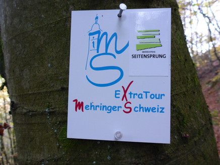
Moselsteig side route Mehringer Schweiz
- start: Parking lot at the Mehring sports facilities
- destination: Parking lot at the Mehring sports facilities
- medium
- 14,06 km
- 5 hours
- 600 m
- 425 m
- 125 m
- 80 / 100
- 60 / 100
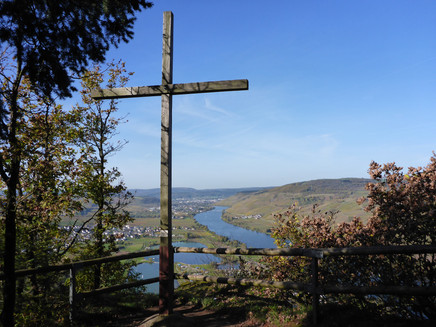
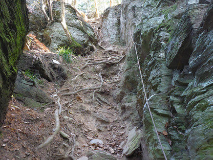
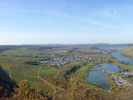
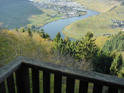
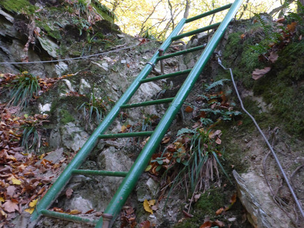
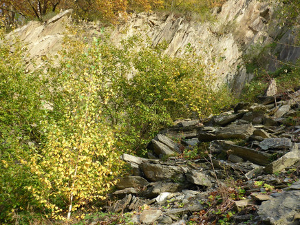
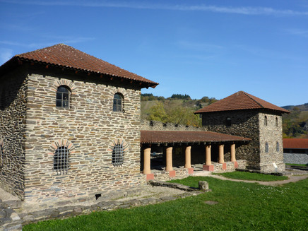
The Moselsteig side route "Mehringer Schweiz" A full dose of Mosel panorama, the reconstructed Roman villa in Mehring, and mega viewpoints such as the "Kumer-Knüppchen" and the "Fünfseenblick" provide plenty of wow moments. A wonderfully composed premium route between relaxed enjoyment and sporting challenge. Summit happiness with a Mosel view – in the "Mehringer Schweiz" this is the ultimate dream combination for a very special adventure trip: between picturesque winegrower villages and sun-drenched vineyards, adventure-seeking hikers and climbing fans can climb steep rock walls on steel cables and experience the thrilling mix of adrenaline and alpine pleasure. The terrain is demanding; some sections require surefootedness and a certain lack of fear of heights in rugged terrain, while the fitness level is tested repeatedly. But don’t worry: the most challenging sections can be bypassed on normal paths. So everyone can dose themselves... …and for the finale, nature and hiking enthusiasts are rewarded with an extra portion of "Mosel view" – sun, water, and vineyard slopes in abundance... The start is at the sports field in Mehring. After just a few minutes, you enter the forest, climb a first steep slope, and follow the Mosel course before you will plunge into the rustic floodplain landscape of the Molesbach. Via climbing route or the more relaxed variant along the stream? Soon you will have the choice. At the foot of the deeply cut Molesbach valley, a signpost offers an interesting alternative route where sportily ambitious hikers can climb the "Kumer-Knüppchen" (320 m above sea level) on the "Mehring/Riol climbing route." The somewhat gentler variant of the side route runs along the stream but also climbs steeply here. Towards the end, it becomes really steep; then the summit is reached, where you can enjoy a wonderful panoramic view. From here, it goes quite relaxed without major inclines through a diverse forest area to the "Fünf-Seen-Blick" viewpoint. The approx. 20 m high wooden viewing tower offers a magnificent 180° view of the harmonious Mosel valley landscape, located between the Hunsrück and Eifel. Due to the narrowness of the Mosel valley and the many river bends, only small parts of the Mosel can be seen, which is why the scenery from up here resembles an extensive lake district. A successful optical illusion... Now heading towards the Mosel, it goes downhill on wonderful forest paths. The first vineyards appear – but also smaller climbing sections. From now on, vineyard paths follow that lead the hiking and Mosel lovers back to Mehring, though not without one last somewhat steeper section – even with ladders – in store. The block rubble of the abandoned slate quarry in the "Pölicher Held" thus demands your entire terrain capability once again. Then it goes back to Mehring relaxed, and just before the end of the route, the Roman "Villa Rustica" constructed in the mid-2nd century AD on an area of 28 x 23 meters is visited. Nature, adventure, and culture – you simply can’t have more... Hiking tips: Via the newly created "Elsbüschenweg," which is marked as a blue line on the map. It divides the "Mehringer Schweiz" side route into two half stages. Corresponding junctions in the terrain indicate this alternative route. We recommend bringing packed food. After the tour, you can choose from a good range of dining options in Mehring. If you are considering walking clockwise, this offers the possibility of using the dining option at Triolago at the end of the tour. But please continue to follow the Moselsteig markings from the summit cross at the "Kumer Knüppchen." Best time: April to October. Many steep and sloping ascents and descents, so only recommended in dry weather. Only partially walkable in ice and snow. In wet weather, the climbing route variants should not be used. The side route should only be walked with suitable (firm) shoes/hiking boots. Gloves can be helpful for the steel cables on the climbing route or the cable-secured passages.
If you are planning a longer mountain hike, the Mehringer Schweiz side tour extratour is just right for you. About 14 km (which can be divided into two smaller circuits if necessary), this challenging circular tour with many elevation meters (one ascent can alternatively also be done over a section with cable-secured passages) passes impressive viewpoints, a dining option, and natural forest sections. In the cultural landscape shaped by viticulture since Roman times, the Roman villa of Mehring represents the cultural highlight directly on the route. The Mehringer Schweiz side tour extratour can be seen as a sporting training session. Those who take a bit more time while hiking will experience the natural trail routing and the magnificent viewpoints more intensively. Not only is the view from the tower at the Fünfseenblick unique. Along the way, there are always views into and of the Mosel valley.
The entire circuit is about 14 km, which is not particularly long, but the ascents and descents on natural paths require stamina and concentration.
General information
Directions
At the starting point of the Mehringer Schweiz side route at the Mehring sports facility, you need to decide in which direction you want to tackle the challenging circular route. If you want to experience the climbing sections, you should hike counterclockwise, as suggested by the description presented here.
Passing between the sports field and sports hall, you reach the hedge-covered hillside edge. From here, the Moselsteig accompanies the side route for a large part of the circuit up to the Fünfseenblick viewpoint. On grassy paths at the edge of the settlement, the trail gently ascends. Past a first viewpoint, the path reaches the forest edge. In the forest, the side route ascends steeply for a short stretch before leading downhill on a former forest road through the hillside made up of slate rocks down to the Mosel level.
The following section along the forest edge is less strenuous, even though the path steadily ascends slightly. Just a short distance from the path lies the recreational facility Triolago, which offers a hotel, restaurant, summer toboggan run, mini golf, and various water sports activities.
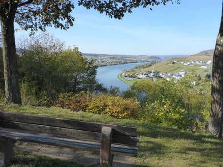
Now the side route becomes sporty! Along the Molesbach, which has impressively carved a channel into the slate rocks here, the path climbs steeply. This section is tough. Over 150 meters of elevation must be overcome in a short distance. The ascent is definitely worth it! Seating and a deck chair invite you to enjoy the magnificent Mosel panorama for longer.
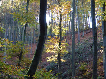
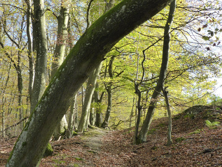
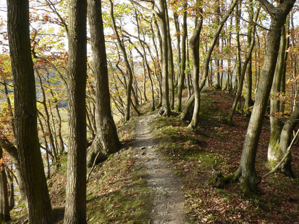
The following section descends steeply into the steep slope of the Mehringer Schweiz via narrow paths, steps, and footholds. Upon reaching a forest road, the side route now stays on a level for a short stretch. The path crosses the MTB trail park route. After a short climb through coniferous forest, a higher forest road is reached, which leads side route and Moselsteig walkers through the wooded steep slope. Because this path steadily ascends, this is hardly noticeable on the varied route. After crossing the district road (the parking lot here can also be used as a start/end point for the side route), you follow a forest road. The following path at the forest edge is even more beautiful thanks to the rustic trees there. Here the highest point of the Mehringer Schweiz side route is reached. Through the high forest dominated by large beech trees, the path leads to a forest road that, after a short ascent, reaches the Fünfseenblick viewing tower.
You shouldn’t miss the view from the approximately 20 m high tower, even though you have to climb 105 steps. Besides the Mosel “lakes,” the panorama over the vineyards and forest areas to the hills of the Eifel is impressive.
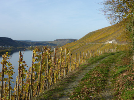
From now on, the path follows only the side route marker, as the Moselsteig continues along the heights, while the side route turns steeply downhill directly at the base of the tower onto a path. In the forest, it continues to descend steeply. Only after crossing a steep ravine does the path remain level on the slope. Over a rocky path, you finally reach the vineyards. The side route now uses the path between forest and vineyards. This allows you to enjoy the view of the Mosel over a longer distance.
The narrow paths in a former quarry are a bit more challenging again (partly with cable protection and iron ladder) but no less impressive. Here you also have to overcome some more elevation. The last section back to Mehring leads through the vineyards (passing a water treading basin and rest areas). A loop on the outskirts leads to the reconstructed Roman villa (Villa rustica), which represents the cultural highlight and a beautiful conclusion to an eventful hike.
Safety Guidelines
In wet weather, the climbing route variants should not be used.
Equipment
The side route should only be walked with suitable (firm) shoes/hiking boots. Gloves can be helpful for the steel cables in the cable-secured passages.
Tip
The side route runs predominantly through forest and in the shade of the steep Mosel hills. This makes the hike suitable even on warm summer days despite the large altitude differences that have to be overcome. If you are considering walking clockwise, this offers the opportunity to use the dining option at Triolago at the end of the tour. Please continue to follow the Moselsteig markings from the summit cross at Kumer Knüppchen.
Getting there
You can reach the Mehring sports facilities from B 53. In Mehring, cross to the other side of the Mosel. Opposite the signposting for the Roman villa, the starting point is located at the sports facilities.
From the Mehring exit of the A1, the K 85 leads to Mehring. The parking lot at the sports facility is located shortly after the town entrance.
Parking
The parking lot at the sports facility offers sufficiently large areas.
Public transit
With bus line 220 every hour from Trier to Mehring - get off at "Brückenstraße"!
From there, it is about 400 meters to the Mehring sports facility and the start/end portal of the hike.
More information on the detailed timetable at: www.vrt-info.de
or directly on the VRT timetable page by entering bus line 220 in the search mask: https://www.vrt-info.de/fahrplanauskunft/XSLT_TRIP_REQUEST2?language=de&itdLPxx_contractor=vrt
Literature
"Seitensprünge Band 1" - 10 premium circular hikes from Trier to Bernkastel-Kues by ideemedia
Authors: Ulrike Poller, Wolfgang Todt, Publisher: ideemedia, 114 pages, size: 11.0 x 16.4 cm, ISBN: 978-3-942779-59-3, €12.95
Maps
Freizeitkarte Moselsteig - Map 2: Trier - Zell (Mosel) (Stages 5 - 14), ISBN: 978-3-89637-420-2
Additional Information
Mosellandtouristik GmbH
Kordelweg 1, 54470 Bernkastel-Kues; phone: 06531/97330
Tourist Information Roman Wine Road
Brückenstr. 46, 54338 Schweich; phone: 06502/93380
Weather
This tour is presented by: Verein Römische Weinstraße e.V., Author: Mosellandtouristik GmbH
