Moselsteig Side Trail Borjer Ortsbachpädche
- start: Burgen, market place
- destination: Burgen, market place
- medium
- 8,73 km
- 3 hours 30 minutes
- 230 m
- 300 m
- 75 m
- 60 / 100
- 40 / 100
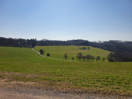
The circular trail leads through forest and valley and rewards with far-reaching views of the Hunsrück and the Mosel valley.
The Moselsteig side trail Borjer Ortsbachpädche, about nine kilometers long, is a varied loop with start and finish in the Mosel village of Burgen. The magnificent distant views, the Hunsrück heights and the idyllic lower Baybach valley invite hikers to explore wide forest and meadow paths, a tight, long climb and rustic forest trails. Shelters invite to the rest.
General information
Directions
The side trail "Borjer Ortsbachpädche" starts right next to the tourist information and follows over the bridge, slowly ascending the road after through the old village center to the last house from the left. From here, a narrow path leads up steps and past vineyards. Then the path goes in serpentines always upwards through the forest. At the "Moselblick" refuge, you are rewarded with views of the Mosel valley and Bischofsstein Castle on the opposite bank of the Mosel.
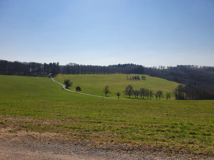
Once you have left the forest, there is a final ascent to an open plateau with a magnificent view of the Hunsrück. Here the view sweeps far over the Hunsrück heights. Several villages can be seen on the horizon and are precisely marked on an information board. Shortly before the Birkenhof, the route turns sharply left into the open fields. The path continues to the Zwergenhütte, which is located at the beginning of the forest, before an imposing beech stand has to be crossed. A descent on a wide forest path leads to the Waldesruh refuge and to the local stream that gives it its name. Shortly after, you reach the hotel "Forellenzucht" with its beautifully designed and maintained fish ponds, which invites you to stop for a break.
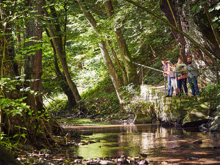
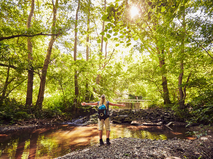
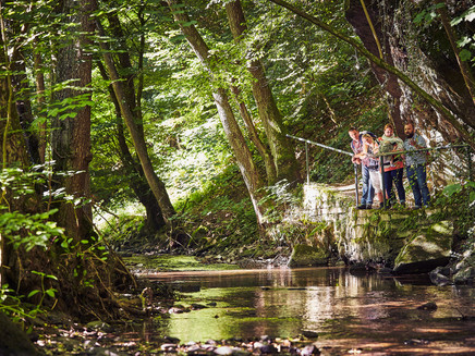
A short passage runs along the road coming up from Burgen. Together with the trout trail, the side trail then turns left after about 100 m, across a wide meadow with many fruit trees. The path then enters the forest. For the next two kilometers, the trail follows the direction of the stream's flow on narrow riverside paths mostly directly along the water and gently downhill. Rugged rocks line the path and the Baybach is also quite wild in its lower reaches. Numerous information boards convey interesting facts about flora and fauna and provide insights into the history of the area. Small rapids and eddies indicate that it is a torrent that rises near the village of Hausbay on the Hunsrück and flows into the Mosel after 30 kilometers near Burgen.
Over a small, short bridge the rushing Baybach is crossed and the path continues on an asphalt sidewalk along the county road in the direction of Schmausemühle, then turn left and pass the cemetery to come back to the tourist information.
Safety Guidelines
The trail should not be hiked in snow & ice.
Equipment
Sturdy shoes are recommended for the tour! This is especially true for the narrow path along the Baybach.
Tip
The shelters invite you to eat the rest you brought with you.
Getting there
A 61, AS Koblenz/Waldesch or Boppard, B 327, L 207 to Alken an der Mosel, B 49 to Burgen. Burgen is located at the B 49 between Treis-Karden and Koblenz
Parking
There are many free parking spaces available on the Moseluferstraße B49.
Public transit
Bus line 301 (Koblenz main station - Burgen), stop Burgen Marktplatz, the stop is in immediate vicinity of the starting point.
Literature
Literature (only available in German):
"Seitensprünge Band 2" - 17 Premium-Rundwanderungen von Bernkastel-Kues bis Koblenz von ideemedia
Authors: Ulrike Poller, Wolfgang Todt, Publisher: ideemedia, 160 pages, Format: 11,0 x 16,4 cm, ISBN: 978-3-942779-60-9, 12,95 €
Maps
Leisure Map Moselsteig Trail – Map 3: Zell (Moselle) - Koblenz (Stages 15 - 24), ISBN: 978-3-89637-421-9
Leisure map Mosel "Maifeld und Untermosel" (1:25 000), ISBN: 978-3-944620-16-9
Free of charge: Flyer Hiking and Cycling Map This way; schematic overview of hiking trails in the Sunny Lower Moselle region. Information and request at www.sonnige-untermosel.de
Additional Information
Mosellandtouristik GmbH
Kordelweg 1, 54470 Bernkastel-Kues; Phone: +49 (6531) / 97330
Tourist information office Sonnige Untermosel
Moselstraße 7, 56332 Alken; Phone: +49 (2605) / 8472736
Weather
This tour is presented by: Tourist-Informationen Sonnige Untermosel & Erlebnis Rheinbogen, Author: Julia Gries
