Moselsteig Stage 02: Palzem - Nittel
- start: Palzem: Station
- destination: Nittel: Station directly on B 419 (intersection Uferstraße/Weinstraße)
- medium
- 16,36 km
- 4 hours 30 minutes
- 330 m
- 315 m
- 140 m
- 60 / 100
- 40 / 100
Variations on the Upper Moselle.
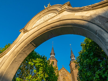
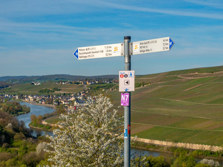
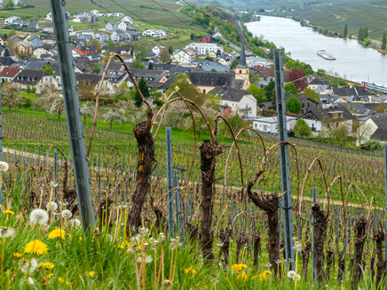
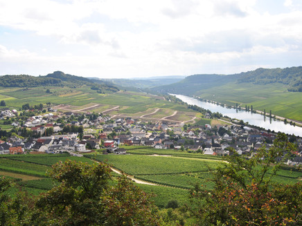
The second stage of the Moselsteig surprises with a particularly varied route guidance. It starts in Palzem, the southernmost Moselle community in Rhineland-Palatinate and directly located on the Luxembourg border. The impressive 'Helfanter Cathedral' with its double towers invites you to visit. The hike continues over short, steep ascents through forests and meadows. Along the way, there are repeated opportunities to pause at impressive viewpoints and – with views of the Moselle – take a break. Finally, it goes through the vineyards along an old Way of the Cross downhill to the wine village of Nittel.
General information
Directions
Your hiking day on this stage starts at Palzem station. Before you start, you could still experience the Roman bridge with its Celtic predecessor Palzem in its original appearance. Download the free ARGO app for this and activate an augmented reality application on your smartphone or tablet that shows you the original structure as if it were still unchanged in its place. The free app and more information about the Roman bridge can be found at www.ar-route.eu.
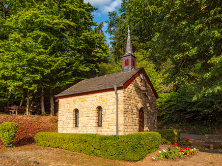
The approach marking guides you past the square in front of the church to the edge of the village. There you cross the federal road and hike a bit along the district road to the chapel. From here the Moselsteig leads through vineyards to the edge of the forest where the St. Michael Chapel stands. Then it continues into the forest and, after crossing a small stream, noticeably uphill. From the edge of the forest, there is a good view of the further route. Apart from the Helfanter mill, the silhouette of a large church can be seen far in the distance: the Helfanter Cathedral, a highlight of this stage.
The path descends to the federal road and follows it, protected by a guardrail, around the bend. The next section leads purposefully to the small village of Helfant, with the surprisingly large church of the village always in view. In the village, you can take a break at the playground or visit the Helfanter Cathedral, which lies just a few steps from the path. It's worth it!
At the back of the large church, the path leads out of the village. Along a stream it goes gently upwards at first. Before reaching the forest, you should look back once more. From here you get a particularly beautiful perspective of Helfant with its extraordinary church.
The next section leads gently but steadily uphill through the Haardt forest. Before the crest, it even gets quite steep, but the view from the edge of the forest compensates for the effort. The view extends over the Moselle valley westward far into Luxembourg. The view of Luxembourg remains the dominant impression on the following section, which leads steadily downhill. The path reaches a new development area of Wincheringen and finally descends steeply to the cycle path in the valley of the stream. From here you can reach the village center or Wincheringen station via side paths.
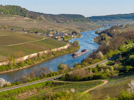
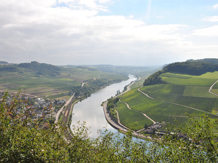
Now the Moselsteig continues along vineyards further downhill to a road, which is only briefly touched before it goes steeply uphill. After a short flat section, where the path passes some houses of Wincheringen, there is a great panoramic view at the edge of the village by a bench! Downstream, you can see the Moselle, framed here on both sides by vines, and further on to Nittel, the stage destination. The next intermediate goal, the Chapel of Rehlingen, can also be easily made out from here.
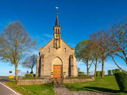
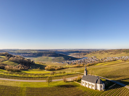
After a short road section, the path reaches the Gemünd shelter. The following section is shaped by an interplay of forest, vineyards and meadows with fruit trees. Shortly before Rehlingen, the path leads on a beautiful trail through magnificent forest. In Rehlingen, the steep ascent to the St. Martin Chapel begins, where a great view rewards your effort. This time the view is mainly upstream on the section already covered.
But the climb is not yet quite done, as a few more altitude meters need to be overcome until the edge of the forest. Up top you get an even more comprehensive panorama towards Luxembourg and France. A short, densely wooded section alternates with a short, steeply descending vineyard section before the Moselsteig again gently ascends above the Rehlingen stream towards the houses of Köllig. However, the houses are not reached, as the path leads uphill again and then over the ridge in the forest.
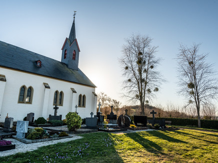
The other side of the mountain delights with a mysterious path section through the ancient path lined by rock walls and old trees. At Hüttenberg the Moselsteig leaves the forest for this stage and in the vineyards the view opens up to Nittel. Well-known rocks complete the panorama of the village from above: here runs the Nittel rock path, which the Moselsteig follows over long sections on the stage Nittel – Konz. The descent into the village leads you over the steep Way of the Cross, ending at the cemetery.
Via the streets Im Bungert and Rochusstraße, the Moselsteig reaches the path to the village center and Nittel station. The Wine Street leads you downhill into the village from here. The station is about 800 m away.
Equipment
- sturdy footwear
- weather-appropriate, suitable hiking clothing
- backpack provisions
Tip
After the climb through the Haardt forest, there is an opportunity to spread out your picnic blanket and then enjoy the panorama well protected among the hedges!
Getting there
Starting point: Palzem via B 419
Destination: Nittel via B 419
Parking
Palzem: Some parking spaces are available at the square with the Moselsteig information board in Bahnhofstraße.
Nittel: Along the station on B 419.
Public transit
You can reach the stage destinations Palzem (station) and Nittel (station) by train (RB 82).
There are regular connections. Please note that during the school holidays of Rhineland-Palatinate / Saarland, on weekends and public holidays, there may be restrictions to the frequency! Please obtain the current timetables from the timetable information on the website of the Verkehrsverbund Region Trier (VRT):
Literature
"Moselsteig" - Official Moselsteig hiking guide by ideemedia, €14.95;
Authors: Ulrike Poller, Wolfgang Todt, Publisher: ideemedia, 300 pages with almost 300 pictures, elevation profiles, QR codes and GPS tracks, format 11.5 x 23 cm, ISBN: 978-3-942779-21-0, €14.95;
"Official Moselsteig hiking maps" in pocket format:
The complete route is divided into 3 maps:
Leisure map Moselsteig - Map 1: Perl - Trier (stages 1 - 4), ISBN: 978-3-89637-419-6
Leisure map Moselsteig - Map 2: Trier - Zell (Mosel) (stages 5 - 14), ISBN: 978-3-89637-420-2
Leisure map Moselsteig - Map 3: Zell (Mosel) - Koblenz (stages 15 - 24), ISBN: 978-3-89637-421-9
Map single: €5.90
Maps in 3-set: €14.50 (ISBN: 978-3-89637422-6)
"Premium set"
Premium set consisting of official hiking guide including 3-set hiking maps, publisher: ideemedia, ISBN: 978-3-942779-24-1, €26.95;
The hiking guides and maps are available from bookstores or on the website https://www.visitmosel.de/wandern/service-infos-tipps under the section "Prospect order".
Maps
Leisure map Moselsteig - Map 1: Perl - Trier (Stages 1 - 4), ISBN: 978-3-89637-419-6
Additional Information
Mosellandtouristik GmbH
Kordelweg 1, 54470 Bernkastel-Kues; Phone: +49 (0)6531/97330
Saar-Obermosel-Touristik e. V.
Graf-Siegfried-Straße 32, 54439 Saarburg; Phone: +49 (0)6581/995980
Saarstraße 1, 54329 Konz; Phone: +49 (0)6501/6018040
Weather

This tour is presented by: Mosel. Faszination Urlaub, Author: Mosellandtouristik GmbH
