Moselsteig Stage 08: Leiwen – Neumagen-Dhron
- start: Leiwen: Intersection Mühlenstraße/Euchariusstraße
- destination: Neumagen-Dhron: Intersection Moselstraße/Pelzersgasse
- easy
- 14,09 km
- 4 hours
- 325 m
- 360 m
- 120 m
- 80 / 100
- 20 / 100
On the trail of our nature.
The stage between Leiwen and Neumagen-Dhron is a fascinating landscape and nature experience. Initially, it leads the hiker on exciting paths through vineyards and past rustic cliff formations. It continues along hedges, forests, and wildlife enclosures. Moreover, this stage promises a view that even Moselle experts find consistently fascinating. The path ends in Neumagen-Dhron, the oldest wine town in Germany, at the dock of the "Stella Noviomagi," a replica of a Roman wine ship.
General information
Directions
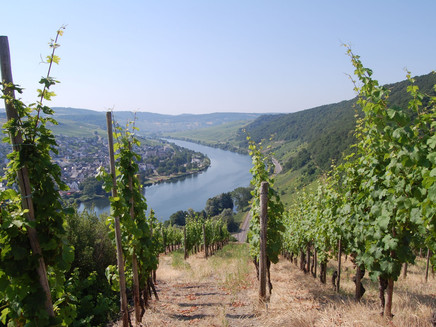
The starting point of this stage is the bus stop at Euchariusstraße or the tourist information in Leiwen. The access path marking guides you through the town to the tennis courts. Here, after about one kilometer, you meet the main path. Just a few meters further, you reach the barbecue hut in the Schantelbachtal, where there is also a large, beautifully designed adventure children's playground. Especially the play opportunities around the Schantelbach offer a lot of adventure potential! The Moselsteig follows the Schantelbach valley upstream. Before reaching the forest, the path crosses a meadow into which the brook has carved its narrow bed. On the other side of the valley, the path now ascends through the vineyards. At the Peace Chapel, which is only a few steps from the path, you should take a moment and enjoy the fantastic view of Leiwen and Trittenheim.
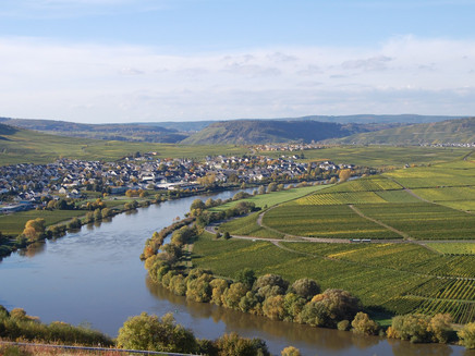
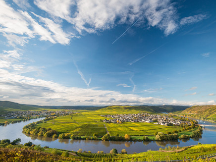
The further ascent behind the chapel first leads through vineyards, which are replaced a bit higher by low forest. At an orchard meadow, the view opens again into the Moselle valley. A shelter also offers resting opportunities so you can enjoy the view a little longer. The route continues through low forest to the edge of the Sonnenberg holiday park, becoming quite steep at the end. Here, above the wildlife enclosure, you should definitely turn around and admire the wonderful view towards the Moselle while catching your breath. The Moselsteig then leads downhill into the forest and remains in the forest along the downhill path. After some houses in the Zummethöhe district, you reach the district road at the parking lot. After crossing, you stand above the vineyards and see the Trittenheimer Mosel loop in front of you – one of the very typical loops of the Middle Moselle lined with vineyards. Trittenheim with its church, located in the middle of the loop, completes this beautiful picture. An access path leads from here to the famous wine town.
Via stairs, the Moselsteig reaches the ridge, and now the path briefly leaves the Moselle valley to ascend through former vineyard areas in the side valley of the Kleine Dhron. The sun often shines on this side of the mountain while fog still hangs in the Moselle valley. Thus, the view is free into the valley towards the few houses of the Dhrönchen district, where the writer Stefan Andres was born. Moselsteig hikers also encounter him in Schweich. At the Vogelsang barbecue hut, you reach the edge of the Moselle valley again, and after a few meters, you stand at the Vogelsang viewpoint, which offers a view of the Trittenheimer Mosel loop from a different perspective. A small platform below the path stands almost vertically above the Moselle as a lookout.
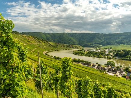
You hike along the ridge on a forest road to the meeting point with the Römersteig. Here, you can reach Trittenheim via a path, and you should definitely take a small detour to a viewpoint (see the author's tip)! After a short trip into the hinterland over one of the many Moselle terraces, the Moselsteig returns to the ridge and offers unique views on a beautiful natural path over the steeply descending rocks and slopes down to the Moselle. The path leads into a side valley and steeply downhill in the forest. Shortly before reaching Moselle level, you reach vineyards again. At the Martyrs' Chapel, the descent is complete.
Between the road and vineyards, the Moselsteig continues along the Way of the Cross towards Neumagen. A short section along the bike path follows, then you reach the edge of the town. Via a meadow path (the former track of the Moselbahn), you pass the marina and campsite into the center of Neumagen-Dhron. In the summer months, the replica of a Roman wine ship, the , moors in the harbor and offers a worthy end to this Moselsteig stage!
Equipment
- sturdy footwear
- weather-appropriate, functional hiking clothing
- packed meals
Tip
As a resting place, the meadow plateau above the slate caves is suitable. The spot is a bit off the path, which means it is somewhat quieter here, but the view is no less beautiful than at the well-known places.
Getting there
Starting point: Leiwen A 1, AS Föhren/Bekond and then L 48 or B 53 and L 48
End point: Neumagen-Dhron via B 53
Parking
Leiwen: small parking lot directly at the Euchariusstraße bus stop, more parking spaces are available at the Platz in Schulstraße
Neumagen-Dhron: large parking lot on the Moselle bank in the area of the Stella Noviomagi
Zummethöhe: hiking parking lot on L 148 approximately in the middle of the daily stage
Public transit
You can reach the stage towns Leiwen (Euchariusstraße bus stop or Zummet bus stop) as well as Neumagen-Dhron (Realschule plus bus stop) by bus line 220.
There are regular connections. Please note that during school holidays in Rhineland-Palatinate/Saarland, on weekends, and on public holidays, there may be schedule restrictions! Please check the current daily times on the website of the Verkehrsverbund Region Trier (VRT):
Literature
"Moselsteig" - Official Moselsteig hiking guide by ideemedia, €14.95
Authors: Ulrike Poller, Wolfgang Todt, Publisher: ideemedia, 300 pages with almost 300 pictures, elevation profiles, QR codes, and GPS tracks, format 11.5 x 23 cm, ISBN: 978-3-942779-21-0, €14.95
"Official Moselsteig hiking maps" in pocket format:
The entire route is divided into 3 maps:
Leisure map Moselsteig - Map 1: Perl - Trier (Stages 1 - 4), ISBN: 978-3-89637-419-6
Leisure map Moselsteig - Map 2: Trier - Zell (Moselle) (Stages 5 - 14), ISBN: 978-3-89637-420-2
Leisure map Moselsteig - Map 3: Zell (Moselle) - Koblenz (Stages 15 - 24), ISBN: 978-3-89637-421-9
Individual map: €5.90
Maps in 3-set: €14.50 (ISBN: 978-3-89637422-6)
"Premium Set"
Premium set, consisting of the official hiking guide including a 3-map set, Publisher: ideemedia, ISBN: 978-3-942779-24-1, €26.95
The hiking guides and maps are available in bookstores or on the website https://www.visitmosel.de/wandern/service-infos-tipps under the section "Prospect order".
Maps
Leisure map Moselsteig - Map 2: Trier - Zell (Moselle) (Stages 5 - 14), ISBN: 978-3-89637-420-2
Additional Information
Mosellandtouristik GmbH
Kordelweg 1, 54470 Bernkastel-Kues; Telephone: +49 (0)6531/97330
Tourist Information Roman Wine Route
Brückenstraße 46, 54338 Schweich; Telephone: +49 (0)6502/9338-0
Tourist Information Holiday Region Bernkastel-Kues
Gestade 6, 54470 Bernkastel-Kues; Telephone +49 (0)6531/500190
Weather

This tour is presented by: Mosel. Faszination Urlaub, Author: Mosellandtouristik GmbH
