Moselsteig Stage 17: Ediger-Eller – Beilstein
- start: Ediger-Eller: Ediger district, square in front of the Tourist Information on Mosel wine road (B 49)
- destination: Beilstein: Square opposite the ferry terminal
- medium
- 15,98 km
- 5 hours
- 525 m
- 240 m
- 85 m
- 60 / 100
- 40 / 100
Of Roman graves and fairy tale places.
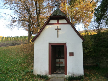
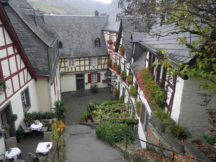
A challenging stage that leads right through cultivated vineyards and offers varied views of the Mosel valley. After starting in Ediger-Eller, the route passes numerous shrine chapels. An access path to the Roman graves in Nehren, whose vault paintings are the best preserved north of the Alps, provides an option for a detour. After a vineyard section, the path continues over a narrow forest path through the Briederner Schweiz, which impresses with its stunning nature. Past the large Carmelite church, the path leads over the famous monastery stairs to the stage end point Beilstein. The small Mosel village is also known as the "Sleeping Beauty of the Mosel" because in the past it was often used as a filming location for homeland films with its small alleys and half-timbered backdrop.
General information
Directions
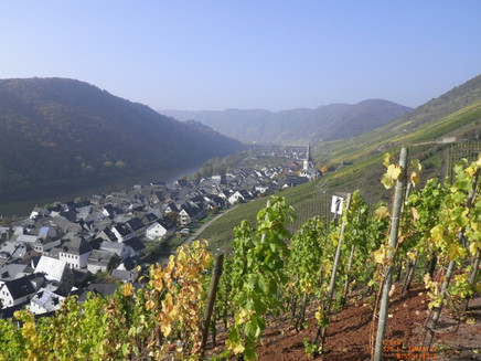
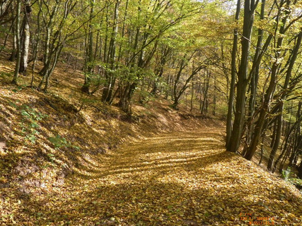
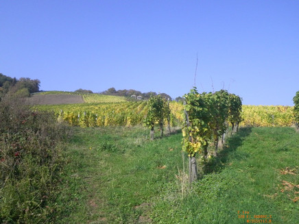
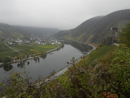
This stage starts at the square in front of the Tourist Information. Via the access path, you reach the Moselsteig at the edge of the town. From here, you first hike through the Pehrbach valley past countless shrine chapels and in a large, gently ascending loop to the other side of the valley. The vineyard path on the slope now remains at a height for a while. Be sure to take a look back: the densely packed houses of Ediger and Eller in the narrow, vine-covered Mosel valley and in the background the steeply falling rock faces of the Calmont make a wonderful picture! The vineyard path now climbs and leads mostly through no longer cultivated areas. In the forest, it goes quite steeply uphill for a short distance. In return, you will advance more easily on the following section. Through beautiful deciduous forest, you cross a side valley and reach the vineyards again at the forest edge. Anyone who wants to visit the Roman graves Nehren on the ridge can change here to a marked access path. The Moselsteig now leads down through the vineyards to the outskirts of Nehren.
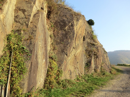
The intermediate section to Senhals runs rather unspectacularly through vineyards. You cross the B 49 over a bridge. Now you also walk through the small district Senheim on quiet local streets before crossing the bridge to the Hunsrück side. You continue along the dam beside the harbor basin. After crossing the road, a short access path branches off to the town center and the bus stop. The Moselsteig leads along the edge of the town and then steeply uphill into the vineyards. At the Margareten hut, you have almost mastered the climb; from here, the path runs for a longer section without major elevation changes. Again and again, wonderful views of the Mosel valley with the towns of Senheim and Mesenich and impressive slate rock formations await you! The Mesenich Stone Rich Cap cultural trail also runs here: There are play stations along the way, stone-carved artworks, and you learn various interesting facts about the topic of stone. In the Mesenich Goldgrübchen vineyard site you will find a approx. 2.5 m high head made of stone in front of a dry stone wall, the Mesenich Stone Rich Cap. Also striking are the many dry stone piles, also called stone riches. These stone accumulations have a special significance for flora and fauna. They are often reinforced with a dry stone wall and thus offer a habitat for heat-loving plant and animal species. Therefore, the Mesenich Stone Rich Cap is considered a focal point of biological diversity (https://www.lebendige-moselweinberge.de/leuchtpunkte.html). The focal point is signposted on site. You access further information via a QR code. The following link https://www.youtube.com/watch?v=48yH9HpvIPU&t=2s shows you a great video about the diversity of the Mesenich Stone Rich Cap. The endpoint of this section is the recreational area Mesenich. How about a strengthening break here? And maybe you also take a look into the quite worth seeing chapel. You reach Mesenich itself from here via an access path.
Extensive vineyards now accompany the Moselsteig further towards Briedern. You circle a cellar complex and can reach the town from here via a short access path. At the end of another vineyard section, the stage destination Beilstein comes into view for the first time: You see the large monastery church and above the town the ruins of Metternich castle. On the other side of the Mosel, surrounded by vineyards, Ellenz-Poltersdorf can be seen. Now the side valley of the Talbach is to be crossed. The small chapel on Wahlberg is only a few meters off the path. In front of the chapel, you have a lovely view of the Mosel valley and Briedern.
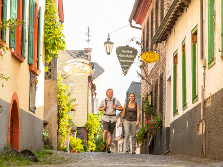
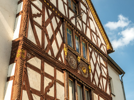
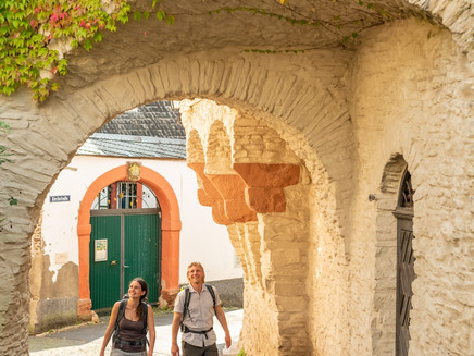
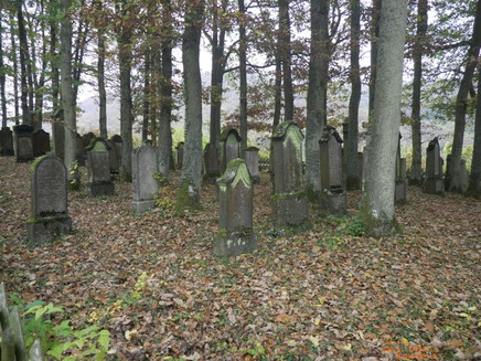
Then begins the path section through the forest slope of the Briederner Schweiz. The path through the steep slope is very narrow and requires attention, but it also offers a beautiful nature experience in the forest. The path ends at the Jewish cemetery above Beilstein. When you leave the forest here, you look at the impressive complex of the ruins of Metternich castle. And at the old walls themselves, you are rewarded again with a charming view into the Mosel valley and to Ellenz-Poltersdorf on the other side! The descent into the town leads the Moselsteig over paths and stairs. Directly past the monastery church and over the monastery stairs, you reach the half-timbered alleys of the town known as the "Sleeping Beauty of the Mosel." The endpoint of this stage is the square on the Mosel, exactly opposite the ferry terminal.
Equipment
- sturdy footwear
- weather-appropriate, functional hiking clothing
- packed lunch
Getting there
Starting point: Ediger-Eller via the B 49 between Alf and Cochem
Destination point: Beilstein via the L 98 between Senheim and Cochem
Parking
Ediger-Eller: Parking spaces along the Mosel riverbank road (B 49)
Beilstein: The few parking spaces in the area of the ferry terminal are often occupied. A large parking lot is located a little upriver on the L 98.
Public transit
You reach the stage towns Ediger-Eller as well as Beilstein.
Bus connection between Ediger-Eller (stop at train station or Bachstraße) and Ellenz-Poltersdorf (stop Mosel ferry) with line 711, ferry between Ellenz-Poltersdorf and Beilstein.
There are regular connections. Please note the ferry times!
Please note that during school holidays in Rhineland-Palatinate / Saarland, on weekends, and on public holidays, there may be restrictions on the frequency! Please check the current daily times in the timetable information on the website of the Rhein-Mosel transport association (VRM): www.vrminfo.de
Literature
"Moselsteig" - Official Moselsteig hiking guide by ideemedia, €14.95
Authors: Ulrike Poller, Wolfgang Todt, Publisher: ideemedia, 300 pages with almost 300 pictures, elevation profiles, QR codes and GPS tracks, format 11.5 x 23 cm, ISBN: 978-3-942779-21-0, €14.95
"Official Moselsteig hiking maps" in pocket format:
The entire route is divided into 3 maps:
Leisure map Moselsteig - Map 1: Perl - Trier (Stages 1 - 4), ISBN: 978-3-89637-419-6
Leisure map Moselsteig - Map 2: Trier - Zell (Mosel) (Stages 5 -14), ISBN: 978-3-89637-420-2
Leisure map Moselsteig - Map 3: Zell (Mosel) - Koblenz (Stages 15 - 24), ISBN: 978-3-89637-421-9
Single map: €5.90
Maps in 3-set: €14.50 (ISBN: 978-3-89637422-6)
"Premium Set"
Premium set, consisting of official hiking guide including 3-map set, publisher: ideemedia, ISBN: 978-3-942779-24-1, €26.95
The hiking guides and maps are available in bookstores or on the website www.moselsteig.de under the section "Brochures & Information Material".
Maps
Moselsteig leisure map - Map 3: Zell (Mosel) - Koblenz (Stages 15 - 24), ISBN: 978-3-89637-421-9
Additional Information
Mosellandtouristik GmbH
Kordelweg 1, 54470 Bernkastel-Kues; Phone: 06531/97330
Tourist Information Ferienland Cochem
Endertplatz 1, 56812 Cochem; Phone: 02671/60040
Weather

This tour is presented by: Mosel. Faszination Urlaub, Author: Mosellandtouristik GmbH
