Moselsteig Stage 19: Cochem – Treis-Karden
- start: Cochem: Carlfritz-Nicolay-Platz or Cochem train station
- destination: Treis-Karden: district Karden, St.-Castor-Straße right next to the train station
- difficult
- 23,92 km
- 8 hours 30 minutes
- 830 m
- 335 m
- 85 m
- 80 / 100
- 100 / 100
Detour in time and space.
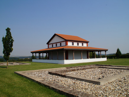
The Moselsteig shows great variety here, offering worthwhile detours, e.g. to a roaring waterfall in the Dortebachtal nature reserve with its exotically appearing microclimate, or to one of many places to stop in the idyllic wine villages along the route. Directly on the Moselsteig, the Martberg Archaeology Park invites you to take a journey through time in the faithfully reconstructed buildings of the former Celtic-Roman mountain sanctuary. But this stage also offers a lot in terms of landscape; the path leads through beautiful high forest, vineyards and along stream valleys, until the stage destination Treis-Karden is reached.
The long stage can be well divided into two or three sections by the train stations in Klotten and Pommern and is also suitable as a family route (see author's tip)!
General information
Directions
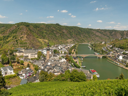
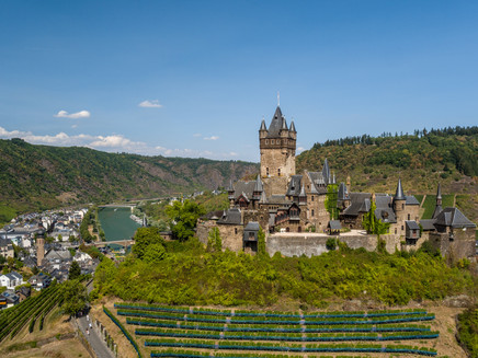
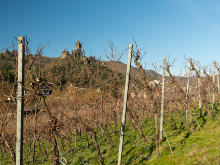
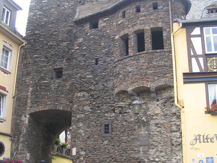
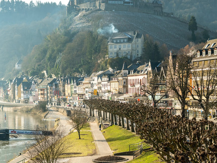
You start your extensive hiking day – this stage is one of the longest on the Moselsteig – from Carlfritz-Nicolay-Platz at the Mosel Bridge. From here you pass the Old Thorhaus and walk along Endertstraße towards the valley station of the chairlift. Along the way, the Moselsteig passes under the railway line directly at the portal of the Kaiser Wilhelm Tunnel, which was the longest railway tunnel in Germany until the ICE era. Upon reaching the chairlift to Pinnerberg, you can choose whether to tackle the first ascent of the day by lift or on foot. Those who decide to ascend on foot cross the Endertbach on a footbridge and then climb steeply on a path studded with steps, partly under the cable car route, uphill towards Pinnerkreuz. Enjoy the wonderful view of the town and Reichsburg Cochem along the way! You shouldn't miss the short detour to Pinnerkreuz, which is located on a rocky ledge – from here you get the best view of Cochem. Then a few more rocky meters uphill, and you reach the top station of the chairlift and the gastronomy on Pinnerberg (observe opening hours).
The next intermediate destination is not far away: after a steep climb through the forest, a flat section along an asphalt path, and a final stretch uphill, you reach the Klotten wildlife and leisure park. The Moselsteig now leaves the park area as a slightly descending path and enters the forest along the edge of the slope. At a shelter you can take a look into the Mosel valley. However, the view from the nearby Rabenlay is much better, but this requires a small detour from the main path. A little further down the path you reach the Schwedenkreuz, where there is a covered rest area – an ideal spot for a refreshing break in any weather! The slope edge allows one last view of Cochem. The Moselsteig now shortens some of the hairpin bends of the driveway by path and reaches the Seitz chapel, which stands idyllically next to large chestnuts. From here you can see Klotten, the town you will reach next.
The Moselsteig now leads over the highest vineyard path to the Friedenskreuz and then into the forest. A steep path leads downhill to the Klotten cross path. You meet Wildparkstraße and follow it past a chapel into the town. However, the Mosel only leads here after a small detour. Through the vineyards below Coraidelstein castle you come to Richeza-Platz, which also offers a beautiful view into the Mosel valley. A loop through the vineyards then finally brings you back to the edge of town and via stairs you reach the town center. Now it is not far to the train station and to Haus Moselschiefer, where there is a large car park and the tourist information.
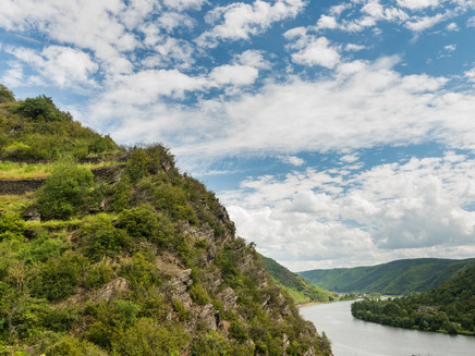
The next highlight is the Dortebachtal nature reserve. You reach its entrance at a railway underpass after a section along the railway and federal road. The small side valley is one of the driest and warmest along the entire Mosel. A special flora and fauna has developed on the steep slate slopes. You walk along the creek up to the first wooden footbridge. There the Moselsteig switches to the other side of the creek and leads quickly uphill on steep paths on the oak-wooded slope. Once at the top, you should take a small detour (marked connecting path) to the Kasteschkopp viewpoint: the covered rest area is a good place for a break and the view into the Mosel valley is fantastic – it extends from Klotten to Pommern downstream.
The next section is mainly over meadow paths; it goes along the forest edges on the hillside of the Dortebachtal. Somewhat removed, you pass the Annischerhof and then cross the field-covered plateau to the opposite forest edge. In the forest you reach the other bank of the Fellerbach by stepping stones. Now a little further uphill in the forest gorge of the creek, then the ascent is initially accomplished! Through a large windthrow area and then along the forest edge, the Moselsteig now leads to Kail, from where you had a nice view earlier. In the small town, the unusually large church stands out. The "Café zur Tanke" in Kail is located directly on the Moselsteig and invites you to take a break and linger after the long hike. Directly on the edge of town, the path then descends into the Schilzergraben, which cuts deeper into the plateau and finally forms a respectable gorge. The path first follows the creek for quite a while until it is back at the vineyard edge on the Mosel valley slope after a small intermediate climb. Now you hike parallel to the Mosel valley through the vine plantations along the freshly consolidated slope. Past the Pommern sundial you soon reach Pommern via the cross path. The village's train station is connected by a short connecting path.
After you have crossed the Pommern creek, it goes uphill again in the town – then steeply uphill on old vineyard paths, with the view into the Mosel valley improving with each meter of altitude. The second part of the ascent leads through the forest, which thins out on the Martberg plateau. At the top, you come across a partially reconstructed Roman temple site and rebuilt Celtic houses – take some time to visit them in peace! Those looking for a resting place with a view will find it via a short connecting path at the Fahrlei viewpoint. The Moselsteig continues on winding paths to the hillside edge, where you have a pretty view of the Mosel and Treis-Karden from several points. The descent leads over paths partly closely lined by boxwood to the St.-Castor viewpoint and the hut at the Josefinenrast. Both offer a nice view of the St.-Castor Basilica in Karden. You continue walking on a now only moderately descending former vineyard path with a relaxed view over the entire Mosel valley at Treis-Karden. From a hairpin bend it then goes steeper downhill again and into the town. On St.-Castor-Straße, barely 100 m from the train station, this stage ends.
Equipment
- Sturdy footwear
- Weather-appropriate, practical hiking clothing
- Backpack provisions
Tip
Tip for families: The Moselsteig section from Cochem to Klotten is also suitable as a family route! The ascent in Cochem to Pinnerkreuz can be done with a chairlift ride (no stroller transport). Towards Klotten, the Moselsteig leads directly to the Klotten wildlife and leisure park (open from April to October). From there, the Moselsteig continues comfortably to Klotten. The tour ends at the local train station and a short train ride takes you back to Cochem. The tour is 7 km long (from Cochem train station to Klotten train station, from the Cochem chairlift to Klotten train station it is 6.8 km). In Cochem, the Reichsburg, the indoor wave pool/swimming pool with its own children's area, or a boat trip on the Mosel provide variety for the kids.
Getting there
Starting point: Cochem via B 49
Destination: Treis-Karden via B 49 or B 416
Parking
Cochem: Most parking spaces in Cochem require a fee. Behind the train station there is a large parking lot.
Treis-Karden: There is a parking lot near the train station.
Public transit
You can reach the stage towns of Cochem (train station) and Treis-Karden (train station) by train (RB 81 or RE1).
There are regular connections. Please note that during school holidays in Rhineland-Palatinate / Saarland, on weekends and public holidays, there may be reduced frequency! Please refer to the current daily timetable on the website of the Rhein-Mosel transport association (VRM):
Literature
"Moselsteig" - Official Moselsteig Hiking Guide from ideemedia, €14.95
Authors: Ulrike Poller, Wolfgang Todt, Publisher: ideemedia, 300 pages with almost 300 pictures, elevation profiles, QR codes and GPS tracks, format 11.5 x 23 cm, ISBN: 978-3-942779-21-0, €14.95
"Official Moselsteig Hiking Maps" in pocket format:
The entire route is divided into 3 maps:
Leisure map Moselsteig - Map 1: Perl - Trier (Stages 1 - 4), ISBN: 978-3-89637-419-6
Leisure map Moselsteig - Map 2: Trier - Zell (Mosel) (Stages 5 -14), ISBN: 978-3-89637-420-2
Leisure map Moselsteig - Map 3: Zell (Mosel) - Koblenz (Stages 15 - 24), ISBN: 978-3-89637-421-9
Single map: €5.90
Maps in 3-set: €14.50 (ISBN: 978-3-89637422-6)
"Premium set"
Premium set, consisting of the official hiking guide including 3-map set, publisher: ideemedia, ISBN: 978-3-942779-24-1, €26.95
The hiking guides and maps are available in bookstores or on the website https://www.visitmosel.de/wandern/service-infos-tipps under the section "Brochure order".
Maps
Leisure map Moselsteig - Map 3: Zell (Mosel) - Koblenz (Stages 15 - 24), ISBN: 978-3-89637-421-9
Additional Information
Mosellandtouristik GmbH
Kordelweg 1, 54470 Bernkastel-Kues; Phone: +49 (0)6531/97330
Tourist Information Ferienland Cochem
Endertplatz 1, 56812 Cochem; Phone: +49 (0)2671/60040
Tourist Information Ferienland Treis-Karden
St.-Castor-Straße 87, 56253 Treis-Karden, district Karden; Phone: +49 (0)2672/9157700
Weather

This tour is presented by: Mosel. Faszination Urlaub, Author: Mosellandtouristik GmbH
