Moselsteig Stage 23: Kobern-Gondorf – Winningen
- start: Kobern-Gondorf: Train Station
- destination: Winningen: Train Station
- medium
- 13,89 km
- 5 hours 30 minutes
- 434 m
- 275 m
- 70 m
- 100 / 100
- 60 / 100
On the trail of the secret of the Tatzelwurm.
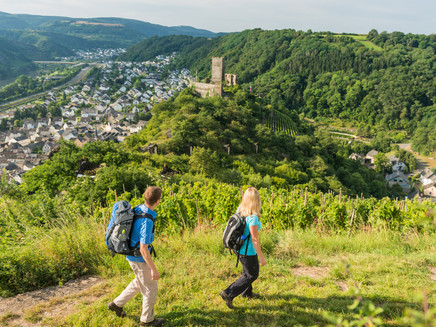
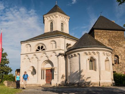
This stage leads through the Mühlental directly into the realm of the Tatzelwurm, a legendary mythical creature said to live in these forests. Walking through ancient vineyards, you reach Niederburg, shortly thereafter the ruins of Oberburg, and the late-Romanesque Matthias Chapel. This was built in the 13th century in honor of a relic of the Apostle Matthias. The path leads steeply through the forest, accompanied by mysterious traces of the Tatzelwurm. The renewed ascent via a serpentine path is rewarded with a fantastic Moselle panorama. The path continues through the forest until the view soon reaches the suburbs of Koblenz, the destination – or start – of the Moselsteig. The view of the terraces of the Winninger Uhlen steep slope first heralds the imminent arrival in the wine village of Winningen.
General information
Directions
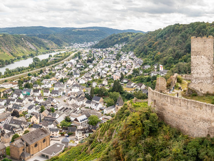
You start this stage directly in front of the Kobern-Gondorf train station building. Along Bahnhofstraße, you walk on the access path towards the center of the Kobern district. Behind the ferry landing, you reach the marketplace with the Tatzelwurm fountain and many beautiful half-timbered houses. Past the old half-timbered town hall and the church, you meet the main Moselsteig trail shortly below the cemetery. Additionally, the trail markings of the Traumpfad Koberner Burgpfad are now on the same route. The path goes slightly uphill into the Mühlental. Then the path leaves the houses in the valley and leads steeply up the hillside. A detour to the ruins of Niederburg is worthwhile at a hairpin bend, as the remains of the site and the view from here over Kobern-Gondorf are impressive!
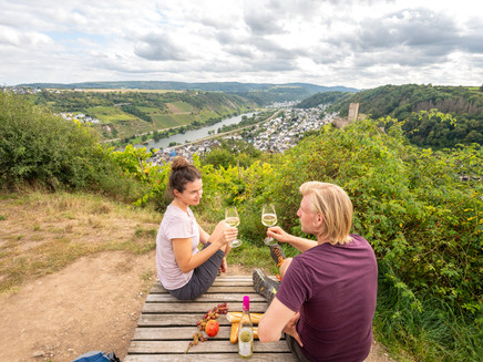
Accompanied by Stations of the Cross made of volcanic rock, the path continues steeply uphill on rocky terrain. The view into the Moselle Valley and to Niederburg improves with every meter climbed. At a small plateau with a cross, the first ascent is completed, and you can take a break here on a lounger with a wonderful view of Kobern-Gondorf. The Koberner Schlossberg is home to many heat-loving plant and animal species, such as the endangered red-winged Oedipoda caerulescens grasshopper. You will also find many cultural-historical monuments there, such as the Matthias Chapel. Therefore, the Koberner Schlossberg is also considered a beacon of biodiversity (https://www.lebendige-moselweinberge.de/leuchtpunkte.html). The beacon is marked on site. You can access further information via a QR code. The following link https://www.youtube.com/watch?v=u9lMT8qs1K4 shows a great video about the diversity of Koberner Schlossberg. A paved path soon leads to Oberburg and Matthias Chapel. From here, there are also charming views – now also of the Maifeld and the Eifel. And be sure to take a look inside the culturally and architecturally unique Matthias Chapel (note opening hours)!
Now a path leads into the forest. Slightly downhill and along the hillside, you continue into the side valley of the Hohensteinsbach. Shortly behind the Guidoborn (a sour spring), the Traumpfad leaves the Moselsteig, which changes valley sides and descends a little in the valley floor. Together with the Tatzelwurmweg, it then goes steeply uphill again. The path runs through a low oak forest. Along the way, quirky benches invite you to take a break with a view of the Moselle Valley. Shortly afterwards, a path branches off that winds through the hillside before you climb steeply uphill to the viewpoint at Rosenberg. The view high above the Moselle Valley over Kobern-Gondorf is fantastic! Just a few more meters uphill on the path, and you reach the plateau.
Across the open fields, you now walk more comfortably at first without major elevation changes. You reach the forest edge, which shortly afterwards also forms the hillside edge of the Moselle Valley. The Moselsteig leads into the forest and then down into the Belltal. It goes very steeply downhill at first until you reach a forest road that then runs moderately steeply along the hillside. Above an old windthrow area, your gaze falls for the first time on the imposing Winninger motorway bridge! Now the Moselsteig meets the RheinBurgenWeg and leads downhill into the Belltal. Almost at Moselle level, you walk alongside a stream uphill again – at first only slightly, but then the rocky path becomes sportingly demanding. Surefootedness is required here! You reach the steep edge of the slate rocks and catch a spectacular view into the Moselle Valley. In the large Moselle loop, you look at the fruit cultivation in Dieblich, at Kobern-Gondorf with its castles, at the Winninger motorway bridge, and last but not least at the terraces of the wine-growing site Winninger Uhlen. Around Winningen are the most extensive vineyard terraces in the entire Moselle region. They provide habitat for many special and rare animal species, such as the Apollo butterfly. Therefore, the Winninger vineyard terraces are also considered a beacon of biodiversity (https://www.lebendige-moselweinberge.de/leuchtpunkte.html). The beacon is marked on site. You can access further information via a QR code.
The highest point is soon reached, and a moderate up and down follows on the forest slope. Finally, the Moselsteig reaches the Blumslay. From here, the view drops almost vertically down to the shining Moselle.
The motorway bridge is now already quite close, and if you pass under the bridge at the rest area, you will get a fascinating impression of the size of this structure. Behind the rest area, the path leads through a short forest section and then continues into a meadow and vineyard area. On a mostly flat route, past the Distelberger Hof, you reach the Domgarten hut, which offers the last highlight of this stage: The view from the hut and from the rest area is so beautiful that you should take another break here! Embedded in the vineyard landscape is Winningen before you – and further down the Moselle, on the other side of the river, you can already see the Koblenz district of Lay.
Then you reach Winningen downhill via the Moselsteig access path on a steep serpentine path. Through the town, it goes quickly towards the marketplace or the train station, where the stage ends.
Equipment
- sturdy footwear
- weather-appropriate, suitable hiking clothing
- packed food
Getting there
Starting point: Kobern-Gondorf via B 416 between Treis-Karden and Koblenz or A 48 AS Kobern-Gondorf and then via L 117
Endpoint: Winningen via B 416 between Treis-Karden and Koblenz or A 61 AS Koblenz-Metternich and L 125
Parking
Kobern-Gondorf: Parking options along Bahnhofstraße near the endpoint (train station)
Winningen: Parking options at the train station or under the railway line along B 416
Public transit
You can reach the stage destinations Kobern-Gondorf (train station) as well as Winningen (train station) by train (RB 81).
There are regular connections. Please note that during school holidays in Rhineland-Palatinate / Saarland, weekends, and public holidays, there may be restrictions on the schedule! Please check the current departure times on the website of the Rhein-Mosel Transport Association (VRM):
Literature
"Moselsteig" - Official Moselsteig Hiking Guide by ideemedia, €14.95
Authors: Ulrike Poller, Wolfgang Todt, Publisher: ideemedia, 300 pages with almost 300 pictures, elevation profiles, QR codes and GPS tracks, format 11.5 x 23 cm, ISBN: 978-3-942779-21-0, €14.95
"Official Moselsteig Hiking Maps" in pocket format:
The entire route is divided into 3 maps:
Recreational Map Moselsteig - Map 1: Perl - Trier (Stages 1 - 4), ISBN: 978-3-89637-419-6
Recreational Map Moselsteig - Map 2: Trier - Zell (Moselle) (Stages 5 - 14), ISBN: 978-3-89637-420-2
Recreational Map Moselsteig - Map 3: Zell (Moselle) - Koblenz (Stages 15 - 24), ISBN: 978-3-89637-421-9
Single map: €5.90
Maps in 3-set: €14.50 (ISBN: 978-3-89637422-6)
"Premium Set"
Premium set consisting of official hiking guide including 3-map set, publisher: ideemedia, ISBN: 978-3-942779-24-1, €26.95
The hiking guides and maps are available in bookstores or on the website https://www.visitmosel.de/wandern/service-infos-tipps under the section "Brochure order".
Maps
Recreational Map Moselsteig - Map 3: Zell (Moselle) - Koblenz (Stages 15 - 24), ISBN: 978-3-89637-421-9
Additional Information
Mosellandtouristik GmbH
Kordelweg 1, 54470 Bernkastel-Kues; Phone: +49 (0)6531/97330
Tourist Information Sonnige Untermosel
Moselstraße 7, 56332 Alken; Phone: +49 (0)2605/8472736
Weather

This tour is presented by: Mosel. Faszination Urlaub, Author: Mosellandtouristik GmbH


