Moselsteig Trail Stage 02: Palzem – Nittel
- start: Palzem: Railway station
- destination: Nittel: Railway station directly on the B 419 (junction of Uferstraße and Weinstraße)
- medium
- 16,36 km
- 4 hours 30 minutes
- 330 m
- 315 m
- 140 m
- 60 / 100
- 40 / 100
Variations on the Upper Moselle.
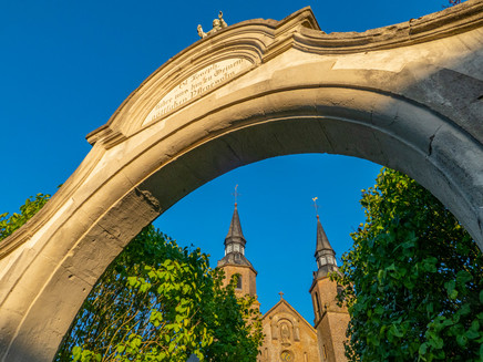
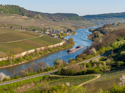
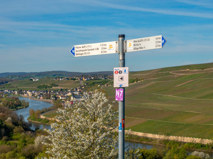
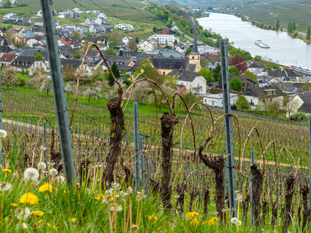
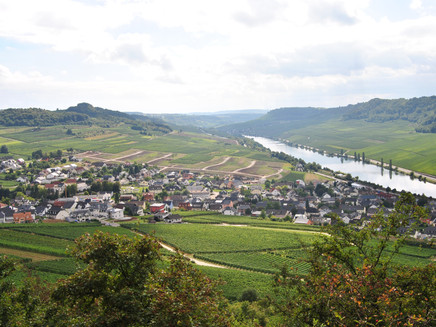
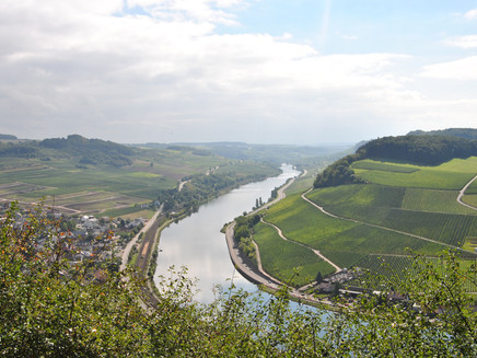
The second stage of the Moselsteig Trail simply cannot fail to surprise you with its uniquely varied route. This section starts in Palzem, the southernmost Moselle village in Rhineland-Palatinate, which lies directly on the Luxembourg border. Majestic "Helfant Cathedral" with its twin towers is certainly worth a visit. The trail continues over short, steep inclines,through forests and across meadows, again and again offering opportunities to pause for a moment at breathtaking viewpoints and enjoy the views over the Moselle. The trail finally takes you through the vineyards along an old way of the cross and descends into the wine-growing village of Nittel.
General information
Directions
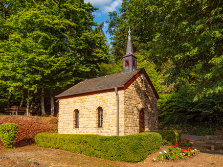
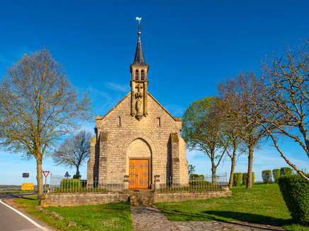
On this section, your hiking day starts the Palzem railway station. The access route marking at the square in front of the church will take you to the outskirts of the town. Here, you cross the highway and hike along the county road to the chapel. From here, the Moselsteig Trail takes you through the vineyards to the edge of the forest where the St Michael chapel is located. Continue hiking into the forest and cross the small stream. The route now starts to ascend. You have an excellent view of the rest of the route from the edge of the forest. In addition to the Helfant Mill, you will notice a silhouette in the distance: the Helfant Cathedral, one of the highlights of this leg.
The trail descends to the highway and continues along it, around the bend, protected by a barrier. The next section heads straight to the small town of Helfant, with its surprisingly large church, which is always in view. You can take a rest at the town’s playground or visit the Helfanter Cathedral, which is only a few steps away from the trail. It’s worth it!
At the rear of the church, the trail takes you out of the town. First, at a slight incline along a stream. Before you reach the forest, you should take a look back. This location offers you a particularly beautiful view of Helfant with its unusual church.
The next section continues at a slight but consistent incline through the Haardt forest (Haardtwald). At the summit it even gets quite steep, but the view from the edge of the forest is so worth the effort. The view opens up across the Moselle Valley right to Luxembourg in the west. The view of Luxembourg remains the main feature of the next downhill section. The trail reaches the new residential area of Wincheringen and finally, at a steep incline, joins the cycle trail in Bachtal. From here, you follow the access routes to the town centre or to Wincheringen railway station.
The Moselsteig Trail now runs downhill along vineyards to a road, which you walk along for a short distance, before continuing steeply uphill. Passing several houses of Wincheringen on a short flat stretch you arrive at a the outskirts of the town, where a bench invites you to take a rest and admire a stunning panorama view! Downstream, you will see the Moselle, flanked by vines on both sides, and also Nittel, the end of the leg. You can also easily see your next stopover, the chapel of Rehlingen.
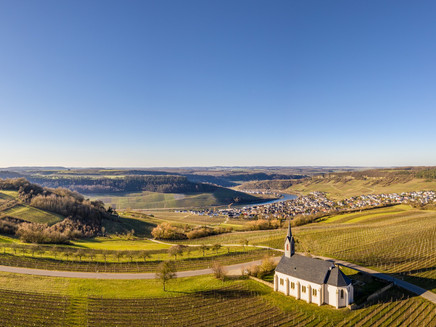
After a short road section the trail reaches the Gemünd mountain hut. The subsequent section is characterised by an interplay of woodlands, vineyards and meadows full of fruit trees. Just before Rehlingen, the trail takes you through a beautiful forest on a wonderful path. The steep ascent to the St. Martin chapel starts in Rehlingen. Once there, you are awarded for your efforts with a stunning view. Here, the view is of the upstream section you have already covered.
But, you have not quite finished the ascent, there are still a few metres to cover until you get to the edge of the forest. At the top, you are rewarded with an even more comprehensive panorama view towards Luxembourg and France. A short, densely populated forest alternates with a short, steeply descending vineyard section, before the Moselsteig Trail continues at a slight incline to the houses of Köllig, just above the Rehling stream. However, you do not hike to the houses, as the trail now continues uphill again and, in the forest, also across a ridge.
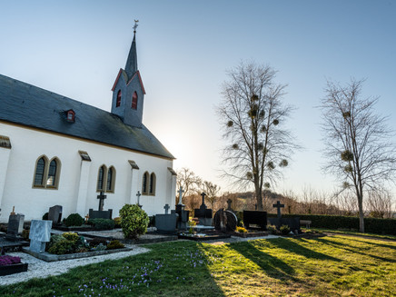
The other side of the mountain is a thrilling hike with a mysterious trail section where cliff and old tree stocks flank the trail. At the Hüttenberg, the Moselsteig Trail leaves the forest for this leg, and once in the vineyards, the view of Nittel opens up. Famous rocks complete the panorama view of the town towards the top: This is where the Nittel Rock Path runs. The Moselsteig Trail follows this on the Nittel – Konz leg. The descent to the town takes you over a cross path and ends at the cemetery.
Following the Im Bungert and Rochusstraße roads, the Moselsteig Trail takes you to the town centre and the Nittel railway station. The wine route takes you downhill here to the town. The railway station is about 800 m away.
Equipment
- Sturdy hiking footwear
- Appropriate weatherproof hiking gear
- Picnic lunch
Tip
After climbing through the Haardt Forest, you'll come across an area perfect for spreading out your picnic blanket and relishing the panoramic views protected by the hedges!
Getting there
Starting point: Palzem via the B 419
Destination: Nittel via the B 419
Parking
Palzem: There are a few parking spaces available in the square with the Moselsteig Trail information board in Bahnhofstraße.
Nittel: By the railway station along the B 419.
Public transit
You can reach the stage towns Palzem (train station) as well as Nittel (train station) by train (RB 82).
There are regular connections. Please note that during the school vacations of Rhineland-Palatinate / Saarland, at weekends and on public holidays there may be restrictions on the frequency! Please check the daily timetable on the website of the Verkehrsverbund Region Trier (VRT): www.vrt-info.de
Literature
Literature (only available in German):
"Moselsteig" - Offzieller Moselsteig-Wanderführer von ideemedia, 14,95 €
Authors: Ulrike Poller, Wolfgang Todt, publisher: ideemedia, 300 pages with around 300 images, altitude profiles, QR codes and GPS Tracks (in German), Format 11,5 x 23 cm, ISBN: 978-3-942779-21-0, 14,95 €
"Official Moselsteig Trail hiking maps" in pocket format:
The entire route is divided into 3 maps:
Leisure Map Moselsteig - Map 1: Perl - Trier (Stages 1 - 4), ISBN: 978-3-89637-419-6
Leisure Map Moselsteig - Map 2: Trier – Zell (Moselle) (Stages 5 -14), ISBN: 978-3-89637-420-2
Leisure Map Moselsteig - Map 3: Zell (Moselle) – Koblenz (Stages 15 -24) ISBN: 978-3-89637-421-9
Individual maps: €5.90
Set of 3 maps: € 14.50 (ISBN: 978-3-89637422-6)
"Premium-Set"
Premium set consisting of the official hiking guide including set of 3 hiking maps. Publisher: ideemedia, ISBN: 978-3-942779-24-1, 26,95 €
The hiking guides and the maps are available in bookstores or on the website https://www.visitmosel.de/wandern/service-infos-tipps under the heading “Ordering brochures”.
Maps
Leisure Map Moselsteig Trail - Map 1: Perl - Trier (Stages 1 - 4), ISBN: 978-3-89637-419-6
Additional Information
Mosellandtouristik GmbH
Kordelweg 1, 54470 Bernkastel-Kues; Phone: +49 (6531) / 97330
Saar-Obermosel-Touristik e. V.
Graf-Siegfried-Straße 32, 54439 Saarburg; Phone: +49 (6581) / 995980
Saarstraße 1, 54329 Konz; Phone: +49 (6501) / 6018040
Weather

This tour is presented by: Mosel. Faszination Urlaub, Author: Mosellandtouristik GmbH
