Moselsteig Trail Stage 17: Ediger-Eller – Beilstein
- start: Ediger-Eller: Ediger, just in front of the Tourist Information Office on Moselweinstraße (B 49)
- destination: Beilstein: Square opposite the ferry landing stage
- medium
- 15,98 km
- 5 hours
- 525 m
- 240 m
- 85 m
- 60 / 100
- 40 / 100
Of Roman tombs and fairytale villages.
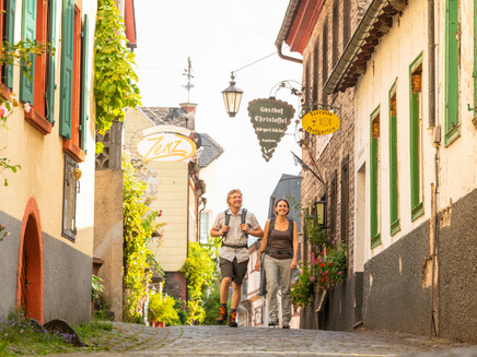
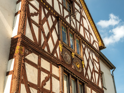
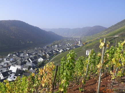
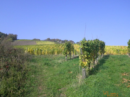
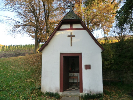
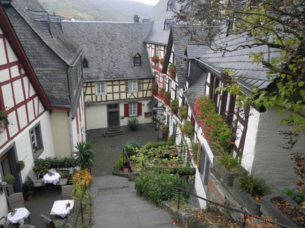
This is a challenging section that leads through the middle of cultivated vineyards, affording different views into the Moselle Valley. After leaving the starting point in Ediger-Eller, the route passes a number of different shrine-like chapels dedicated to different saints, known as Heiligenhäuschen. It is definitely worth taking a detour to the Roman tombs in Nehren as they have some of the best-preserved vault paintings north of the Alps. The trail continues through the vineyards and then along a narrow woodland path through an area known as Briedener Schweiz, where you simply cannot fail to be impressed by the breathtaking scenery. After passing the large Carmelite monastery church, the path descends down the famous monastery steps to the finish of the stage in Beilstein. The small village on the Moselle is also known as the "Sleeping Beauty of the Moselle", as its narrow lanes and half-timbered architecture have been used many times in the past as a location for 'Heimat films', a genre of romantic, rural, homeland films popular in the German-speaking world in the post-war era.
General information
Directions
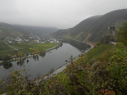
This stage starts on the square in front of the tourist information office. Over an access route you arrive at the Moselsteig Trail at the outskirts of the town. From here, you first hike in the Pehrbachtal past countless shrines, and in a long, slightly ascending loop, to the other side of the valley. The vineyard path in the slope remains level for some distance. Don’t forget to look back: The tightly-packed houses of Ediger and Eller in the narrow Moselle Valley with its many vines, and in the background, the steep rock cliffs of the Calmont, make for a magnificent picture! The vineyard path now ascends and takes you through no longer cultivated areas. In the forest, the path is quite steep for a short distance. However, the next section is a lot easier. Through a beautiful deciduous forest you cross a side valley and arrive at the vineyards at the edge of the forest. If you would like to pay a visit to the Roman graves at the slope edge, you can change on to the sign-posted access route. The Moselsteig Trail now continues downhill through the vineyards and reaches the outskirts of Nehren.
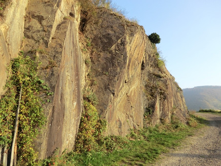
The intermediate section to Senhals continues rather unspectacular though the vineyards. You cross the B 49 over a bridge. You now hike on quiet town roads through the small town district of Senheim, and then cross the bridge to change to the Hunsrück side. Crossing the dam, the trail continues along the harbour basin. After the road crossing a short access route branches off to the town centre and the bus stop. The Moselsteig Trail takes you along the outskirts of the town and then steeply uphill through the vineyards. At the Margareten-Häuschen you have nearly managed the ascent, from here the trail runs over a longer section without great height differences. On the entire route, beautiful views open up of the Moselle Valley with the towns of Senheim and Mesenich and the impressive slate rock formations. This is also where the Mesenicher Steinreichskäpp cultural trail is located: There are play areas along the path, works of art carved in stone and you learn a lot interesting information about the topic of rocks. The endpoint of this section is the Mesenich recreational area. How about a well-deserved rest? And maybe you even feel like taking a look at the remarkable chapel. You can reach Mesenich via an access route.
From here, vast vineyards accompany the Moselsteig Trail towards Briedern. Hike around the grounds of a winery and you can now reach the town via a short access route. At the end of another vineyard section, Beilstein, the destination of this leg, can be seen for the first time. You will see the large abbey church and the ruins of Castle Metternich above the town. On the other side of the Moselle, surrounded by vineyards, you will be able to make out Ellenz-Poltersdorf. Now you can hike through the side valley of the Talbach. The small chapel at the Wahlberg is only a few metres off the trail. From the chapel, you have a pretty view of the Moselle Valley and Briedern.
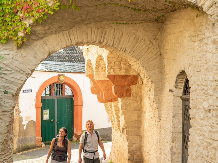
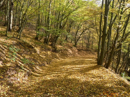
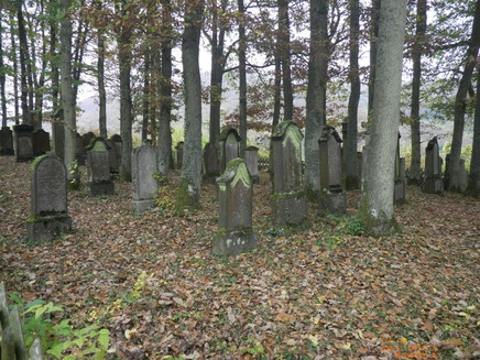
This is where the path section through the forest slope of the Briederner Schweiz starts. The path through the steep slope is very narrow and requires full concentration, it however, also offers a wonderful nature experience in the forest. The path end at the Jewish cemetery above Beilstein. If you leave the forest here, you will see the impressive site of the ruins of Castle Metternich. And at the old walls, a stunning view of the Moselle Valley and Ellenz-Polstersdorf on the other side of the Moselle is a rewarding site! The Moselsteig Trail now descends into the town over paths and steps. Past the abbey church and over the monastery steps you arrive in the half-timbered alleys of the town known as the “Sleeping Beauty of the Moselle”. The endpoint of this leg is the square at the Moselle, directly opposite the ferry terminal.
Equipment
- Sturdy hiking footwear
- Appropriate weatherproof hiking gear,
- Picnic lunch
Getting there
Starting point: Ediger-Eller via the B 49 between Alf and Cochem
Destination: Beilstein via the L 98 between Senheim and Cochem
Parking
Ediger-Eller: Parking spaces along Moseluferstraße (B 49)
Beilstein: The few parking spaces close to the ferry landing stage are often occupied. There is a larger car park a little way upstream on the L 98.
Public transit
You can reach the stage towns Ediger-Eller as well as Beilstein.
Bus connection between Ediger-Eller (stop Bahnhof or Bachstraße) and Ellenz-Poltersdorf (stop Moselfähre) with line 711, ferry between Ellenz-Poltersdorf and Beilstein.
There are regular connections. Please note the times of the ferry!
Please note that during the school vacations of Rhineland-Palatinate / Saarland, on weekends as well as on public vacations there may be restrictions on the frequency! Please refer to the timetable information on the website of the Verkehrsverbund Rhein-Mosel (VRM): www.vrminfo.de
Literature
"Moselsteig" - Offzieller Moselsteig-Wanderführer von ideemedia, 14,95 €
Authors: Ulrike Poller, Wolfgang Todt, publisher: ideemedia, 300 pages with around 300 images, altitude profiles, QR codes and GPS Tracks (in German), Format 11,5 x 23 cm, ISBN: 978-3-942779-21-0, 14,95 €
"Official Moselsteig Trail hiking maps" in pocket format:
The entire route is divided into 3 maps:
Leisure Map Moselsteig - Map 1: Perl - Trier (Stages 1 - 4), ISBN: 978-3-89637-419-6
Leisure Map Moselsteig - Map 2: Trier – Zell (Moselle) (Stages 5 -14), ISBN: 978-3-89637-420-2 Leisure Map Moselsteig - Map 3: Zell (Moselle) – Koblenz (Stages 15 -24) ISBN: 978-3-89637-421-9
Individual maps: €5.90
Set of 3 maps: € 14.50 (ISBN: 978-3-89637422-6)
"Premium-Set"
Premium set consisting of the official hiking guide including set of 3 hiking maps. Publisher: ideemedia, ISBN: 978-3-942779-24-1, 26,95 €
The hiking guides and the maps are available in bookstores or on the website https://www.visitmosel.de/wandern/service-infos-tipps under the heading “Ordering brochures”.
Maps
Leisure Map Moselsteig Trail – Map 3: Zell (Moselle) - Koblenz (Stages 15 - 24), ISBN: 978-3-89637-421-9
Additional Information
Mosellandtouristik GmbH
Kordelweg 1, 54470 Bernkastel-Kues; Phone: +49 (0)6531 / 97330
Tourist information office Cochem
Endertplatz 1, 56812 Cochem; Phone: +49 (0)2671 / 60040
Weather

This tour is presented by: Mosel. Faszination Urlaub, Author: Mosellandtouristik GmbH
