Moselsteig Trail Stage 18: Beilstein – Cochem
- start: Beilstein: Square opposite the ferry landing stage
- destination: Cochem: Carlfritz-Nicolay-Platz or Cochem railway station
- medium
- 13,51 km
- 4 hours
- 380 m
- 320 m
- 80 m
- 80 / 100
- 60 / 100
In the footsteps of the vintners who cultivate the steeper slopes.
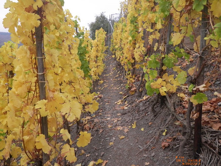
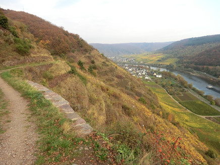
Once you have completed this section with its many steep slopes, you will appreciate the difficulties associated with wine-making on the Moselle. The rocky paths along the steep slopes require a good degree of sure-footedness, but in other places offer unforgettable views over the River Moselle. Finally the trail leads under the vertical "Brauselay" rock wall, from where you can catch a glimpse of the end of this leg in Cochem, above which towers the enchantingly beautiful Reichsburg Castle. With this lovely finish ahead of you, the Moselsteig Trail continues down into this very hospitable and friendly town.
General information
Directions
The starting point of your hiking day is the place at the ferry bier of Beilstein. You quickly leave the hustle and bustle behind you. Just a few steps along the road, the Moselsteig Trail continues steeply uphill at a water gully and along the vineyards. You reach a trail than quickly turns into a path and which is winds challengingly through the steep slope. Although ropes provide good grip, nevertheless suitable footwear and sure-footedness are absolutely necessary. Enjoy the view from the viewing points on the path in peace and quiet. And don't forget to look back every now and then, the view of Beilstein is particularly beautiful! In a small side valley a covered rest area offers the opportunity for an early break. A little later, once you have crossed the lower forest, you should make a stop at the Plaatskopf viewing point: The view here of Beilstein, Ellenz-Polterdorf and the Moselle barrage of Bruttig-Fankel is extremely worthwhile!
Through the flat vineyards of Bruttig-Fankel the Moselsteig Trail reaches the district of Bruttig. Under, along and on the dam – a railway line planned for war purposes, but never operated – you continue towards Cochem. At the road crossing the access route branches off to Ernst on the other side of the Moselle. Here, you continue of a short distance on the vine-planted former railway embankment. The steep ascent into the unspoilt Kubaner Backtal starts now. Accompanied by the stream, over several wooden walkways and large boxwood pastures, the path ascends. Also once the stream is left behind, the Moselsteig Trail and forest continue at an incline. A short distance behind the highest point, a detour to the Iron mast (with covered rest area) invites you. From here you have a wonderful view: Upstream of the Moselle you have a view of the already covered part of the leg up to Beilstein, downstream, you see the outskirts of Cochem. Hiking through forest and meadows, you then reach the "Schöne Aussicht" (Beautiful View) on the slope edge at Valwigerberg. This viewing point bears its name rightly, and the connection path along the slope edge also allows for wide ranging views of the Moselle Valley! Shortly before Valwigerberg, the Apolloweg joins the Moselsteig Trail. At the sports field near the outskirts of the town, an old mighty oak awaits you, you have now reached the village's pilgrimage church.
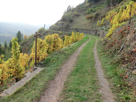
Along the county road, you leave the town and follow a path into the low oak forest. Not much further, you reach a path with several viewing points overlooking the Moselle Valley, with benches allowing you to take a short rest. Downhill, the path now leads to a small mountain hut, where a short winding path through the forest begins. This takes the Moselsteig Trail to a slightly lower vineyard path: This path beautifully runs through the slope, slightly downhill, always with an unobstructed view of the Moselle Valley. The leisurely descent ends at the viewing point Hahnenberg and the Apollohütte Valwig. The next section is more demanding, you should only tackle this with good slip resistance and suitable footwear! On a narrow path and over steep vineyard steps you hike under the almost vertically sloping rock wall of Brauselay. Through the vineyards, you continue downhill, until you reach the resting place and have completed this demanding section. The path through the vineyards now once again takes a slight incline and the impressive Cochem imperial castle gradually comes into view. Finally, you arrive at a rest area with a pretty view of the Cochem old town and waterfront. Here, the Moselsteig Trail changes to a path which leads downhill to Cochem-Cond over steps. Now you continue along the Valwiger Straße to the Moselle Bridge ("Skagerakbrücke"). On the other side of the river, you reach the Carlfritz-Nicolay-Platz, and the end of this stage. A few meters from here is the bus station and via the Ravenestraße you reach the train station.
Equipment
- Sturdy hiking footwear
- Appropriate weatherproof hiking gear
- Picnic lunch
Tip
Consider taking the boat one way if you are planning this section of the trail as a day hike.
Getting there
Starting point: Beilstein via the L 98 between Senheim and Cochem
Destination: Cochem via the B 49
Parking
Beilstein: The few parking spaces close to the ferry landing stage are often occupied. There is a larger car park a little way upstream on the L 98.
Cochem: There is a charge for most of the parking spaces in Cochem. There is a large car park behind the railway station.
Public transit
You can reach the stage towns Beilstein (ferry stop) as well as Cochem (train station) with the bus line 716.
There are irregular connections. Please note that during the school vacations of Rhineland-Palatinate / Saarland, at weekends and on public holidays there may be restrictions on the frequency! Please refer to the timetable information on the website of the Verkehrsverbund Rhein-Mosel (VRM) for the daily timetables: www.vrminfo.de
Literature
"Moselsteig" - Offzieller Moselsteig-Wanderführer von ideemedia, 14,95 €
Authors: Ulrike Poller, Wolfgang Todt, publisher: ideemedia, 300 pages with around 300 images, altitude profiles, QR codes and GPS Tracks (in German), Format 11,5 x 23 cm, ISBN: 978-3-942779-21-0, 14,95 €
"Official Moselsteig Trail hiking maps" in pocket format:
The entire route is divided into 3 maps:
Leisure Map Moselsteig - Map 1: Perl - Trier (Stages 1 - 4), ISBN: 978-3-89637-419-6
Leisure Map Moselsteig - Map 2: Trier – Zell (Moselle) (Stages 5 -14), ISBN: 978-3-89637-420-2 Leisure Map Moselsteig - Map 3: Zell (Moselle) – Koblenz (Stages 15 -24) ISBN: 978-3-89637-421-9
Individual maps: €5.90
Set of 3 maps: € 14.50 (ISBN: 978-3-89637422-6)
"Premium-Set"
Premium set consisting of the official hiking guide including set of 3 hiking maps. Publisher: ideemedia, ISBN: 978-3-942779-24-1, 26,95 €
The hiking guides and the maps are available in bookstores or on the website https://www.visitmosel.de/wandern/service-infos-tipps under the heading “Ordering brochures”.
Maps
Leisure Map Moselsteig Trail – Map 3: Zell (Moselle) - Koblenz (Stages 15 - 24), ISBN: 978-3-89637-421-9
Additional Information
Mosellandtouristik GmbH
Kordelweg 1, 54470 Bernkastel-Kues; Phone: +49 (0)6531 / 97330
Tourist information office Cochem
Endertplatz 1, 56812 Cochem; Phone: +49 (0)2671 / 60040
Weather

This tour is presented by: Mosel. Faszination Urlaub, Author: Mosellandtouristik GmbH


