Moselsteig Trail Stage 22: Löf – Kobern-Gondorf
- start: Löf: Niederbachstraße close to the church and the Moselle Bridge
- destination: Kobern-Gondorf: Railway station
- difficult
- 13,68 km
- 4 hours 30 minutes
- 537 m
- 320 m
- 65 m
- 80 / 100
- 80 / 100
Of plateaus and forest elephants.
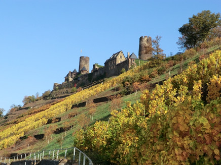
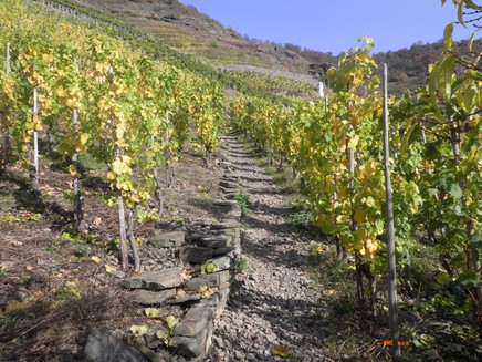
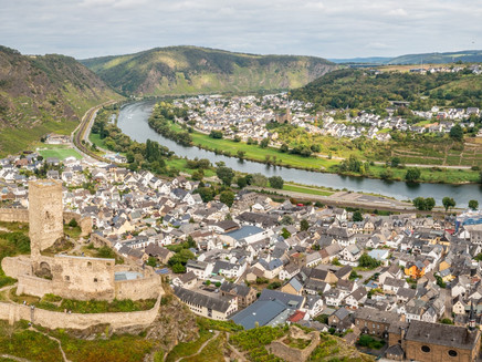
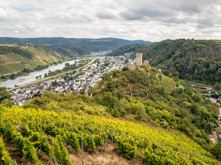
Starting in Löf and continuing via Alken to Kobern-Gondorf, this section of the trail promises a journey through time. The trail first heads for one of the oldest castles in the Moselle region, Thurant Castle, dating back to the 12th century, which boasts magnificent views down into the valley. The next section is rather challenging and follows the "Seven Stations of the Cross" through the vineyards until it reaches the plateau of the Bleidenberg. The trail winds around the edge of the plateau following the edge of the slope, offering breathtaking views. The trail now offers a surprising insight into the ancient history of the region: surely no one can fail to be thrilled and amazed by the attractive reconstruction of the Homo Erectus encampment complete with a mighty iron sculpture of a forest elephant. This section comes to an end with two viewing points that can be seen from afar – the Hitzlay and the Mönch-Felix Lodge. Finally the Moselsteig Trail descends around steep hairpin bends into the Aspelerbach Valley and, from there, over the Moselgold Bridge to Kobern-Gondorf.
General information
Directions
You start this Moselsteig Trail stage where the Niederbachstraße meets the Moselle Bridge at the outskirts of Löf. It takes you over two bridges. On the first bridge you have a gorgeous view of Alken and Burg Thurant (Thurant Castle) which majestically sits on top of the mountain. Behind the bridge, a steep footpath takes you up the slope, until it meets a path parallel to the L 207. At the end, this trail again turns into a steep path. After crossing the L 207, carry on a little further to the castle entrance. On the turning vineyard path you continue to hike on a flat route and then cross a ramp of the vineyard wall on to a steep path, which gains height quickly with even more beautiful views of the castle. Once at the top, the Moselsteig Trail crosses the access road to the castle and you pass through a rock breakthrough. Here you reach the Dream Path Bleidenberger Ausblicke (Bleidenberg Views). You now continue on a narrow path through the forest until the trail ends at an access road, a few meters away from the entrance of Burg Thurant (Thurant Castle) – a visit of the Castle is well worth your time!
The descent to Alken runs along rocky paths, past cliff edges with outstanding views of the Moselle Valley and Alken. On the last few metres in the town you also pass the old St. Michael's church. An access route leads from the Bachstraße to the town centre at the banks of the Moselle. Behind the city gate, the steep ascent to Bleidenberg begins. And this climb on a path through the vineyards is quite demanding! Therefore, treat yourself on the cross path to small rests, and look back to admire the beautiful view of the Burg Thurant (Thurant Castle) and Alken! At the slope edge you have now reached the Trinity Church on the Bleidenberg. A beautiful rest area awaits under an old oak next to the church!
Continue along the slope edge, the magnificent view of Thurant Castle and Alken, always at your side. The trail remains on one height and you have many options for taking a rest – from a simple bench, a relaxing lounger or the cosy rest area at the mountain hut. At the camp-site of the Homus erectus, located a little below the path, you become witness to the history of this place. For example, how tall was a forest elephant at the time? Get an impression here! The Moselsteig Trail now changes into the forest and soon continues steeply downhill to Oberfell - further down also along the stations of the cross. On the branching off access route you reach the town centre or the bus station at the banks of the Moselle.
The Moselsteig Trail does not stay in the Valley for long, the next extremely steep ascent starts immediately. In the fall line of the mountain the path leads through vineyards to a mountain hut with a view of Oberfell. Continue uphill, not quite as steep, through the low forest. At height, the forest recedes and the view of the Eifel is revealed. Continuing along the edge of the forest and an apple tree row, you reach the hut on the Schildberg. The distant view of the Eifel gets better with each step. You have not yet reached the highest point, the path still goes uphill through the forest. The Bleidenberger Ausblicke (Bleidenberg Views) turn off and a short distance further through the beautiful deciduous forest, the Moselsteig Trail is the only hiking trail on this route. At the edge of the forest you then reach the next Dream Path, the Schwalberstieg. The Moselsteig Trail now continues from the free height downhill through the fields. The distant view over the Moselle Valley and of the Eifel is simply divine! The cultural landscape of the Maifeld on the plateau is easy to see and in the far distance, if weather permits, you can see the volcanic groups of the Laacher See and even the Hohe Acht, the highest mountain in the Eifel. The dirt road takes you to the Röder chapel. Now the path turns back to the slope edge and after a short stretch you reach Hitzlay – a viewing point with a fabulous deep view of the Moselle and the barrage at Lehmen! Upstream, you will see Oberfell and Kattenes.
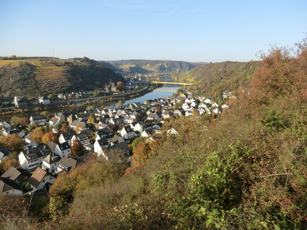
First the Moselsteig Trail still follows the slope edge, and finally takes you downhill through very steep orchard meadows. A slope that even leads slightly uphill, interrupts the descent into the valley. Several places open up to show views downstream of the Moselle. Behind the Moselgold Bridge, you can already see the end of the state, Kobern-Gondorf. The end point of this section is the Mönch-Felix-Hütte - a small wooden viewing tower revealing a great panorama view. The view towards Kobern-Gondorf with both its castles and the Matthias chapel is particularly beautiful!
Finally, on a steep path in narrow serpentines you hike downhill into the Aspeler Bachtal. Without the Schwalberstieg, you now continue downhill to the outskirts of Niederfell and to the B 49. Following the Moselle Bridge, from which you can cast a last view on the castles above Kobern-Gondorf, you reach the other side of the Eifel. The access route branches off at the bridge head, and after a few hundred meters you reach the railway station. You have now reached the end of this stage.
Equipment
- Sturdy hiking footwear
- Appropriate weatherproof hiking gear
- Picnic lunch
Getting there
Starting point: Löf via the B 416 between Treis-Karden and Koblenz
Destination: Kobern-Gondorf via the B 416 between Treis-Karden and Koblenz or the A 48 Kobern-Gondorf exit and then follow the L 117
Parking
Löf: Parking along the B 416
Kobern-Gondorf: Parking along Bahnhofstraße close to the finish (railway station)
Public transit
You can reach the stage towns Löf (train station) as well as Kobern-Gondorf (train station) by train (RB 81).
There are regular connections. Please note that during the school vacations of Rhineland-Palatinate / Saarland, at weekends and on public holidays there may be restrictions on the frequency! Please check the daily timetable on the website of the Verkehrsverbund Rhein-Mosel (VRM):
Literature
"Moselsteig" - Offzieller Moselsteig-Wanderführer von ideemedia, 14,95 €
Authors: Ulrike Poller, Wolfgang Todt, publisher: ideemedia, 300 pages with around 300 images, altitude profiles, QR codes and GPS Tracks (in German), Format 11,5 x 23 cm, ISBN: 978-3-942779-21-0, 14,95 €
"Official Moselsteig Trail hiking maps" in pocket format:
The entire route is divided into 3 maps:
Leisure Map Moselsteig - Map 1: Perl - Trier (Stages 1 - 4), ISBN: 978-3-89637-419-6
Leisure Map Moselsteig - Map 2: Trier – Zell (Moselle) (Stages 5 -14), ISBN: 978-3-89637-420-2 Leisure Map Moselsteig - Map 3: Zell (Moselle) – Koblenz (Stages 15 -24) ISBN: 978-3-89637-421-9
Individual maps: €5.90
Set of 3 maps: € 14.50 (ISBN: 978-3-89637422-6)
"Premium-Set"
Premium set consisting of the official hiking guide including set of 3 hiking maps. Publisher: ideemedia, ISBN: 978-3-942779-24-1, 26,95 €
The hiking guides and the maps are available in bookstores or on the website https://www.visitmosel.de/wandern/service-infos-tipps under the heading “Ordering brochures”.
Maps
Leisure Map Moselsteig Trail – Map 3: Zell (Moselle) - Koblenz (Stages 15 - 24), ISBN: 978-3-89637-421-9
Additional Information
Mosellandtouristik GmbH
Kordelweg 1, 54470 Bernkastel-Kues; Phone: +49 (0)6531 / 97330
Tourist information office Sonnige Untermosel
Moselstraße 7, 56332 Alken; Phone: +49 (0)2605 / 8472736
Weather

This tour is presented by: Mosel. Faszination Urlaub, Author: Mosellandtouristik GmbH


