Moselsteig Trail Stage 24: Winningen – Koblenz
- start: Winningen: Railway station
- destination: Koblenz: Deutsches Eck (German Corner)
- easy
- 15,25 km
- 4 hours
- 285 m
- 205 m
- 60 m
- 40 / 100
- 10 / 100
At the finish. At the start.
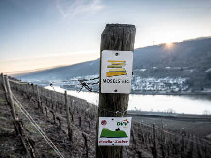
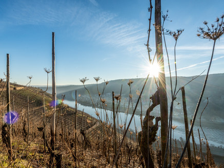
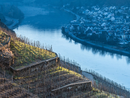
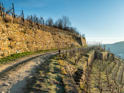
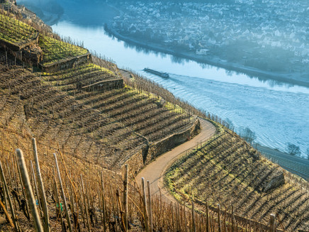
On the Moselsteig Trail. This final section predominantly leads through vineyards, over the Hexenhügel, the Witches' Hill, which has a monument reminding us of the burning of witches in the Middle Ages. Follow the panoramic paths through green meadows and an abundance of fruit trees towards Koblenz. A link road runs along the railway line, past the old castle, to the town's landmark, the Deutsches Eck, the German Corner, a very popular spot especially in summer, marking the place where the River Moselle flows into the Rhine. A cable car trip up to the impressive Ehrenbreitstein Fortress, a visit to the colourful gardens of the former German National Garden Show or a wonderfully relaxing boat trip bring your hike to a perfect end.
General information
Directions
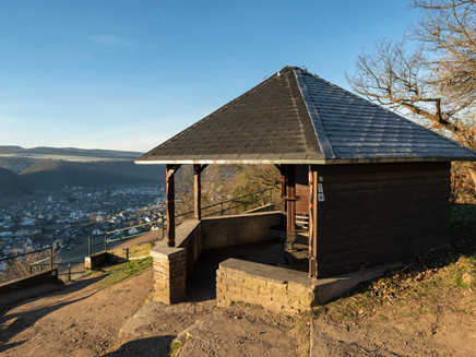
You start this stage right at the railway station, which will take you to the confluence of the Moselle at the Deutsche Eck (German Corner). The Moselsteig Trail access route first winds through the narrow lanes of Winningen, before starting its ascent through the vineyards. Following a serpentine path with a beautiful view of the lower lying village, you then arrive at the Domgartenhütte with a pleasant rest place and a fantastic view of the vineyards over Winningen and the Moselle!
Together with the Rhine-Burgen Trail, you continue along the slope edge. After crossing a side valley, you hike through meadows and vineyards to the L 125 – next to it the Moselsteig Trail now runs a little downhill on the sidewalk. The path now leaves the road again and takes you back uphill into the vineyards. Once at the top, you can again enjoy a gorgeous view of the Moselle Valley: this time upriver and back to the Domgartenhütte. The Moselsteig Trail then continues as a path into the forest to the Hexenhügel (Witch's Hill). The memorial stone reminds of the witch burnings in the Middle Ages.
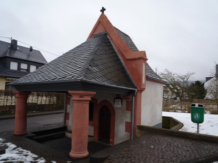
After a short stretch through the forest, the path joins the top vineyard path, on which you can reach the access road to the airport Koblenz/Winningen. But you leave the road immediately again in the direction of the slope edge, where a mountain hut with a stunning view invites you to a long leisurely rest. On a steep path you continue to the lower lying vineyard path, which the Moselsteig Trail follows with best views downstream. After a longer section, which is mainly even, you now continue downhill. You then hike through an area with meadows and fruit trees. Especially when the cherry trees are blooming, this section is particularly attractive! The Gülser cherries in the region are famous. Continue through the new development of Güls and arrive at the old outskirts of the town of the Koblenz district at the Gross-Heiligenhäuschen. This is where the Moselsteig Trail main path ends.
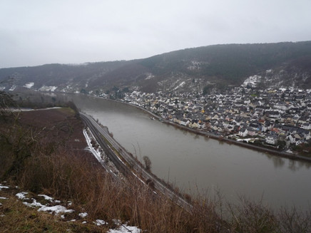
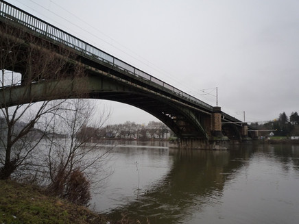
At the Deutsche Eck (German Corner) you follow the Moselsteig Trail access route signs, which will first guide you to the banks of the Moselle. From here, you can see the Gülser railway bridge, on which you cross the Moselle for the last time. On the other side, you immediately continue on the towpath which takes you along the water's edge. You will hike the last few kilometres along the riverbank. If you would like to find out more about the river inhabitants, a visit to the Mosellum at the last Moselle barrage is worth a visit. With its exhibition on the Moselle's wild life and the Fischtreppe (Fish Stairs) it offers you an exciting stop, before continuing in direction of the Koblenz old town. Along the old town you then pass the last Moselle bridges and reach the worthy end point of this stage: the Deutsche Eck (German Corner) at the confluence of the Rhine and Moselle.
Equipment
- Sturdy hiking footwear
- Appropriate weatherproof hiking gear
- Picnic lunch
Getting there
Starting point: Winnigen via the B 416 between Treis-Karden and Koblenz or the A 61 Kobern-Gondorf exit and then follow the L 125
Destination: Koblenz via the A 48 Koblenz-Nord (North) exit and the B 9 or A 61 Koblenz-Waldesch exit and then follow the B 327
Parking
Winningen: Parking spaces at the railway station or under the railway tracks along the B 416
Koblenz-Güls: Car park on "Am Turnerheim" street, accessible via a link road
Public transit
You can reach the stage places Winningen (train station) as well as Koblenz (main station) by train (RB 81).
There are regular connections. Please note that during the school vacations of Rhineland-Palatinate / Saarland, at weekends and on public holidays there may be restrictions on the frequency! Please refer to the timetable information on the website of the Verkehrsverbund Rhein-Mosel (VRM): www.vrminfo.de
Literature
"Moselsteig" - Offzieller Moselsteig-Wanderführer von ideemedia, 14,95 €
Authors: Ulrike Poller, Wolfgang Todt, publisher: ideemedia, 300 pages with around 300 images, altitude profiles, QR codes and GPS Tracks (in German), Format 11,5 x 23 cm, ISBN: 978-3-942779-21-0, 14,95 €
"Official Moselsteig Trail hiking maps" in pocket format:
The entire route is divided into 3 maps:
Leisure Map Moselsteig - Map 1: Perl - Trier (Stages 1 - 4), ISBN: 978-3-89637-419-6
Leisure Map Moselsteig - Map 2: Trier – Zell (Moselle) (Stages 5 -14), ISBN: 978-3-89637-420-2 Leisure Map Moselsteig - Map 3: Zell (Moselle) – Koblenz (Stages 15 -24) ISBN: 978-3-89637-421-9
Individual maps: €5.90
Set of 3 maps: € 14.50 (ISBN: 978-3-89637422-6)
"Premium-Set"
Premium set consisting of the official hiking guide including set of 3 hiking maps. Publisher: ideemedia, ISBN: 978-3-942779-24-1, 26,95 €
The hiking guides and the maps are available in bookstores or on the website https://www.visitmosel.de/wandern/service-infos-tipps under the heading “Ordering brochures”.
Maps
Leisure Map Moselsteig Trail – Map 3: Zell (Moselle) - Koblenz (Stages 15 - 24), ISBN: 978-3-89637-421-9
Additional Information
Mosellandtouristik GmbH
Kordelweg 1, 54470 Bernkastel-Kues; Phone: +49 (0)6531 / 97330
Tourist information office Sonnige Untermosel
Moselstraße 7, 56332 Alken; Phone: +49 (0)2605 / 8472736
Koblenz-Touristik
Tourist information office in Forum Confluentes, Zentralplatz 1, 56068 Koblenz; Phone: +49 (0)261 / 19433
Weather

This tour is presented by: Mosel. Faszination Urlaub, Author: Mosellandtouristik GmbH
