RuT6 at Sommerau - history of usage in the Ruwer valley
- start: Sommerau, parking lot at the village exit on the right. GPS: N 49° 42.960' E 6° 44.125'
- destination: Sommerau, parking lot at the village exit on the right. GPS: N 49° 42.960' E 6° 44.125'
- easy
- 5,88 km
- 1 hour 51 minutes
- 193 m
- 342 m
- 183 m
- 80 / 100
- 20 / 100
This varied themed trail near Sommerau deals with the history of usage in the Ruwer valley and was created as part of the Ruwer water project.
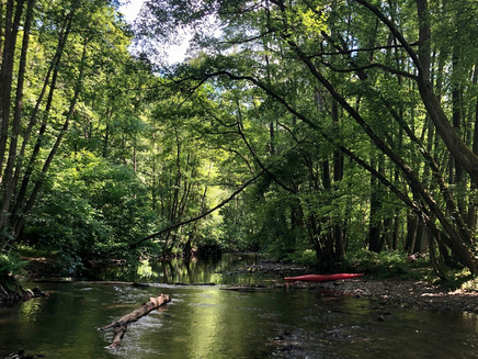
The scenic themed trail around the small, idyllic village of Sommerau deals with the history of usage of the Ruwer and offers detailed information at six different locations on various topics that were investigated here as part of the Ruwer water project. For example, the path leads past the waterfall in Sommerau, a natural monument that arose as a result of the construction of the castle in the 13th century. We also discover the narrow floor of the Ruwer valley, which is too tight and swampy to be used agriculturally. Here, such a beautiful floodplain forest has been able to grow unhindered for a long time.
The length of the circular route is 5.7 km with a walking time of about 2 hours, to comfortably enjoy the relaxed atmosphere and beautiful impressions of the Ruwer valley.
General information
Directions
From the starting point, we hike towards Sommerau and along the waterfall. When Sommerau Castle was built in the 13th century, the Ruwer was redirected, creating this natural monument. Over time, the force of the Ruwer has reduced the height of the waterfall, but it remains a beautiful natural spectacle. Along the vineyards, the path continues uphill on the steep slopes of the Ruwer valley, and we enjoy the beautiful view of the village of Sommerau. Then it continues over green fields. Level areas on the slopes, where the soil layer is thicker than on the slopes, are suitable for agricultural use. The parcels are usually small, and fences create a network of herbaceous edges, where many plant and animal species find a habitat.
The view of Neuhof shows us that flat and sufficiently large spring basins were already preferred places for settlements by our ancestors. The supply of drinking water for people and livestock was easy, and the gently sloping terrain was suitable for arable farming. We reach the Ruwer valley again and pass the former shoe factory site in the Gusterath valley. Here the Gasthaus Reh offers a place to stop. Afterwards, we turn right onto the K64. Here, the narrow floor of the Ruwer is too tight and swampy to be used agriculturally. This has allowed the floodplain forest to grow unhindered for a long time. In the quiet bays where sand and mud settle, the brook lamprey finds its habitat. Parallel to the road runs the mill race, whose water has long powered the mill in Sommerau. Back in Sommerau, we find another place to stop at Gut Sommerau, located directly on the Ruwer-Hochwald cycle path.
Safety Guidelines
In principle, entering the forest and walking the trails is at your own risk. Due to the season or weather conditions, increased surefootedness is required on some trail sections. Therefore, wear clothing and hiking boots suitable for the season and weather with an appropriate tread.
Equipment
Sturdy footwear, comfortable and weather-appropriate clothing is recommended.
Tip
A detour to Sommerau Castle, which stands on a rise in the middle of the valley! It was involved in the history of the Ruwer in many ways.
Getting there
From the A1: Exit Reinsfeld B52 towards Trier, after approx. 11 km turn towards Waldrach, continue towards Korlingen, before Korlingen turn left towards Gutweiler and Sommerau. Parking in front of the village on the left side.
From Trier: Towards Korlingen to Gutweiler, in Gutweiler turn left towards Sommerau, parking in front of the village on the left side.
Parking
Free parking directly at the village entrance on the left side.
Public transit
By lines 30 or 31 from Trier, more information can be found at www.vrt-info.de
Additional Information
The themed trail is funded within the Ruwer water project via the federal water edge strip program with participation of the state of Rhineland-Palatinate. The goal is to preserve and develop the Ruwer and its tributaries with the floodplains over around 186 km of watercourse as a near-natural water and floodplain landscape in the Saar-Hunsrück Nature Park.
Overall, 6 themed hiking trails (Rut1-Rut6) are part of this project and thus bring the Ruwer and its use very vividly and informatively close to the hiker.
Pavings
- Street (22%)
- Asphalt Coating (6%)
- Crushed Rock (12%)
- Hiking Trail (44%)
- Path (16%)
Weather

This tour is presented by: Mosel. Faszination Urlaub, Author: Touristinformation Ruwer


