E-Bike: Sauer-Mosel-Route
- start: Konz, Saarstraße 1
- destination: Konz, Saarstraße 1
- medium
- 66,01 km
- 4 hours 45 minutes
- 345 m
- 380 m
- 128 m
- 100 / 100
- 60 / 100
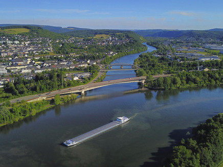
The route leads up to the open plateau of Luxembourg, through the Sauer valley and along the Mosel.
After starting in Konz, you first cycle along the Mosel Cycle Path to Oberbillig. There you take the ferry to Wasserbillig. Along the Mosel, you continue and then climb up to the small village of Münschecker. From there it goes to Manternach and then on to Berbourg. Shortly after Bech, you join the national cycle path PC2 and cycle to Wolpert. You go under the N11 in a tunnel. From Wolpert, you go to Consdorf and Scheidgen. From here, you cycle comfortably down into the valley to Echternach, where a visit to the medieval town centre is recommended. Then you continue along the Sauer. You pass through some pretty villages here and then go through Moersdorf. All these villages belong touristically to the Müllerthal region - Little Luxembourg Switzerland. You cycle on the national cycle path PC3 where you can enjoy views of the Sauer valley. Behind Moersdorf, you enter the Mosel region, known for its wine, vineyards and beautiful villages.
General information
Directions
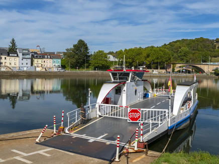
You start the route at the Tourist Information in Konz and initially cycle along the Mosel Cycle Path to Oberbillig. From there, you take the electric ferry "Sankta Maria II" across to the other side of the Mosel to Wasserbillig. From Wasserbillig, you first cycle along the Mosel, then head up the climb to Münschecker. By the way, there is a train station in Wasserbillig.
After Münschecker, you cycle to Manternach and then a somewhat longer stretch to Berbourg and Bech. Shortly after Bech, you join the national cycle path PC2 to Wolpert, where you go through a tunnel passing beneath the national road N11. From there, you cycle to Consdorf and then to Scheidgen. Before you cycle leisurely down into the valley to Echternach from Scheidgen, you pass through the impressive gorge of the "Canyon".
From Echternach, you follow the national cycle path PC 3 along the Sauer towards Rosport. The first town on the Sauer you pass through is Steinheim. Then you continue on the right edge of the forest, and after crossing the N10 before Rosport, you pass the production site of the famous Rosport table water. In Rosport, you will also find the birthplace of the inventor of lead accumulators, Henri Tudor. The Musée Tudor is dedicated to him, located next to the offices of the Rosport municipal administration.
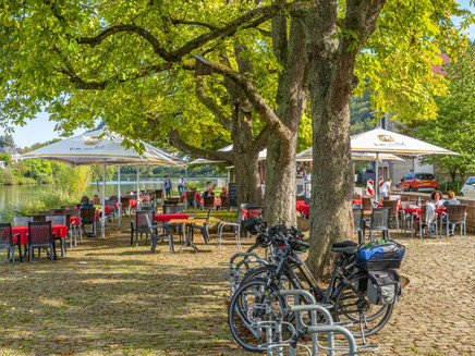
The route continues along the cycle path by the Sauer. You then reach Hinkel, where you can take a break at Kulturhaff Millermoler, which lies directly on the cycle path. Then the route leads on to Born, where the famous Ramborn Cider is produced.
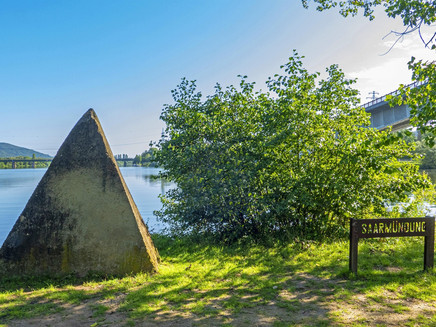
You pass through Moersdorf and arrive back in Wasserbillig, where the Sauer flows into the Mosel. Here you cross the Sauer bridge to Wasserbilliger Brück. On the Mosel Cycle Path, you ride past Igel to the railway bridge. Over this bridge, you cross the Mosel one last time before returning to your starting point in Konz.
E-bike charging stations can be found en route in:
- Konz at the train station on Bahnhofstraße (Bike & Ride Box) as well as at Brunoplatz/Brunostraße 24 in the Karthaus district.
- Oberbillig at the ferry landing on Moselstraße.
Safety Guidelines
Important note:
This route proposal runs along various long-distance cycle paths in the Rhineland-Palatinate and Luxembourg region. There is no uniform signage for the route.
Even if you are travelling on traffic-calmed roads, please keep in mind that residents and farmers may cross your path.
Equipment
Take sufficient provisions with you!
Tip
Electric ferry "Sankta Maria II" in Oberbillig.
Please observe the current ferry information at: www.twitter.com/ogoberbillig
Getting there
You can reach Konz from Trier or Saarburg via B 51 or along the Upper Mosel via B 419.
Parking
Free parking is available at the main station in Konz, the market directly by the town hall, or the carpool parking lot on B 419 (Am Luxemburger Damm).
Public transit
DB line Trier - Saarbrücken to Konz station or DB line Wittlich - Trier - Perl to Konz Mitte station.
Information on current public transport timetables can be found at www.bahn.de or www.vrt-info.de/busnetz.
Literature
Tips and information as well as free brochures and maps about the Saar-Obermosel holiday region are available from Saar-Obermosel-Touristik at the Tourist Information offices in Konz (Tel. 06501-6018040) and Saarburg (Tel. 06581-995980).
Or order the desired brochures directly in our online brochure shop.
Tip: Saar-Obermosel guest newspaper, Saar-Obermosel leisure map.
Maps
The ADFC regional map "Trier & Surroundings" at a scale of 1:50,000 is available for 10.95 € from Saar-Obermosel-Touristik at the Tourist Information offices in Konz and Saarburg. Or order the map directly from our online brochure shop.
Additional Information
Saar-Obermosel-Touristik, Tourist Information Saarburg, Graf-Siegfried-Str. 32, 54439 Saarburg, Tel. 06581-995980
Saar-Obermosel-Touristik, Tourist Information Konz, Saarstr. 1, 54329 Konz, Tel. 06501-6018040
E-mail: info@saar-obermosel.de
Visit our website with exclusive tips and information about the Saar-Obermosel holiday region:
https://www.saar-obermosel.de/
https://www.facebook.com/saarobermosel
Pavings
- Unknown (89%)
- Street (1%)
- Crushed Rock (9%)
- Path (1%)
Weather
This tour is presented by: Saar-Obermosel-Touristik e.V , Author: Saar-Obermosel-Touristik e.V.
