Premium route Bergheidenweg
- start: 56729 Arft, parking lot at Raßberg
- destination: 56729 Arft, parking lot at Raßberg
- medium
- 10,28 km
- 3 hours
- 289 m
- 649 m
- 409 m
- 100 / 100
- 40 / 100
The route offers southern flair between juniper heaths and pine groves. Wonderful paths lead through mixed forest, along the Nette and the Selbach streams, with beautiful views of the Eifel.
Highlights on the premium route
- Mountain and juniper heath
- Nettetal
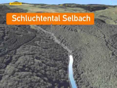
- Selbachtal gorge valley
- Raßberg
- Heidbüchel and Dr. Heinrich Menke Park nature reserves


General information
Directions
The path starts at the parking lot of the winter sports facility near Arft and leads through an open heathland into the Heidbüchel nature reserve. Primitive pines line the path through the typical sand and heath vegetation. Upon reaching the summit of Heidbüchel, a unique view rewards the ascent.
On the descent through the forest, a path branches off to the neighboring premium route "Wacholderweg." At the forest edge, the path turns left towards Nettetal. Behind the small village of Netterhöfe, the Nette is crossed and then the premium route follows the stream into the valley. Over stepping stones, the water is crossed once again. In the following Selbachtal, dense forest surrounds the hiker, impressive cliffs give the valley a gorge-like character.
Along the babbling brook, the path goes uphill through the forest and later on field paths up to a shelter, from where a breathtaking panorama can be enjoyed. The route continues slightly uphill across open fields. After crossing the L10, it goes on to Dr. Heinrich Menke Park. After crossing the L10 again, passing the Konrad Adenauer monument, the Raßberg is circled. Soon the starting point of the premium route is reached.
Safety Guidelines
Safety instructions - safe hiking on the premium routes
Hikers desire narrow paths, natural trails (over forest soil, grass paths, or along streams) and rocky ascents that lead to spectacular views. Of course, such paths must be walked with particular care.
What you should consider on your hike:
- Wear weather-appropriate, functional clothing that protects you from cold and moisture or heat and sun.
- Plan your hike with adequate breaks and use your strength sparingly.
- Carry enough fluids. There are not always places to stop for refreshments.
- Please wear appropriate hiking shoes for the premium routes that provide sufficient grip even on slippery, steep, rocky, and uneven paths.
- If you consider certain sections of the path to be impassable for you, you should bypass them or turn back. Especially during adverse weather conditions, natural paths can be muddy and slippery.
- In autumn, be especially careful as leaves on the ground can hide unevenness, roots, stones, or holes in the path.
- You have to expect such path impairments when hiking.
- Before your hike, check online at https://www.traumpfade.info/traumpfade/wege-status/ whether the premium route you intend to hike is possibly closed, whether detours exist, whether trail construction or logging work or other disturbances are planned.
- Recommended hiking months: April to October.
Difficulty rating
Easy routes
...have only slight elevation changes and can mostly be completed within half a day in terms of length. They do not place special demands on fitness and surefootedness. There are no path sections requiring a head for heights. Short steeper sections are possible. Depending on the path type, some sections can be difficult to walk when wet.
Medium routes
...can be completed well with normal fitness. Path sections may require good surefootedness, so sturdy footwear is important; hiking poles can be useful. Some somewhat longer and steeper ascents and descents are possible. Difficult (partially secured) sections are very rare and can usually be avoided by detours. Natural sections can be difficult to walk when wet.
Difficult routes
...require very good fitness and endurance due to length and/or elevation gain. Very good surefootedness is also necessary to manage steep ascents and descents on partly challenging paths. Sections secured with ropes and/or simple climbing passages, requiring a certain minimum degree of surefootedness, are possible. Sturdy footwear and hiking poles are important. Paths and exposed sections are often only difficult or even impossible to walk when wet or in winter weather.
Equipment
Sturdy footwear is recommended for the route!
Path closures can be found at: https://www.traumpfade.info/traumpfade/wege-status/
Tip
+++Due to fallen trees and forestry work, walking on the officially signposted connecting path between the premium routes Bergheidenweg and Wacholderweg is currently unfortunately not possible unrestricted. However, a connection of the two premium routes is still possible via a connecting path through Netterhöfe!+++
Getting there
A 61 exit Wehr/Nürburgring - B 412 towards Weibern - L 10 to Arft - 1 km before Arft
56729 Arft, parking lot at Raßberg
Parking
56729 Arft, parking lot at Raßberg/winter sports facility near Arft
Public transit
Destination stop: Arft, Dorfstraße
Line 388 leisure bus: Mayen-Langscheid-Arft-Herresbach-Kürrenberg-Mayen (April 1 to Nov 1)
Destination stop: Netterhöfe junction
Line 820 Kempenich-Rieden-Mayen
Literature
- Premium routes & small premium paths vol. 2: The 19 best premium circular hikes in the Vordereifel, Ulrike Poller & Wolfgang Todt ISBN: 978-3-934342-61-3
- 27 premium circular routes premium routes, 10-year anniversary edition Premium routes, Ulrike Poller & Wolfgang Todt, ISBN: 978-3-942779-43-2
Maps
- East Eifel with Laacher-See area hiking map 1:25,000 ISBN: 978-3-921805-63-3
Additional Information
Tourism office Vordereifel, Tel.: 02651/800995, tourismus@vordereifel.de, www.naturerlebnis-vordereifel.de
Project office premium routes, Tel. 0261/108419, info@traumpfade.info, www.traumpfade.info
Premium routes app
Premium routes app for iOS: Download app on iTunes
Premium routes app for Android: Download app on Google Play
Weather


This tour is presented by: Traumpfade im Rhein-Mosel-Eifel-Land, Author: Nicole Pfeifer