Premium Path Booser Doppelmaar route
- start: 56729 Boos, L 94 Volcano Park Station Booser Doppelmaar
- destination: 56729 Boos, L 94 Volcano Park Station Booser Doppelmaar
- easy
- 9,12 km
- 2 hours 40 minutes
- 97 m
- 542 m
- 447 m
- 100 / 100
- 20 / 100
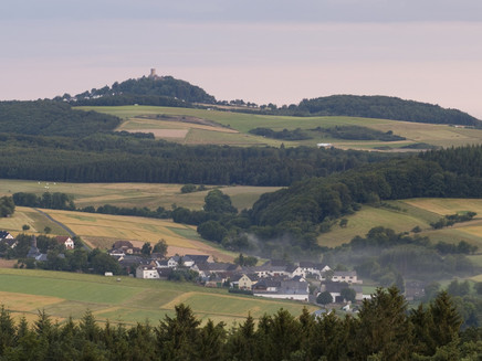
Time travel to a "hot past": stunning views of wide maars, volcanic cones in the charming Eifel landscape, and a unique flora and fauna in the nature reserve "Booser Doppelmaar."
Highlights on the premium path:
- breathtaking panoramic view over the Eifel to the Westerwald
- eight slag cone volcanoes and two dry maars
General information
Directions
The route begins at the hiking car park of the volcano park station "Booser Doppelmaar." From here, a narrow footpath leads to the edge of the western dry maar. It continues towards Unterschemel with a view of the impressive silhouette of the Nürburg ruin. The two maars are strikingly recognizable as extensive, shallow basins in the landscape. The path now ascends steeply to the crater rim, where a shelter invites you to rest with a great view of Boos. Further along, the path enters the forest. It passes ancient burial mounds up to the Hölgertsberg. The descent takes place down a forest-fringed hollow way into the Nitzbach valley. Along the way, there are great views of the towns of Nitz, Drees, and Wanderath. Against a dreamlike mountain forest backdrop along the natural meanders of the Nitzbach valley, the premium path leads back to the starting point.
Safety Guidelines
Safety instructions - Safe hiking on the premium paths
Hikers wish for narrow paths, natural trails (over forest soil, grass paths, or along streams), and rocky ascents leading to spectacular views. It goes without saying that such paths must be treaded with special attention.
What you should consider on your hike:
- Wear weather-appropriate, functional clothing that protects you from cold and wetness or heat and sun.
- Plan your hike with appropriate breaks and use your energy sparingly.
- Bring enough liquids. There are not refreshments available everywhere.
- Please wear suitable hiking shoes on the premium paths that provide adequate support even on slippery, steep, rocky, and uneven paths.
- If you feel that certain sections are not passable for you, you should bypass or turn back. Especially in adverse weather conditions, natural paths can become muddy and slippery.
- In autumn, pay particular attention to fallen leaves that can conceal unevenness, roots, stones, or holes in the path.
- You must expect such path impairments when hiking.
- Inform yourself before your hike on the internet at https://www.traumpfade.info/traumpfade/wege-status/ whether the premium path you want to hike might be closed, if detours exist, or if construction works, logging activities, or other disturbances are present.
- Recommended hiking months: April to October.
Difficulty classification
Easy routes
...have only slight altitude differences and are, regarding the distance, mostly manageable in half a day. They do not impose special demands on fitness or surefootedness. There are no sections that require a head for heights. Short steeper sections are possible. Depending on the path format, some parts might be difficult to walk on wet weather.
Medium routes
...are manageable with normal fitness. Path-like sections may demand good surefootedness; hence sturdy footwear is important, hiking poles can be useful. Some longer and steeper ascents and descents are possible. Difficult (sometimes secured) sections are the absolute exception and can usually be avoided by detours. Natural sections can be difficult to walk on wet weather.
Hard routes
...require very good fitness and endurance due to length and/or altitude meters to be managed. Very good surefootedness is necessary to manage steep ascents and descents on sometimes demanding paths. Rope-secured sections and/or easy climbing passages, requiring a minimum of head for heights, are possible. Sturdy footwear and hiking poles are important. Paths and exposed sections are often difficult or impossible to walk on wet or wintry weather.
Equipment
Sturdy footwear is recommended for the route!
Path closures can be found at: https://www.traumpfade.info/traumpfade/wege-status/
Tip
++++The Eifelturm in Boos is closed until further notice due to structural safety-related damage. For your own safety, please do not enter the observation tower. (Status: 08.10.2024)++++
Getting there
A 48 exit Mayen/Mendig - B 258 towards Nürburgring - in Kreuznick towards Gerolstein/Boos on B 410 - after Boos on L 94 towards Nürburgring
56729 Boos, L 94 Volcano Park Station Booser Doppelmaar
Parking
56729 Boos, L 94 Volcano Park Station Booser Doppelmaar
Others: 56729 Boos (Town Center)
Public transit
Destination stop: Boos, Doppelmaar/Parking lot
Line 377 LeisureBus: Mayen - Kührenberg - Nachtsheim - Boos - Bermel - Monreal - Mayen (04/01 to 11/01)
Destination stop: Boos, Kindergarten
Line 380 RegioBus: Direction Kaisersesch to Kührenberg, Bürgerhaus - from Kührenberg, Bürgerhaus Line 382 towards Boos
Literature
- Premium Paths & Little Premium Paths Volume 2: The 19 best premium circular hikes in the Vordereifel, Ulrike Poller & Wolfgang Todt ISBN: 978-3-934342-61-3
- 27 premium circular routes Premium Paths, Anniversary edition 10 years Premium Paths, Ulrike Poller & Wolfgang Todt, ISBN: 978-3-942779-43-2
Maps
- East Eifel with Laacher See area hiking map 1:25,000 ISBN: 978-3-921805-63-3
Additional Information
Vordereifel Tourist Office, Tel.: 02651/800995, tourismus@vordereifel.de, www.naturerlebnis-vordereifel.de
Premium Paths Project Office, Tel.: 0261/108419, info@traumpfade.info, www.traumpfade.info
Premium Paths App
Premium Paths app for iOS: Download app on iTunes
Premium Paths app for Android: Download app on Google Play
Pavings
- Hiking Trail (66%)
- Path (33%)
- Asphalt Coating (1%)
Weather

This tour is presented by: Traumpfade im Rhein-Mosel-Eifel-Land, Author: Nicole Pfeifer
