Traumpfad Hatzenporter Laysteig
- start: 56332 Hatzenport, train station (Oberstraße/Schrumpftal)
- destination: 56332 Hatzenport, train station (Oberstraße/Schrumpftal)
- difficult
- 11,94 km
- 4 hours
- 348 m
- 265 m
- 77 m
- 80 / 100
- 80 / 100
On primeval paths, the route goes directly through the vineyards on the steep slope of the Mosel. Via ferratas provide thrills, the distinctive Rabenlay and Kreuzlay offer magnificent views before the path dips into the enchanted and quiet Schrumpftal.
Highlights on the Traumpfad
- Picturesque Hatzenport
- Weather station
- Vineyard slopes
- Fantastic views of the Mosel valley from Rabenlay and Kreuzlay
- Idyllic Schrumpftal
- Climbing sections


General information
Directions
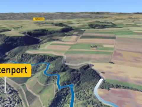
Hatzenporter Laysteig... on primeval paths directly through the vineyards on the steep slope of the Mosel. Via ferratas provide thrills, the distinctive Rabenlay and Kreuzlay offer magnificent views before the path dips into the enchanted and quiet Schrumpftal. Highlights: Picturesque Hatzenport, weather station, vineyard slopes, fantastic views of the Mosel valley from Rabenlay and Kreuzlay, idyllic Schrumpftal, Mosel panoramic trail, climbing sections. Route: The circular route starts at the Hatzenport train station. A narrow path leads the hiker steadily uphill and rewards with the first great view. At the next weather station, display panels provide interesting information about the climate. It continues idyllically eastward in close contact with the vines, offering fantastic views of the Mosel valley, Hatzenport, and St. Johannis Church. On partly primeval paths, after a few kilometers the distinctive Rabenlay with its breathtaking view is reached. Here the landscape changes as the path turns away from the Mosel valley. The view sweeps across wide fields; only at Kreuzlay does the sparkling Mosel come back into view. Over the gently rolling hills of the Schromberger Thalsberg, the hiker soon reaches a splendid dwarf oak forest through which they enter the seemingly enchanted, quiet Schrumpftal. Initially following the gently murmuring Schrumpfbach, the path ascends at Probstmühle to the heights of the Maifeld and finally leads back over the L 113 to the hillside edge, where the view opens over the Mosel. Further along, right through the vine stocks, magnificent views offer themselves on the Mosel panoramic trail. Sure-footed hikers can try their skills as a special finale on the spectacular Dolling climbing path before reaching the destination in Hatzenport.
Safety Guidelines
Surefootedness and a head for heights are required in some sections. The path should not be walked in icy conditions.
General safety instructions:
Safety instructions - safe hiking on the Traumpfade
Hikers want narrow paths, natural trails (over forest floor, grass paths, or along streams), and rocky ascents leading to spectacular views. It is obvious that such paths must be taken with special attention.
What you should observe during your hike:
- Wear weather-appropriate, functional clothing that protects you from cold and damp or heat and sun.
- Plan your hike with adequate breaks and use your strength sparingly.
- Carry enough fluids. Refreshment options are not available everywhere.
- Please wear appropriate hiking shoes suitable for the Traumpfade, which provide sufficient grip also on slippery, steep, rocky, and uneven paths.
- If you believe that certain sections are not passable for you, you should avoid or turn back. Especially in adverse weather conditions, natural paths can become muddy and slippery.
- In autumn, be aware that fallen leaves can cover uneven ground, roots, stones, or holes in the path.
- You must expect such path impairments when hiking.
- Before your hike, check online at https://www.traumpfade.info/traumpfade/wege-status/ whether the Traumpfad you want to hike is possibly closed, whether detours exist, whether construction work or, for example, logging or other disturbances are planned.
- Recommended hiking months: April to October.
Difficulty classification
Easy routes
...have only slight elevation changes and can mostly be managed in half a day in terms of distance. They do not require special physical fitness or surefootedness. No sections require a head for heights. Shorter steeper sections are possible. Depending on the path format, some sections may be difficult to walk in wet weather.
Medium routes
...can be managed well with normal fitness. Path sections may require good surefootedness; therefore sturdy footwear is important, hiking poles can be useful. Some longer and also steeper ascents and descents are possible. Difficult (sometimes secured) sections are the absolute exception and can usually be avoided by detours. Natural sections can be difficult to walk in wet weather.
Difficult routes
...require very good fitness and endurance due to the length and/or elevation to be overcome. Very good surefootedness is also necessary to manage steep ascents and descents on sometimes demanding paths. Rope-secured sections and/or simple climbing sections requiring a minimum degree of surefootedness are possible. Sturdy footwear and hiking poles are important. Paths and exposed sections are often difficult or impossible to walk in wet or winter weather.
Equipment
Sturdy footwear is recommended for the route!
Path closures can be found at: https://www.traumpfade.info/traumpfade/wege-status/
Getting there
B 416 along the Mosel to Hatzenport
56332 Hatzenport, train station (Oberstraße/Schrumpftal)
Parking
56332 Hatzenport, train station or at the ferry tower
Public transit
Destination stop: Hatzenport, train station
RB 81 "Moseltal-Bahn" (daily) Koblenz – Trier
Line 365 RegioBus: (Burg Eltz -) Münstermaifeld-Hatzenport (April 1 to November 1)
Literature
- Traumpfade & Traumpfädchen Volume 1: The 18 best premium circular hikes on the Rhine and Mosel, Ulrike Poller & Wolfgang Todt ISBN: 978-3-942779-64-7
- 27 premium circular routes Traumpfade, anniversary edition 10 years Traumpfade, Ulrike Poller & Wolfgang Todt, ISBN: 978-3-942779-43-2
Maps
- Leisure map Mosel "Maifeld and Lower Mosel" (1:25 000), ISBN: 978-3-944620-16-9
Additional Information
Tourist Information Sunny Lower Mosel, Tel.: 02605/8472736, touristik@sonnige-untermosel.dewww.sonnige-untermosel.de
Project office Traumpfade, Tel.: 0261/108419, info@traumpfade.info, www.traumpfade.info
Traumpfade app
Traumpfade app for iOS: Download the app on iTunes
Traumpfade app for Android: Download the app on Google Play
Weather


This tour is presented by: Traumpfade im Rhein-Mosel-Eifel-Land, Author: Nicole Pfeifer