Traumpfad Monrealer Ritterschlag
- start: 56729 Monreal, train station (Bahnhofstraße)
- destination: 56729 Monreal, train station (Bahnhofstraße)
- difficult
- 13,67 km
- 5 hours
- 508 m
- 459 m
- 272 m
- 100 / 100
- 100 / 100
On the trail of knights: Majestically, the Löwen- and Philippsburg castles overlook the medieval half-timbered town of Monreal. Steep winding forest paths, adventurous gorges, and spectacular panoramic views make the route a unique experience.
Highlights on the Traumpfad
- Monreal half-timbered idyll with quaint alleys
- Views into the Elz and Thürelz river valleys
- Castle ruins of Philippsburg and Löwenburg
- Connection to the Traumpfad Hochbermeler


General information
Directions
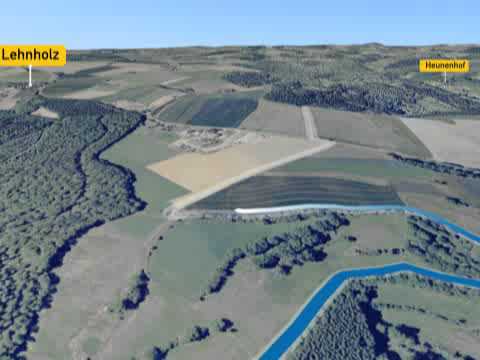
From the train station in Monreal, an access path leads to the starting point at the Old Parsonage. The route continues through the historic town center over the Lower Schoss Bridge. Following the bank of the Elz, the path leads through a quiet residential area out into nature. The gently ascending path conquers the slope above the Elz and opens up a breathtaking view of the castles. (The farm shop is permanently closed). The path continues on soft trails through the idyllic Elz valley, uphill through a deeply cut hollow path and further through open meadowland with a magnificent panorama. After a bend and a short climb to Juckelsberg, a bench invites you to linger. The path crosses L 98 and leads over a short field section into the forest before the view opens onto Hochbermel and the dreamy Thürelz valley. The following serpentine descent leads over a barren steep slope covered with stunted oaks down into an open broom landscape. In the valley, the path crosses the railway line (underpass) and a stream, passes the connecting path to the “Traumpfad Hochbermeler” and climbs over narrow paths to a rocky ridge. The path briefly follows the ridge between Elz and Thürelz, then begins the descent to Augstmühle. After the confluence of the two streams, the Elz is crossed and the sports field of Monreal is reached. Here begins the steep ascent of 100 meters elevation to the Monreal castles. After a meadow section, a rock spur with a spectacular view of Monreal and the castles is reached in the forest. A few meters later, the access path to Philippsburg branches off. A final ascent leads into the walls of Löwenburg. The path goes down on a narrow path back to Monreal.
Safety Guidelines
In some sections, surefootedness and a head for heights are required. Hiking poles are recommended. The path should not be hiked on ice.
General safety instructions:
Safety instructions - Safe hiking on the Traumpfade
Hikers desire narrow paths, nature-close routes (over forest floor, grassy trails or along streams) and rocky ascents that lead to spectacular views. It is of course essential that such paths be walked with special care.
What you should consider on your hike:
- Wear weather-appropriate, functional clothing that protects you from cold and moisture or heat and sun.
- Plan your hike with appropriate breaks and use your strength sparingly.
- Take enough fluids with you. There are not always places to stop.
- Please wear appropriate hiking shoes for the Traumpfad that give you enough support even on slippery, steep, rocky and uneven paths.
- If you believe certain path sections are not passable for you, you should avoid or turn around. Especially in adverse weather conditions, natural paths can have muddy and slippery sections.
- Especially in autumn, note that leaves on the ground can conceal unevenness, roots, stones or holes in the path.
- You must expect such path impairments when undertaking a hike.
- Before your hike, check online at https://www.traumpfade.info/traumpfade/wege-status/ whether the Traumpfad you want to hike is possibly closed, if detours exist, if path construction measures are planned or if there are logging works or other disturbances.
- Recommended hiking months: April to October.
Difficulty classification
Easy routes
... have only slight elevation differences and can mostly be completed in half a day in terms of distance. They do not place special demands on fitness or surefootedness. There are no sections requiring a head for heights. Short steeper sections may occur. Depending on the path type, some sections can be difficult to walk when wet.
Medium routes
... can be managed well with normal fitness. Path sections can require good surefootedness, so sturdy footwear is important, hiking poles may be useful. Some somewhat longer and steeper ascents and descents are possible. Difficult (partly secured) sections are rare and can usually be avoided by detours. Natural sections can be difficult to walk when wet.
Hard routes
... require very good fitness and endurance due to length and/or elevation gain. Very good surefootedness is also necessary to manage steep ascents and descents on partly demanding paths. Rope-secured sections and/or simple climbing parts that require a minimum head for heights are possible. Sturdy footwear and hiking poles are important. Paths and exposed sections are often difficult or impossible to walk when wet or in winter conditions.
Equipment
Sturdy footwear is recommended for the route!
Information on trail closures can be found at: https://www.traumpfade.info/traumpfade/wege-status/
Tip
The Traumpfad is connected to the Traumpfad Hochbermeler by an access path.
Getting there
A 48 exit Mayen - B 262 towards Mayen - right on B 258 towards Nürburgring - right on L 98 to Monreal - at the end of Monreal, right on L 96 towards Uersfeld/Kelberg - immediately right parking lot at the train station (access to start)
Parking
56729 Monreal, parking lot at train station (Bahnhofstraße)
56729 Monreal, at Philippsburg
Public transit
Destination stop: Monreal train station
RB 38 Kaisersesch-Mayen-Andernach - Pellenz-Eifel line (Lahn-Eifel railway)
Destination stop: Monreal, Bahnhofstraße
Line 370 Ulmen - Uersfeld - Bermel/Kaisersesch - Monreal - Mayen
Line 377 Leisure bus: Mayen - Kürrenberg - Nachtsheim - Boos - Bermel - Monreal - Mayen (04/01 to 11/01)
Literature
- Traumpfade & Traumpfädchen Volume 2: The 19 best premium circular hikes in the Vordereifel, Ulrike Poller & Wolfgang Todt ISBN: 978-3-934342-61-3
- 27 Premium Circular Trails Traumpfade, 10-year anniversary edition Traumpfade, Ulrike Poller & Wolfgang Todt, ISBN: 978-3-942779-43-2
Additional Information
Vordereifel Tourist Office, Tel.: 02651/800995, tourismus@vordereifel.de, www.naturerlebnis-vordereifel.de
Traumpfade Project Office, Tel.: 0261/108419, info@traumpfade.info, www.traumpfade.info
Traumpfade App
Traumpfade app for iOS: Download app on iTunes
Traumpfade app for Android: Download app on Google Play
Weather


This tour is presented by: Traumpfade im Rhein-Mosel-Eifel-Land, Author: Nicole Pfeifer