Difficulty rating:
Easy tours
\n...have only slight differences in altitude and can usually be completed in half a day in terms of distance. They are not particularly demanding in terms of fitness and surefootedness. There are no sections of the trail that require a head for heights. Short, steeper sections are possible. Depending on the trail format, some sections may be difficult to walk in wet weather.
\nMedium tours
\n...are easy to manage with a normal level of fitness. Path sections may require good sure-footedness, so sturdy footwear is important, hiking poles may be useful. Some longer and steeper ascents and descents are possible. Difficult (partly secured) passages are the absolute exception and can usually be avoided by taking a detour. Natural sections can be difficult in wet weather.
\nDifficult tours
\n...require very good stamina and endurance due to the length and/or the meters of altitude to be covered. You also need to be very sure-footed to tackle steep ascents and descents on sometimes challenging paths. Rope-secured sections and/or easy climbing passages, which require a minimum of freedom from shingles, are possible. Sturdy footwear and hiking poles are important. Paths and exposed passages are often difficult or even impossible to walk in wet or wintry weather.
"},{"@type":"PropertyValue","name":"TourMoreInfos_equipment","value":"Sturdy shoes are recommended for the tour!
\nYou can find trail closures at: https://www.traumpfade.info/traumpfade/wege-status/
\n"},{"@type":"PropertyValue","name":"TourMoreInfos_tip","value":"
\n
"},{"@type":"PropertyValue","name":"TourMoreInfos_gettingThere","value":"
A 48 Exit Polch - further on L 113 to Trimbs - 56753 Trimbs, car park directly at the civic centre (Auf dem Reusch)
"},{"@type":"PropertyValue","name":"TourMoreInfos_parking","value":"56753 Trimbs, car park directly at the civic centre (Auf dem Reusch)
\n56753 Welling, civic centre (Schulstraße)
"},{"@type":"PropertyValue","name":"TourMoreInfos_publicTransit","value":"Destination stop: Trimbs Nettebrücke
\nLine: 360 RegioBus Münstermaifeld - Mertloch - Polch - Hausen - Mayen
\n\n"},{"@type":"PropertyValue","name":"TourMoreInfos_literature","value":"
Freizeitkarte Mosel \"Maifeld und Untermosel\" (1:25 000), ISBN: 978-3-944620-16-9
"},{"@type":"PropertyValue","name":"TourMoreInfos_additionalInformation","value":"Tourist-Information Maifeld, Tel.: +49 (0)2605/9615026, touristik@maifeld.de, https://www.maifeld.de/tourismus-kultur/
\nProjektbüro Traumpfade, Tel.: +49 (0)261/108419, info@traumpfade.info, www.traumpfade.info
\n\n
Traumpfade-App
\nTraumpfade-App für iOS: App bei iTunes download
\nTraumpfade-App für Android: App bei Google play download
"},{"@type":"PropertyValue","name":"license","value":""},{"@type":"PropertyValue","name":"highlight","value":true},{"@type":"PropertyValue","name":"area","value":"Eifel"},{"@type":"PropertyValue","name":"Kondition","value":40},{"@type":"PropertyValue","name":"qualityOfExperience","value":100},{"@type":"PropertyValue","name":"Panorama","value":100}],"address":{"@type":"PostalAddress","addressLocality":"Trimbs","postalCode":"","streetAddress":"","addressRegion":"","addressCountry":""},"amenityFeature":[{"@type":"LocationFeatureSpecification","name":"scenic","value":true},{"@type":"LocationFeatureSpecification","name":"Scenic","value":true},{"@type":"LocationFeatureSpecification","name":"geology","value":true},{"@type":"LocationFeatureSpecification","name":"Geological highlights","value":true},{"@type":"LocationFeatureSpecification","name":"fauna","value":true},{"@type":"LocationFeatureSpecification","name":"Fauna","value":true},{"@type":"LocationFeatureSpecification","name":"loopTour","value":true},{"@type":"LocationFeatureSpecification","name":"Round trip","value":true},{"@type":"LocationFeatureSpecification","name":"flora","value":true},{"@type":"LocationFeatureSpecification","name":"Flora","value":true},{"@type":"LocationFeatureSpecification","name":"top","value":true},{"@type":"LocationFeatureSpecification","name":"duration","value":210,"unitCode":"MIN"},{"@type":"LocationFeatureSpecification","name":"totalAscent","value":295,"unitCode":"MTR"},{"@type":"LocationFeatureSpecification","name":"totalDescent","value":295,"unitCode":"MTR"},{"@type":"LocationFeatureSpecification","name":"elevationMax","value":285,"unitCode":"MTR"},{"@type":"LocationFeatureSpecification","name":"elevationMin","value":172,"unitCode":"MTR"},{"@type":"LocationFeatureSpecification","name":"difficulty","value":"medium"},{"@type":"LocationFeatureSpecification","name":"round_tour","value":true}],"geo":{"@type":["GeoCoordinates","GeoShape"],"latitude":50.323036999999999,"longitude":7.2996189999999999,"line":"50.32304 7.29962 50.32322 7.30012 50.3235 7.30106 50.32352 7.30161 50.32366 7.30166 50.32368 7.30187 50.32345 7.30327 50.3232 7.30381 50.32309 7.30397 50.32288 7.30405 50.32242 7.30404 50.32186 7.30362 50.32165 7.30366 50.32149 7.30387 50.32136 7.30427 50.32155 7.30575 50.32171 7.30635 50.32203 7.30722 50.32234 7.30768 50.32266 7.30799 50.32366 7.30825 50.32319 7.3077 50.32262 7.30716 50.32209 7.30645 50.3221 7.30627 50.32219 7.30614 50.32323 7.30694 50.32349 7.30699 50.32393 7.30734 50.3239 7.30714 50.3236 7.30692 50.32308 7.30626 50.32263 7.30605 50.32219 7.3058 50.32217 7.30572 50.32266 7.30553 50.32335 7.30569 50.32355 7.3054 50.32427 7.3048 50.32464 7.3034 50.3248 7.30371 50.32498 7.30392 50.32684 7.30548 50.32678 7.30506 50.32678 7.30447 50.32687 7.30403 50.32706 7.30384 50.32708 7.30352 50.32714 7.30345 50.32742 7.30337 50.32789 7.30372 50.32771 7.30323 50.32788 7.30315 50.32798 7.30305 50.32822 7.303 50.32867 7.3031 50.32934 7.30341 50.32948 7.30338 50.32949 7.30304 50.32976 7.30229 50.32959 7.30205 50.3294 7.30165 50.32933 7.30109 50.32872 7.29998 50.32859 7.29987 50.32834 7.2989 50.32835 7.29863 50.32937 7.29834 50.32941 7.29821 50.32925 7.29758 50.32929 7.29744 50.32947 7.29735 50.32901 7.2954 50.32874 7.29522 50.32847 7.29451 50.32767 7.29197 50.32751 7.29211 50.32736 7.29244 50.32702 7.29344 50.3269 7.29365 50.32676 7.2937 50.32615 7.29372 50.32585 7.29341 50.32573 7.29322 50.32553 7.29306 50.32538 7.29306 50.32531 7.29291 50.32531 7.29277 50.32542 7.29257 50.32574 7.29223 50.32592 7.29148 50.32592 7.29102 50.32599 7.2909 50.32588 7.29042 50.32587 7.29016 50.3258 7.29012 50.32556 7.2894 50.32521 7.28832 50.32518 7.28814 50.32502 7.28803 50.32546 7.28744 50.32583 7.28712 50.32595 7.28668 50.32605 7.28659 50.32604 7.28648 50.32617 7.28618 50.32632 7.28603 50.32636 7.28593 50.32632 7.28481 50.32634 7.28275 50.32638 7.28214 50.32644 7.28182 50.3265 7.28118 50.3266 7.2809 50.32679 7.28075 50.32691 7.2807 50.32698 7.28057 50.32703 7.28036 50.32673 7.28047 50.32587 7.28153 50.32571 7.28153 50.32557 7.2814 50.32555 7.28078 50.32569 7.2802 50.32563 7.2794 50.32555 7.27915 50.32488 7.27853 50.32466 7.27861 50.32435 7.27935 50.32408 7.28036 50.32246 7.28002 50.32211 7.27999 50.32174 7.28012 50.32087 7.28006 50.32062 7.2799 50.32052 7.27991 50.32014 7.27971 50.31944 7.27964 50.3186 7.2794 50.31832 7.27922 50.31803 7.2789 50.31755 7.27777 50.31756 7.27719 50.31753 7.2769 50.31745 7.27673 50.31697 7.27674 50.31657 7.27664 50.31606 7.27594 50.3159 7.27589 50.31613 7.27678 50.31649 7.27756 50.31687 7.2781 50.31729 7.27858 50.31771 7.27896 50.31814 7.27948 50.3184 7.27992 50.31879 7.28018 50.31905 7.28027 50.31958 7.28108 50.31986 7.28135 50.32007 7.28162 50.32029 7.28214 50.32024 7.28243 50.32024 7.28273 50.32037 7.28313 50.32055 7.28333 50.32081 7.28344 50.32108 7.28329 50.32159 7.28342 50.32106 7.28532 50.32093 7.28602 50.32088 7.28665 50.32103 7.28729 50.32133 7.28805 50.32132 7.28894 50.32136 7.28932 50.32163 7.29012 50.32169 7.29044 50.32168 7.2909 50.32161 7.2912 50.32136 7.29136 50.32113 7.29157 50.32103 7.2918 50.32103 7.29214 50.32108 7.29248 50.32109 7.29302 50.32128 7.2938 50.32124 7.29437 50.32126 7.29603 50.32135 7.29615 50.32141 7.29674 50.32152 7.2972 50.32172 7.29752 50.32215 7.29839 50.32215 7.2986 50.32271 7.29955 50.32286 7.29936 50.32302 7.2993 50.32303 7.29951 50.32303 7.29951"},"logo":["https://img.oastatic.com/img2/1830959/max/variant.png"],"author":{"@type":["Organization"],"name":" Nicole Pfeifer","url":"","address":{"@type":"PostalAddress"}},"dateCreated":"2009-02-25T16:43:14+01:00","dateModified":"2025-05-05T17:49:03+02:00","keywords":"robots_noindex,Organisation_Traumpfade_im_Rhein-Mosel-Eifel-Land,Author_Nicole_Pfeifer","provider":{"@type":["Organization"],"identifier":["1397487"],"name":"outdooractive.com","url":"http://www.outdooractive.com/"},"sourceOrganization":{"@type":["Organization"],"name":" Traumpfade im Rhein-Mosel-Eifel-Land","url":"https://www.traumpfade.info/","address":{"@type":"PostalAddress"}},"url":"https://en.visitmosel.de/hiking/tour/traumpfad-nette-schieferpfad"}Through the idyllic river landscape of the Nette, along narrow paths and past rough slate cliffs. Glimpses of slate mining, great views and adventure in the tunnel of a former railway track round off this trail splendidly.
Highlights at Traumpfad
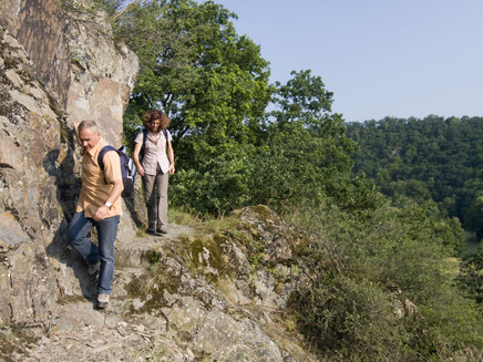
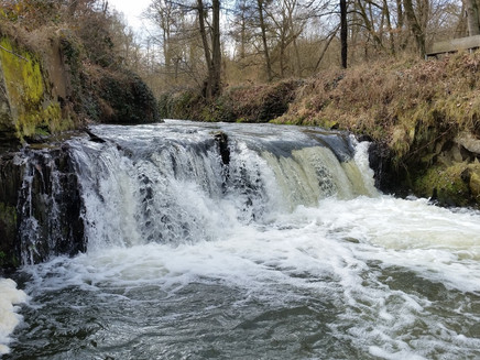
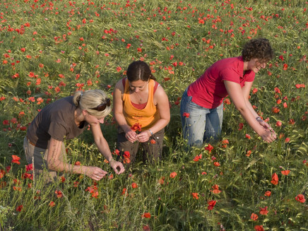
The trail goes over the Nette stone bridge in Trimbs into the flowering valley meadows of the Nette. Initially it follows the rippling rivulet and then starts to ascend along soft grass footpaths. Across rare low nutrient calcareous grassland and past rough slate cliffs, soon “Trimbs Switzerland“ is reached where a grand view of Trimbs and Welling is awaiting. Continuing along the trail the hiker goes through spacious fields up to the Burberg hill. Here there is a wonderful all round panorama view of the Nette valley. The path continues along the slope down into the Nette valley.
Having arrived in the valley, the hiker follows the murmuring Nette along a beautiful natural footpath. Through sparse alluvial forests the trail goes slowly but continuously uphill, until the mighty portal of “Hausen 2” is reached. A fancy for adventure and railway romance overcomes the hiker on walking through the 250 m long, lit tunnel. At the end there is a unique view of the Nette viaduct before the trail continues into the silent forest. Following the edge of the forest there are repeatedly wonderful views before the steep descent returns down into the Nette valley. After several kilometres along the river and through narrow side valleys the hiker reaches his destination in Trimbs.
+++In some passages surefootedness and a head for heights is required. This trail should not be hiked in ice and snow.+++
+++From December to March danger of flooding after heavy rain.+++
Safety guidance – stay safe whilst hiking on the Traumpfade/Traumpfädchen
Hikers like narrow pathways, unspoilt natural trails (leading over the forest floor, across the grass or alongside streams) and rocky climbs which lead to spectacular views. It goes without saying that particular care should be exercised when taking such routes.
Things to bear in mind when preparing for your hike
Difficulty rating:
Easy tours
...have only slight differences in altitude and can usually be completed in half a day in terms of distance. They are not particularly demanding in terms of fitness and surefootedness. There are no sections of the trail that require a head for heights. Short, steeper sections are possible. Depending on the trail format, some sections may be difficult to walk in wet weather.
Medium tours
...are easy to manage with a normal level of fitness. Path sections may require good sure-footedness, so sturdy footwear is important, hiking poles may be useful. Some longer and steeper ascents and descents are possible. Difficult (partly secured) passages are the absolute exception and can usually be avoided by taking a detour. Natural sections can be difficult in wet weather.
Difficult tours
...require very good stamina and endurance due to the length and/or the meters of altitude to be covered. You also need to be very sure-footed to tackle steep ascents and descents on sometimes challenging paths. Rope-secured sections and/or easy climbing passages, which require a minimum of freedom from shingles, are possible. Sturdy footwear and hiking poles are important. Paths and exposed passages are often difficult or even impossible to walk in wet or wintry weather.
Sturdy shoes are recommended for the tour!
You can find trail closures at: https://www.traumpfade.info/traumpfade/wege-status/
A 48 Exit Polch - further on L 113 to Trimbs - 56753 Trimbs, car park directly at the civic centre (Auf dem Reusch)
56753 Trimbs, car park directly at the civic centre (Auf dem Reusch)
56753 Welling, civic centre (Schulstraße)
Destination stop: Trimbs Nettebrücke
Line: 360 RegioBus Münstermaifeld - Mertloch - Polch - Hausen - Mayen
Freizeitkarte Mosel "Maifeld und Untermosel" (1:25 000), ISBN: 978-3-944620-16-9
Tourist-Information Maifeld, Tel.: +49 (0)2605/9615026, touristik@maifeld.de, https://www.maifeld.de/tourismus-kultur/
Projektbüro Traumpfade, Tel.: +49 (0)261/108419, info@traumpfade.info, www.traumpfade.info
Traumpfade-App
Traumpfade-App für iOS: App bei iTunes download
Traumpfade-App für Android: App bei Google play download
This tour is presented by: Traumpfade im Rhein-Mosel-Eifel-Land, Author: Nicole Pfeifer
It appears that you are using Microsoft Internet Explorer as your web browser to access our site.
For practical and security reasons, we recommend that you use a current web browser such as Firefox, Chrome, Safari, Opera, or Edge. Internet Explorer does not always display the complete content of our website and does not offer all the necessary functions.