Traumpfad Saynsteig
- start: 56170 Bendorf-Sayn, Sayn Castle (Schloss Straße 100)
- destination: 56170 Bendorf-Sayn, Sayn Castle (Schloss Straße 100)
- difficult
- 15,45 km
- 5 hours 30 minutes
- 460 m
- 321 m
- 76 m
- 80 / 100
- 80 / 100
A hike on the trail in search of knights and Romans in Sayn is offered by the Traumpfad Saynsteig. It leads through shady forests and natural paths to impressive rocky cliffs. Quiet forest sections alternate with fabulously beautiful views far into the Rhine Valley and the Eifel.
Highlights on the Traumpfad
- Sayn Castle and Fortress
- former Premonstratensian Abbey Sayn
- wide views from Oskarhöhe and "Loh"
- UNESCO World Heritage Limes with reconstructed Roman tower
- beautiful floodplain landscape in the idyllic Brextal
- nice forest paths


General information
Directions
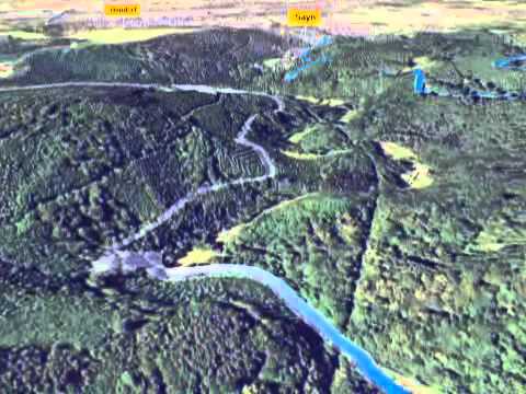
The starting point is Sayn Castle, opposite the princely castle park. If you park not at the castle but at the abbey church, you reach the start via Brexbachstraße. Passing the castle, turn right onto a field path leading up to Saynn Castle; the impressive structure already offers the first wonderful view. Continue on a straight path until reaching Oskarhöhe. Here you will find great views of the abbey church, the romantic "Alt-Sayn," the Rhine Valley, and the Eifel. The path crosses L306 and reaches the forest edge at Ottilienhöhe. Now it goes downhill, over a side valley to the Brexbach, through a varied floodplain landscape up to the scout camp. A narrow path leads up and meets the Rheinsteig. Then continue uphill to the Upper German-Raetian Limes World Heritage Site with the reconstructed Roman tower. Now the almost level forest path allows for relaxation; the Meisenhof invites you to stop for refreshments. The following section across open fields again offers great views over the Rhine Valley. Then it goes down to Sayn. From the footbridge over the Brexbach, past the Heins Mill Museum, it's only a few steps back to the castle.
Safety Guidelines
In some sections, surefootedness and a head for heights are required. This path should not be hiked on ice.
General safety instructions:
Safety instructions - Safe hiking on the Traumpfade
Hikers desire narrow paths, natural paths (over forest floor, grass paths, or along streams), and rocky climbs that lead to spectacular views. It goes without saying that such paths must be walked with special attention.
What you should keep in mind during your hike:
- Wear weather-appropriate, functional clothing that protects you from cold and wet or heat and sun.
- Plan your hike with adequate rest breaks and use your strength sparingly.
- Take enough fluids with you. Refreshment options are not available everywhere.
- Please wear appropriate hiking shoes for the Traumpfade that provide sufficient support even on slippery, steep, rocky, and uneven paths.
- If you think that certain sections are impassable for you, you should bypass them or turn back. Especially in adverse weather conditions, natural paths can have muddy and slippery sections.
- Especially in autumn, be aware that fallen leaves can conceal unevenness, roots, stones, or holes in the path.
- You must expect such path impairments when hiking.
- Inform yourself before your hike on the internet at https://www.traumpfade.info/traumpfade/wege-status/, whether the Traumpfad you want to hike is possibly closed, whether there are detours, if construction measures or forestry work or other disturbances exist.
- Recommended hiking months: April to October.
Difficulty classification
Easy routes
… have only minor elevation changes and are usually doable in half a day regarding distance. They do not require special fitness or surefootedness. There are no sections requiring a head for heights. Short steeper sections are possible. Depending on the trail format, parts can be difficult to walk in wet weather.
Medium routes
… are manageable with normal fitness. Path sections may require good surefootedness, so sturdy footwear is important; hiking poles may be useful. Some somewhat longer and steeper ascents and descents are possible. Difficult (partly secured) sections are a rare exception and can usually be bypassed. Natural sections may be difficult to walk in wet weather.
Difficult routes
… require very good fitness and endurance due to length and/or elevation. Very good surefootedness is necessary to manage steep ascents and descents on partly challenging paths. Rope-secured sections and/or simple climbing passages requiring a minimum head for heights are possible. Sturdy footwear and hiking poles are important. Paths and exposed sections are often difficult or impossible to walk in wet or wintry weather.
Equipment
Sturdy footwear is recommended for the route!
You can find information about path closures at: https://www.traumpfade.info/traumpfade/wege-status/
Getting there
A 48 exit Bendorf - B 42 direction Bendorf Sayn - up to Sayn Castle - then turn right into Brexbachstraße
56170 Bendorf-Sayn, Sayn Castle (Schloss Straße 100)
Parking
56170 Bendorf-Sayn Parking lot Prälatengarten Abbey Sayn (up to Sayn Castle, then turn right into Brexbachstraße up to the parking lot)
Public transit
Literature
- Traumpfade & Traumpfädchen Volume 1: The 18 best premium circular hikes on the Rhine and Mosel, Ulrike Poller & Wolfgang Todt ISBN: 978-3-942779-64-7
- 27 premium circular routes Traumpfade, Anniversary edition 10 years Traumpfade, Ulrike Poller & Wolfgang Todt, ISBN: 978-3-942779-43-2
Maps
- Topographic map "Upper Middle Rhine Valley/Koblenz (1:25,000) ISBN: 978-3-89637-363-2
Additional Information
Tourist Information Bendorf, Tel.: 02622/703444, info@saynerhuette.org,www.bendorf.de
Project office Traumpfade, Tel.: 0261/108419, info@traumpfade.info, www.traumpfade.info
Traumpfade app
Traumpfade app for iOS: Download app on iTunes
Traumpfade app for Android: Download app on Google Play
Weather


This tour is presented by: Traumpfade im Rhein-Mosel-Eifel-Land