Traumpfad Waldseepfad Rieden
- start: 56745 Rieden, Am Waldsee
- destination: 56745 Rieden, Am Waldsee
- medium
- 14,15 km
- 4 hours 30 minutes
- 464 m
- 574 m
- 360 m
- 80 / 100
- 60 / 100
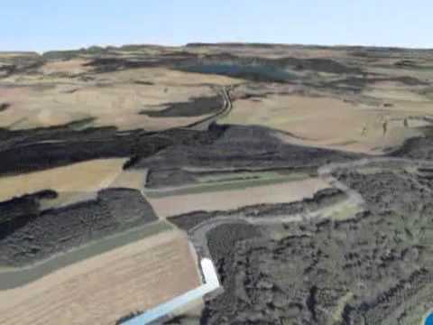
Experience dreamy valleys, quiet forest sections, and fantastic views of the volcanic landscape. Highlights include the Rieden forest lake and a magnificent 360° panorama from the Gänsehals tower.
The highlights on the Traumpfad
- Idyllic forest lake Rieden
- Rehbach valley
- Ascent to the Gänsehals with transmission tower and panoramic view over the Eifel and to the Rhine
- Eifel village Rieden with mineral spring
- Gänsehalshütte with phenomenal view


General information
Directions
Along the idyllic shore of the Rieden forest lake, the route starts before it follows the Rehbach to Rieden. Passing a mineral spring, it then crosses Rieden and continues on a rustic path into the forest. A pleasant forest trail runs with an almost imperceptible incline, sometimes under swaying fir branches, sometimes under the rustling canopy, into a majestic beech hall forest.
A section across extensive meadows offers a view of the Gänsehals transmission tower. A serpentine path winds steeply uphill through dense coniferous forest. Over a short field edge passage and a charming forest path in a small fir forest, you reach the transmission tower. This rewards the ascent with a magnificent 360° panoramic view of the Vulkaneifel and the Neuwied basin. The descent leads briefly through mixed forest, then open fields to the Gänsehalshütte with a phenomenal view.
At the nearby hiking car park, the path goes uphill to the "Maifeldblick" and further straight into the forest. Here awaits the final highlight of the route: the path leads right through a sea of rocks made up of imposing boulders in the deciduous forest. Then on in lively alternation, sometimes through forest, sometimes across open meadows with ever new views towards Nettetal and Kirchwald, and finally down to the Rieden forest lake.
Safety Guidelines
Safety instructions - Safe hiking on the Traumpfade
Hikers desire narrow paths, natural trails (over forest floor, grass paths or along streams), and rocky climbs that lead to spectacular views. It is obvious that such paths must be walked with special attention.
What you should consider on your hike:
- Wear weather-appropriate, practical clothing that protects you from cold and wet or heat and sun.
- Plan your hike with adequate breaks and conserve your energy.
- Take sufficient fluids with you. Refreshment options are not available everywhere.
- Please wear appropriate hiking shoes for the Traumpfade that provide enough grip even on slippery and steep or rocky and uneven paths.
- If you believe certain sections of the path are impassable for you, you should avoid or turn back. Especially with adverse weather conditions, natural paths can become muddy and slippery.
- Especially in autumn, be aware that fallen leaves on the ground can hide unevenness, roots, stones, or holes in the path.
- You must expect path impairments of this kind when undertaking a hike.
- Before your hike, check online at https://www.traumpfade.info/traumpfade/wege-status/, whether the Traumpfad you plan to hike might be closed, if there are any detours, if construction work or logging or other disruptions are planned.
- Recommended hiking months: April to October.
Difficulty classification
Easy routes
… have only slight elevation differences and can mostly be completed in half a day in terms of distance. They do not require special fitness or surefootedness. There are no path sections requiring a head for heights. Short steeper sections are possible. Depending on the path, some parts can be difficult to walk when wet.
Medium routes
… can be managed well with normal fitness. Path sections may require good surefootedness, so sturdy shoes are important, hiking poles can be useful. Some longer and steeper ascents and descents are possible. Difficult (partly secured) passages are very rare and can usually be avoided by detours. Natural sections can be difficult to walk when wet.
Hard routes
… require very good fitness and endurance due to length and/or elevation gain. Very good surefootedness is also necessary to manage steep ascents and descents on sometimes demanding paths. Secured sections with ropes and/or simple climbing passages requiring a minimum head for heights are possible. Sturdy shoes and hiking poles are important. Paths and exposed sections are often difficult or not passable when wet or in winter conditions.
Equipment
Sturdy footwear is recommended for the route!
Trail closures can be found at: https://www.traumpfade.info/traumpfade/wege-status/
Tip
For those who want to explore the region on a shorter hike, we recommend the Traumpfädchen Riedener Seeblick.
Getting there
A61 exit Wehr, towards Adenau/Kempenich - B412 right towards Wehr/Rieden - left at L114, through Rieden to the forest lake (car park signposted)
56745 Rieden, Am Waldsee, Waldsee car park
Parking
56745 Rieden, Am Waldsee, Waldsee car park
56745 Rieden, Kirmesplatz car park (Kirchstraße)
56745 Bell, Gänsehals, hiking car park Gänsehals
Public transit
Destination stop: Rieden, Waldsee
Line 399 Leisure Bus: Mayen - Rieden - Maria Laach - Nickenich - Andernach - Namedy (April 1 to November 1)
Line 820 Mayen East Station – Rieden - Kempenich
Literature
- Traumpfade & Traumpfädchen Volume 2: The 19 best premium circular hikes in the Vordereifel, Ulrike Poller & Wolfgang Todt ISBN: 978-3-934342-61-3
- 27 Premium Circular Trails Traumpfade, Anniversary Edition 10 Years Traumpfade, Ulrike Poller & Wolfgang Todt, ISBN: 978-3-942779-43-2
Additional Information
Tourist Info Laacher See, Tel.: 02636/19433, info@vulkanregion-laacher-see.de, www.vulkanregion-laacher-see.de
Traumpfade project office, Tel.: 0261/108419, info@traumpfade.info, www.traumpfade.info
Traumpfade app
Traumpfade app for iOS: Download app on iTunes
Traumpfade app for Android: Download app on Google Play
Pavings
- Crushed Rock (27%)
- Asphalt Coating (12%)
- Hiking Trail (48%)
- Path (13%)
Weather


This tour is presented by: Traumpfade im Rhein-Mosel-Eifel-Land, Author: Nicole Pfeifer