Traumpfad Wanderather
- start: 56729 Baar-Wanderath, church or former inn Waldesruh (Birkenweg 1)
- destination: 56729 Baar-Wanderath, church or former inn Waldesruh (Birkenweg 1)
- medium
- 12,01 km
- 4 hours
- 304 m
- 539 m
- 362 m
- 100 / 100
- 40 / 100
... pure nature enjoyment! The path leads through wide meadows with spectacular views, quiet valleys with bubbling streams, and even juniper and broom heaths. For a stretch, it follows the Jodokus pilgrimage path, combined with a detour to the artistically decorated pilgrimage chapel St. Jost.
Highlights on the Traumpfad
- Scenic paths Wanderath-Welschenbach
- Hohe Warte-Wanderath and Welschenbach-Acht
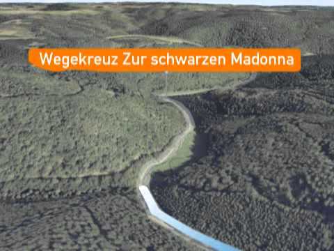
- Achterbach valley with Schwarze Madonna and Jodokus fountain
- Pilgrimage chapel St. Jost
- Juniper heaths Kramershardt on the south slope of the Hohe Warte


General information
Directions
From the church in Baar-Wanderath, the path leads through fields, meadow areas, and forested hills with beautiful panoramic views to Welschenbach. There is a slight ascent through the forest, then back to open fields, meadows, and great natural paths. It gently descends through heathland and along forest and field paths into the Achterbach valley. Along the lively babbling stream, the path leads to the Schwarze Madonna devotional place with a fountain and a small bridge. Together with the Jodokus pilgrimage path, the route follows the Achterbach (detours to the impressive pilgrimage chapel St. Jost and the visitor mine Grube Bendisberg www.grube-bendisberg.de are possible). Returning to the junction, it continues uphill in the Nitzbach valley, along beautiful slate rocks. At Welschenbach, the path leads into the increasingly dense forest, past an old quarry. After crossing the stream and ascending, there is a great view of the Virneburg at the forest edge. It continues uphill through meadow passages, then to the juniper heath at the Hohe Warte. The path circles the Hohe Warte and then leads downhill along its western edge. In the valley, it soon goes uphill on a natural path back to Wanderath.
Safety Guidelines
Safety instructions - safe hiking on the Traumpfade
Hikers desire narrow paths, naturalistic trails (over forest floor, grass paths, or along streams), and rocky ascents that lead to spectacular views. It is obvious that such paths must be walked with particular care.
What you should consider during your hike:
- Wear weather-appropriate, functional clothing that protects you from cold and wet or heat and sun.
- Plan your hike with adequate breaks and use your strength sparingly.
- Carry enough fluids. Refreshment opportunities are not available everywhere.
- Please wear hiking shoes appropriate for the Traumpfade that give you enough support even on slippery and steep or rocky and uneven paths.
- If you think certain sections of the path are not passable for you, you should bypass or turn back. Especially in adverse weather conditions, natural paths can have muddy and slippery sections.
- In autumn, also be aware that fallen leaves on the ground can conceal unevenness, roots, stones, or holes in the path.
- You must expect such path impairments when hiking.
- Before your hike, check on the internet at https://www.traumpfade.info/traumpfade/wege-status/ whether the Traumpfad you want to hike is possibly closed, if there are detours, path construction measures, logging work, or other disturbances.
- Recommended hiking months: April to October.
Difficulty classification
Easy routes
… have only slight changes in elevation and can usually be completed in half a day regarding distance. They impose no special demands on fitness and sure-footedness. There are no sections requiring a head for heights. Brief steeper sections are possible. Depending on the path format, some sections can be difficult to walk when wet.
Medium routes
… can be managed well with normal fitness. Narrow sections may require good sure-footedness, so sturdy footwear is important, hiking poles can be useful. Some somewhat longer and steeper ascents and descents are possible. Difficult (partly secured) sections are the absolute exception and can usually be avoided by detours. Natural sections may be difficult to walk in wet weather.
Hard routes
… require very good fitness and endurance due to length and/or elevation gain. Also very good sure-footedness is necessary to manage steep ascents and descents on partly demanding paths. Secured sections with ropes and/or simple climbing sections, requiring a minimum head for heights, are possible. Sturdy footwear and hiking poles are important. Paths and exposed sections are often only difficult or not passable at all in wet or wintry weather.
Equipment
Sturdy footwear is recommended for the route!
You can find path closures at: https://www.traumpfade.info/traumpfade/wege-status/
Getting there
A 48 exit Mayen/Mendig - B 258 direction Nürburgring - direction Virneburg - via K12/K11 to Baar-Wanderath
56729 Baar-Wanderath, church (main street)
Parking
56729 Baar-Wanderath, church
Others: 56729 St. Jost pilgrimage chapel
Public transit
Destination stop: Oberbaar, Kapellenstraße
Line 388 Leisure Bus Mayen-Langenfeld-Arft-Herresbach-Kürrenberg-Mayen (April 1 to November 1)
Line 380 RegioBus: direction Kaisersesch to Kürrenberg, Bürgerhaus - Kürrenberg, Bürgerhaus Line 381 direction Welchenbach
Literature
- Traumpfade & Traumpfädchen Vol. 2: The 19 best premium circular hikes in the Vordereifel, Ulrike Poller & Wolfgang Todt ISBN: 978-3-934342-61-3
- 27 premium circular routes Traumpfade, 10 years anniversary edition Traumpfade, Ulrike Poller & Wolfgang Todt, ISBN: 978-3-942779-43-2
Maps
- Osteifel with Laacher See area hiking map 1:25,000 ISBN: 978-3-921805-63-3
Additional Information
Tourism Office Vordereifel, Tel.: 02651/800995, tourismus@vordereifel.de, www.naturerlebnis-vordereifel.de
Project Office Traumpfade, Tel.: 0261/108419, info@traumpfade.info, www.traumpfade.info
Traumpfade App
Traumpfade app for iOS: Download app on iTunes
Traumpfade app for Android: Download app on Google Play
Weather


This tour is presented by: Traumpfade im Rhein-Mosel-Eifel-Land, Author: Nicole Pfeifer