Traumpfädchen Eifelturmpfad Boos
- start: 56729 Boos, Vulkanparkstation near Boos (L 94)
- destination: 56729 Boos, Vulkanparkstation near Boos (L 94)
- easy
- 4,05 km
- 1 hour 30 minutes
- 82 m
- 542 m
- 476 m
- 80 / 100
- 20 / 100
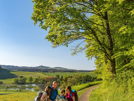
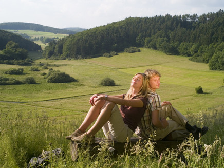
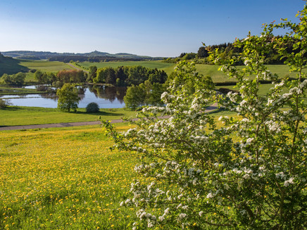
Entertaining and scenic, the route passes by the Booser Doppelmaar and reaches the peaceful Eifel village of Boos after circling Schneeberg. Along the way, there are magnificent wide views of the Vulkaneifel and the Nürburg.
The Booser Eifelturmpfad gives us great views into and upon the world of the Eifel volcanoes. So it is not surprising that, along with magnificent panoramic views, volcanic elements characterize the path. Leading are the Booser Doppelmaar, but also the rock outcrops and a lava bomb testify to the fiery power.
The highlights on the Traumpfädchen:
- Lava bomb
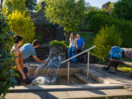
- Water treading basin with herb garden
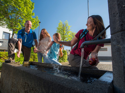
- Eifel village Boos
- Panoramic views over the Vulkaneifel and the Nürburg
- Booser Doppelmaar
General information
Directions
Just outside of Boos, the "Vulkanparkstation Booser Doppelmaar" parking lot marks the start of the Traumpfädchen "Eifelturmpfad Boos." The best experience is clockwise, so you first follow the distinctive blue-white logo along the Traumpfad access path. Soon you enter the forest and descend to the "Schemel" parking lot, where the first rest area is available. From the edge of the forest, you get your first view of the western Booser Maar, its water shimmering in the sun. The view extends all the way to the Nürburg. A bit less conspicuous is the view shortly after a brief forest passage of the eastern Maar, its bottom covered with meadows and shrubs. Next to a bench, the Traumpfädchen leads upward on a short but steep ascent. Up there, benches and a shelter offer a place to rest, allowing you to catch your breath quickly. Now you continue together with the Traumpfad on an easy path and can enjoy a great view of Boos from a bench. Shortly afterward, the Traumpfädchen turns left and leads to the rest area at the volcanic outcrop, where the lava bomb attracts all attention. After a brief climb, you reach the wide path again, and shortly after, the closed Eifelturm remains unnoticed on the left. The route passes through open terrain, offering a great view towards the Nürburg. At Boosblick, two benches provide an opportunity to calmly enjoy the view. After a few steps, you reach the next junction, where the Traumpfad finally turns left. The Traumpfädchen Eifelturmpfad veers right, heading towards the slightly lower Eifel village of Boos. With some bends, the path approaches the village – in good weather, a detour to the water treading basin and the herb garden is recommended – and then leads through Schulstraße into the village center. Past the local host, you reach the nearby church and use the stairs and a somewhat winding footpath to reach the edge of the village. Slightly uphill, it goes back into the open countryside. At the first opportunity, the Eifelturmpfad turns left onto a meadow path with only a very gentle ascent. At the forest edge, a bench invites you to rest in the greenery before the path descends on a final short forest section. Passing by a forest lounger, you return to the hiking parking lot after about 4 very entertaining and scenic kilometers.
Safety Guidelines
General safety instructions:
Safety instructions - safe hiking on the Traumpfädchen
Hikers want narrow paths, nature-near trails (over forest soil, grass paths, or along streams), and rocky climbs that lead to spectacular views. It goes without saying that such paths must be walked with special attention.
What you should consider during your hike:
- Wear weather-appropriate, suitable clothing that protects you from cold and wet or heat and sun.
- Plan your hike with reasonable breaks and use your energy sparingly.
- Bring enough fluids. There are not always places to stop and eat.
- Please wear suitable hiking shoes that provide enough support even on slippery and steep or rocky and uneven paths.
- If you believe certain path sections are not walkable for you, you should avoid them or turn back. Especially in adverse weather conditions, nature-near paths can become muddy and slippery.
- Pay special attention in autumn as the fallen leaves can hide unevenness, roots, stones, or holes in the path.
- You must expect such path impairments when hiking.
- Before your hike, check online at https://www.traumpfade.info/traumpfaedchen/wege-status/ whether the Traumpfädchen you plan to hike is closed, if detours exist, if construction measures are planned, or if tree-felling or other disturbances are present.
- Recommended hiking months: April to October.
Equipment
The Traumpfädchen are not suitable for strollers or walkers.
Path closures can be found at: https://www.traumpfade.info/traumpfaedchen/wege-status/
Tip
+++The Booser Eifelturm is in acute danger of collapse. Therefore, from October 2024 onwards, neither the tower nor its surroundings may be accessed.
There is a life-threatening danger! A detour has been established! +++
+++For Freddy's stamp card, please submit a photo of the lava bomb instead of the stamp!+++
(Status: October 2024)
Getting there
A 48 exit Mayen/Mendig - B 258 towards Nürburgring - in Kreuznick towards Gerolstein/Boos onto B 410 - behind Boos onto L 94 towards Nürburgring
56729 Boos, Vulkanparkstation near Boos (L 94)
Parking
56729 Boos, Vulkanparkstation Booser Doppelmaar (L94)
56729 Parking lot at the youth center (Schulstraße 1)
Public transit
Destination stop: Boos, Doppelmaar/Parking lot
Line 377 LeisureBus: Mayen-Kürrenberg-Nachtsheim-Boos-Bermel-Monreal-Mayen (April 1 to November 1)
Destination stop: Boos, Kintergarten
Line 380 RegioBus: direction Kaisersesche to Kürrenberg, Bürgerhaus - from Kürrenberg, Bürgerhaus Line 382 towards Boos
Literature
- Hiking guide: A beautiful day "traumpfädchen", Ulrike Poller & Wolfgang Todt, ISBN: 978-3-942779-49-4,
- Traumpfade & Traumpfädchen Volume 2: The 19 best premium circular hikes in the Vordereifel, Ulrike Poller & Wolfgang Todt ISBN: 978-3-934342-61-3
Maps
- Traumpfädchen overview map with all 10 Traumpfädchen.
Additional Information
Tourism Office Vordereifel, Tel.: 02651/800995, tourismus@vordereifel.de, www.naturerlebnis-vordereifel.de
Traumpfade project office, Tel.: 0261/108419, info@traumpfade.info, www.traumpfade.info
Traumpfade app
Traumpfade app for iOS: Download app on iTunes
Traumpfade app for Android: Download app on Google Play
Pavings
- Path (15%)
- Hiking Trail (70%)
- Asphalt Coating (9%)
- Street (4%)
- Unknown (2%)
Weather

This tour is presented by: Traumpfade im Rhein-Mosel-Eifel-Land, Author: Nicole Pfeifer
