Traumpfädchen Mendiger Römerreich
- start: 56743 Mendig, Am Wingert (extension of the street "In der Hohl")
- destination: 56743 Mendig, Am Wingert (extension of the street "In der Hohl")
- easy
- 3,58 km
- 1 hour 15 minutes
- 114 m
- 359 m
- 273 m
- 80 / 100
- 10 / 100
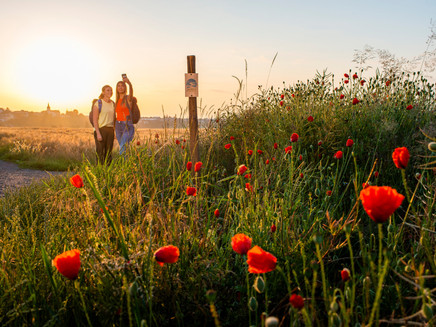
Mandius shows us the way. A Roman legionary named Mandius takes hikers by the hand as they embark upon a charming journey back in time. Exciting stories from the time of the Roman Empire are related as we make our way past the Moosdachhütte, through the idyllic Segbach Valley and past the former site of an ancient villa on woodland trails. This route is a feast for all the senses when everything is in bloom.
Highlights of the Traumpfädchen
- Moosdachhütte
- Segbach Valley
- Villa view/villa rustica
- Meadow orchards
- Panoramic views
General information
Directions
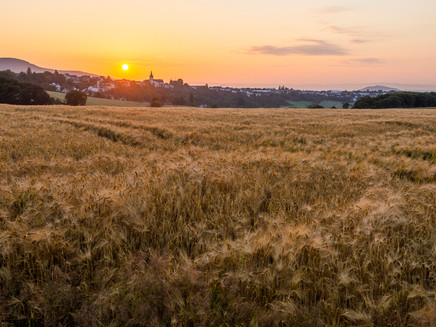
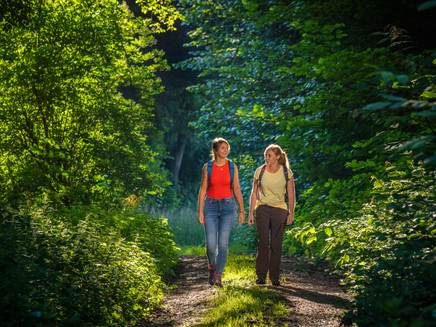
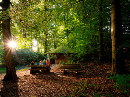
Our thrilling time travel experience on the Traumpfädchen Mendiger Römerreich begins at the “zum Wingert” car park just outside Obermedig. We will be accompanied by Mandius the legionary, who will be telling historical tales of the Roman era at various stop-off points along the way. From the car park, we only need to proceed a few metres down a small lane to arrive at the triple point of the route. Mandius has an entertaining trip back in time in store for us, which he would like us to complete in an anti-clockwise direction. We begin by turning right onto a farm track and make our way gently uphill between the fields. Before reaching the woods, it is well worth casting a look backwards to take in the magnificent view which has now opened up. Almost as soon as we enter the woods, the Moosdachhütte and a rest area offer a great location for a picnic in the heart of nature. Woodland hiking at its very finest now awaits. Our legionary and the Traumpfädchen lead us through our attractive surroundings in relaxed fashion. Majestic beech trees and fragrant pines mark out the route. By now we are making a considerable ascent. If completing the trail in early summer, we will find shimmering yellow broom lighting up the side of the path. Finally we reach a fork at which the logos indicate a left turn. We begin to approach the Segbach along a soft woodland pathway. 1.8 kilometres later, we find ourselves in the Segbach Valley. We bear sharply to the left to start a section of the route that runs alongside the lightly babbling brook. Once again, our enthusiasm and inspiration are fired by the fact that we are following in the footsteps of the ancient Romans and by the charming natural landscape. The deep valley through which we are passing gradually transforms into a woodland meadow. Once we come to a striking old oak tree, it is time to turn left and leave the woods behind. We cross a meadow and a quaint copse, and an easily negotiable field track then takes us through the broad and open spaces of the Segbach Valley flood plain. A stately and entrancing group of huge oak and willow trees provides an impressive sight at any time of the year. Our meadowland section ends at a crossroads, where the Traumpfädchen veers off to the left. We continue briefly uphill to take in the views from a site where a Roman villa rustica once stood. As Mandius explains, this building is now long gone. Shortly afterwards, we go over a hilltop. The fantastic panoramic views with which we are now presented will freeze us in our tracks! The final and gentle descent back to the car park also offers fine vistas. After 3.6 kilometres, our extraordinarily attractive nature trail and highly informative journey back in time are both at an end.
Safety Guidelines
Safety guidance – stay safe whilst hiking on the Traumpfade/Traumpfädchen
Hikers like narrow pathways, unspoilt natural trails (leading over the forest floor, across the grass or alongside streams) and rocky climbs which lead to spectacular views. It goes without saying that particular care should be exercised when taking such routes.
Things to bear in mind when preparing for your hike
- Wear proper clothing that is appropriate to the weather conditions and that will protect you against the cold and the wet or the heat and the sun.
- Schedule suitable breaks during your hike and make sure that you conserve energy.
- Take sufficient liquids with you. Establishments selling refreshments are not available everywhere.
- When hiking on the Traumpfade, please wear appropriate hiking boots which provide a sufficient foothold on slippery, steep, rocky and uneven paths.
- If you do not feel that you are able to negotiate certain parts of the route, then you should avoid such sections or else turn back. Natural pathways may become muddy and treacherous, especially in unfavourable weather.
- In autumn in particular, please remember that leaves lying on the ground may be concealing bumps, routes, stones or holes in the path.
- You will need to expect route impairments of this kind if you are intending to undertake a hike.
- Before setting out, visit https://www.traumpfade.info/traumpfaedchen/wege-status/ in order to find out whether the route you intend to hike is closed or whether diversions are in place. Construction works, timber felling or other disruptions may also be planned.
- Recommended hiking season: April to October
Equipment
Surefootedness and a head for heights are required in some sections.
You should not embark upon the tours in icy conditions.
Robust footwear is recommended!
Details of route closures can be found at: https://www.traumpfade.info/traumpfaedchen/wege-status/
The Traumpfädchen are not suitable for prams or rollator users.
Getting there
A 61/A 48 exit Mendig - B 262 direction Mayen - first exit right direction Mendig/Bell - at the end right into the Pellenzstraße to the district Obermendig - straight ahead to the sculpture traffic circle - in the traffic circle the third exit into the main street - straight ahead - past the church into the Oberstraße continue half-right - after approx. 300 m after the church turn left downhill onto the street "In der Hohl" - continue straight ahead, then turn left and follow the signs to the parking lot at the Schützenplatz (750 meters to the starting point).
Translated with www.DeepL.com/Translator (free version)
Parking
56743 Mendig, parking lot at the Schützenplatz ( 750 m access road to the starting point)
56743 Mendig, parking lot at Wingert (very few parking spaces)
Public transit
Destination stop:
Obermendig, Im Brühl(approx. 1.7 km walk to the start: parking lot "Zum Wingert" (extension of the street "In der Hohl"))
Line 320 RegioBus: Mayen-Kottenheim-Obermendig-Niedermendig
Line 391 Niedermendig - Obermendig - Niedermendig
Literature
Ein schöner Tag Eifel/Mosel/ Rhein Traumpfädchen, Ulrike Poller & Wolfgang Todt, ISBN: 978-3-942779-456-3
Additional Information
Tourist-Information Ferienregion Laacher See, Tel.: +49 (0)2636/19433, info@vulkanregion-laacher-see.de, www.vulkanregion-laacher-see.de
Projektbüro Traumpfade, Tel.: +49 (0)261/108419, info@traumpfade.info, www.traumpfade.info
Traumpfade-App
Traumpfade App for iOS: Download the app from iTunes
Traumpfade App for Android: Download the app from Google Play
Weather

This tour is presented by: Traumpfade im Rhein-Mosel-Eifel-Land, Author: Nicole Pfeifer
