Traumpfädchen Spayer BlickinsTal
- start: 56322 Spay, car park near green waste collection point
- destination: 56322 Spay, car park near green waste collection point
- medium
- 6,12 km
- 2 hours
- 216 m
- 218 m
- 78 m
- 80 / 100
- 40 / 100
Challenging ascents to the Rhine plateau alternate with scenic descents into the valley and relaxed sections across the wide open countryside. Wonderful natural paths and stunning views of the Marksburg and the UNESCO World Heritage Upper Middle Rhine Valley await as a reward.
Highlights on the Traumpfädchen
- Panoramic views of the UNESCO World Heritage Upper Middle Rhine Valley
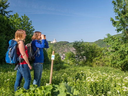
- Long-distance views of Marksburg
- Rhine plateau
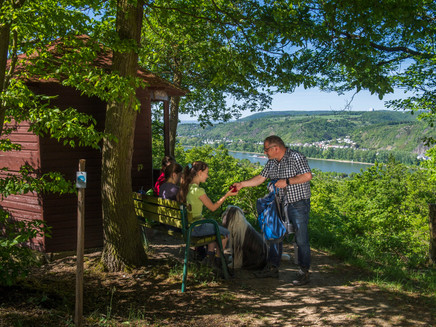
- Long-distance views at the Theoretikerhütte
- Mother of God path and Mother of God chapel
General information
Directions
At the Spay hiking car park is the portal of the Traumpfädchen. Due to the terrain, it is recommended to walk the path counterclockwise with sturdy hiking boots. Therefore, as soon as you reach the starting point of the round after 100 m, turn right onto an ascending forest path.
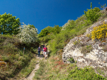
This path leads steadily uphill, crossing the access road to the barbecue hut and passing a water pump station. After a significant altitude gain, the small Sebastian chapel in the middle of the forest marks the first turning point of the route. Now the path goes downward on a winding trail, evoking a hint of primeval forest atmosphere. Suddenly, you leave the wooded area and can recover from this first effort on a comfortable valley path. Benches by the wayside invite you to take a break and offer great views of the impressive Marksburg!
Soon the Traumpfädchen turns left and the next challenge begins: the ascent to the Rhine plateau. Step by step, you pass the stations of the cross, first through meadows, later through light forest. Here, the Rheingoldbogen trail joins in. Together you reach the Mother of God chapel after 1.6 km. From here, it's only a short climb to the Theoretikerhütte, which offers a nice valley view at the forest edge for a breather.
Then it goes very scenic on comfortable field paths almost without elevation change through the open countryside. With some detours, you reach the edge of the slope, where the split from the Traumpfad takes place. The Traumpfädchen uses a magnificent natural path, which even partly has features of a hollow way. Passing a first view of the Rhine, it goes distinctly downhill until the hedges open and a magnificent Rhine view can be admired after 4.1 km. Luckily, there is a bench here!
The return climb to the plateau demands stamina again, but thanks to entertaining route guidance, surrounded by hedges, meadows and forest, the ascent is quickly mastered. At the Spay barbecue area, there is again the opportunity to look into the valley before the final descent begins with a right turn onto a great path. Through species-rich mixed deciduous forest you go downhill, several steep stretches especially require surefootedness when wet. But then it's done and the paved valley path near the B9 is reached. Now it’s not far and you stand again at the starting point of the round, from where you turn right down to the car park.
Safety Guidelines
General safety information:
Safety instructions - safe hiking on the Traumpfädchen
Hikers want narrow paths, natural trails (over forest floor, grass paths or along streams) and rocky ascents leading to spectacular views. It goes without saying that such paths must be walked with special care.
What you should consider during your hike:
- Wear weather-appropriate, functional clothing that protects you from cold and wet or heat and sun.
- Plan your hike with reasonable breaks and use your strength sparingly.
- Take enough fluids with you. There are not always opportunities to refresh yourself along the way.
- Please wear suitable hiking boots that provide sufficient grip even on slippery, steep, rocky and uneven paths.
- If you believe certain sections are not passable for you, you should bypass or turn back. Especially in bad weather conditions, natural trails can become muddy and slippery.
- In autumn, be aware that fallen leaves on the ground can hide unevenness, roots, stones or holes in the path.
- You have to expect such path impairments when hiking.
- Check the status of the trails on the internet before your hike at https://www.traumpfade.info/traumpfaedchen/wege-status/ to see if the Traumpfädchen you want to hike is possibly closed, if detours exist, if construction work is planned, or if there are forestry works or other disruptions.
- Recommended hiking months: April to October.
Equipment
Some parts of the path are steep, so please wear sturdy hiking boots.
The Traumpfädchen are not suitable for strollers or walkers.
Information about path closures can be found at: https://www.traumpfade.info/traumpfaedchen/wege-status/
Tip
PLEASE KEEP DOGS ON LEASH! The Traumpfädchen runs through a bird and nature conservation area. Therefore, dogs must be kept on a leash. This serves to protect resting and breeding birds as well as wild animals. Please avoid contaminating the hiking trail and agricultural land with dog waste.
Getting there
Start: 56322 Spay, car park next to the green waste collection point
Directions: B9 to Spay - in Spay onto K 78 (Rheingoldstraße) towards Siebenborn - about 200 m after the B9 overpass turn left into the farm road (follow signs for green waste collection point) - then after about 400 m on the left side.
Parking
Start: 56322 Spay, car park next to the green waste collection point
Access path: 56322 Spay, Zehnthofstraße (car parks at the cemetery)
Access path: 56322 Spay, corner of Mainzer Straße/Im Lehnacker (car parks along Mainzer Straße)
Public transit
Destination stop: Spay, station (600 m signed access)
Regional train from Koblenz to Spay
Destination stop: Spay, In der Flogt
Line 670 RegioBus: Koblenz-Rhens-Spay-Boppard
Literature
- A beautiful day "traumpfädchen", Ulrike Poller & Wolfgang Todt, ISBN: 978-3-942779-49-4
- Traumpfade & Traumpfädchen Volume 1: The 18 best premium circular hikes on the Rhine and Moselle, Ulrike Poller & Wolfgang Todt ISBN: 978-3-942779-64-7
Additional Information
Tourist Information Erlebnis Rheinbogen, Tel.: 02607/49651, touristik@erlebnis-rheinbogen.de, www.erlebnis-rheinbogen.de
Project office Traumpfade, Tel.: 0261/108419, info@traumpfade.info, www.traumpfade.info
Traumpfade-App
Traumpfade-App for iOS: Download app on iTunes
Traumpfade-App for Android: Download app on Google Play
Pavings
- Asphalt Coating (10%)
- Hiking Trail (47%)
- Crushed Rock (42%)
Weather

This tour is presented by: Traumpfade im Rhein-Mosel-Eifel-Land, Author: Nicole Pfeifer


