Förster Kleinmann Weg im Moselhunsrück near Monzelfeld
- start: Monzelfeld Ortsmitte (Kreuzung "Alte Poststraße" und "Wasenstraße")
- destination: Monzelfeld Ortsmitte
- medium
- 8,89 km
- 3 hours
- 145 m
- 439 m
- 294 m
- 80 / 100
- 40 / 100
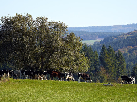
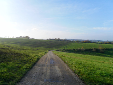
Short but crisp hike through the Hunsrück. After the start in Monzelfeld, the hike first leads through open field and meadow landscapes, then through the forest.
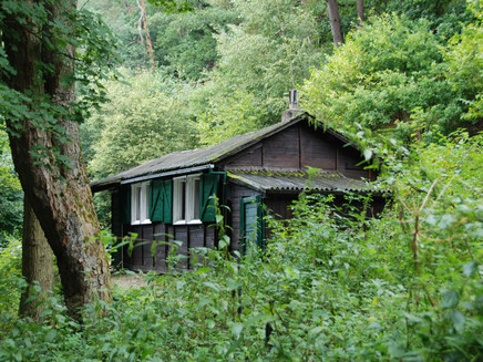
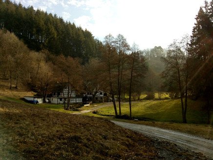
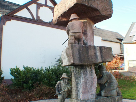
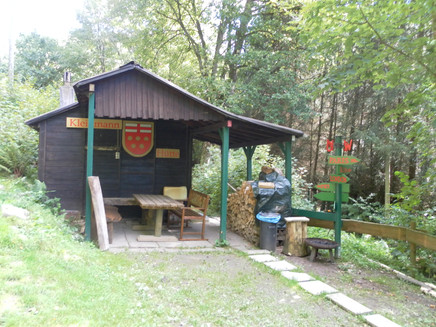
Varied: first long fields, then dense forest.Insights on the hiking tour:The trail starts in the centre of Monzelfeld at a fountain, which reminds you of the mining industry that was practised in Annenberg since the 16th century. It then leads through the forests of the Hunsrück community, opening up magnificent views of meadows and forests. In the Hinterbachtal valley you will come across old mills and the Förster Kleinmann Hut - it is the eponym of this hiking trail. The trail continues into the small village of Annenberg. The mining of silver-bearing lead ore was the reason why the former mining settlement of Annenberg was established in the middle of the forest in the 16th century.There are no refreshment stops along the way, so we recommend that you do your shopping in Monzelfeld. There are good places to rest on benches along the route and at the Förster Kleinmann Hütte. There is also a pizzeria at the beginning/end of the tour in Monzelfeld which invites you to stop for a bite to eat.Translated with www.DeepL.com/Translator (free version)
General information
Directions
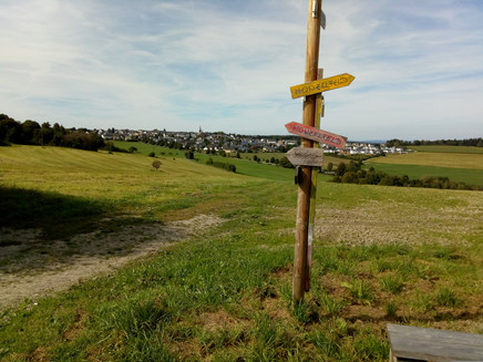
The tour starts in the centre of Monzelfeld near a fountain. First you cross the road. Then you walk along Wasenstraße until you turn off into Mühlenstraße. Turn right into the street and follow it out of the village. After you have crossed an underpass, you will have a wonderful view of the picturesque Hunsrück landscape, with all its meadows, forests and mountains and valleys. You then follow this winding gravel path down through the forest. At a fork in the path, the trail leads you left into the valley to a stream, along which the path runs, past three old mills. At the end of the path, turn left onto a road and then right again after about 20m onto a forest path. On the left side there is the forester Kleinmann hut, which invites you to take a rest, as well as several groups of seats along the way. The path continues past the stream until it is crossed by a footbridge. At the end of the path, the route takes you along a short asphalt path to the small village of Annenberg. There you turn right, through a forest, uphill again. Once you have reached the top, you will again have a wonderful view over the meadows and forests of the Hunsrück. At a crossroads, where there is again a seating area, turn left until you reach a road. You have to cross this road and turn left at the pedestrian path. The next street you have to cross again and then you come over a slight slope onto a gravel path which, if you turn right, leads to Monzelfeld. When you arrive in Monzelfeld, the Wasenstraße leads you to the starting point.
Safety Guidelines
There is enough space on the paths to avoid them.
Equipment
Sturdy shoes and rucksack food if necessary.
Tip
In the middle of the forest you meet the small village of Annenberg. Why? In the 16th century, lead ores containing silver were mined here - Annenberg is a former mining settlement. An artists' café opens there on Sundays and public holidays from 1 May to 31 October.
Getting there
From Bernkastel in the direction of Tier, follow the B53 through Andel to Mülheim. There turn left and follow the L158 to Monzelfeld.
Parking
Car parking spaces are available in the centre of Monzelfeld.
Public transit
Bernkastel-Kues: Taxi Edringer: (0049) 6531 - 8149, Taxi Priwitzer: (0049) 6531 - 96970, Taxi Reitz: (0049) 6531 - 6455
Literature
WanderGuide - the hiking guide in the Bernkastel-Kues holiday region. With description and map. Only available in german
Maps
WanderGuide - the hiking guide in the Bernkastel-Kues holiday region. With description and map. Only available in german
Additional Information
Ferienland Bernkastel-Kues
Gestade 6
54470 Bernkastel-Kues
Phone: (0049) 6531/50019-0
Pavings
- Asphalt Coating (13%)
- Crushed Rock (30%)
- Hiking Trail (53%)
- Street (2%)
- Unknown (2%)
- Path (1%)
Weather

This tour is presented by: Ferienland Bernkastel-Kues, Author: Claus Conrad
