Moselsteig Side Trail Graf Georg Johannes Weg
- start: Veldenz, junction Weingartenstraße/Hauptstraße (close to tourist information)
- destination: Veldenz, junction Weingartenstraße/Hauptstraße (close to tourist information)
- medium
- 14,05 km
- 5 hours
- 600 m
- 425 m
- 170 m
- 80 / 100
- 60 / 100
In the footsteps of the Counts of Veldenz.
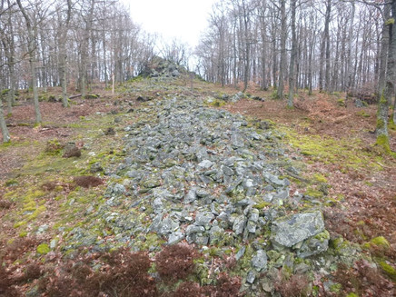
The namesake of this Moselsteig Side Trail - Count Georg Johannes - is the most famous descendent of the Counts of Veldenz, also, because he married a daughter of King Gustav I. of Sweden, in 1563. Over and again, the family history of the Counts of Veldenz is a theme of this approx. 14 km long Moselsteig Side Trail. The seat of the former count, Veldenz Castle, with its ruins can be admired from many viewing points along the trail. An approx. 90 metre long stone wall is testament of the former stronghold of the Celts, which is an impressive feature of this trail.
The tour starts and finishes in the romantic region of Veldenz. The hiking route winds along the mountain slopes of the Veldenz stream or the Hinterbach. The trail crosses the stream twice. Then it’s time to prepare yourself for the climb again!
General information
Directions
The starting point of the Graf Georg Johannes Trail is located in the heart of Veldenz near the Villa romana. In the village, the path crosses the Veldenz stream as it will do a few more times until the return to Veldenz. From the outskirts of the town continue to the valley on the Sonnenweg. You can already hear the Mühlgraben stream's gushing and soon the first view opens up of Castle Veldenz, which towers majestically on the cliff in the midst of the valley.
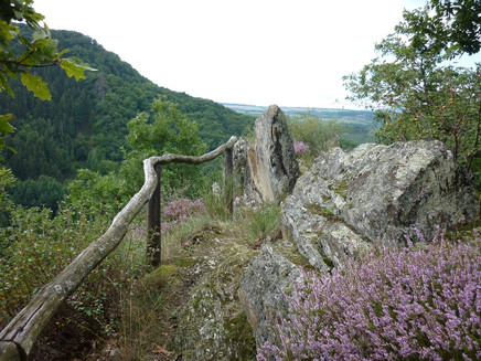
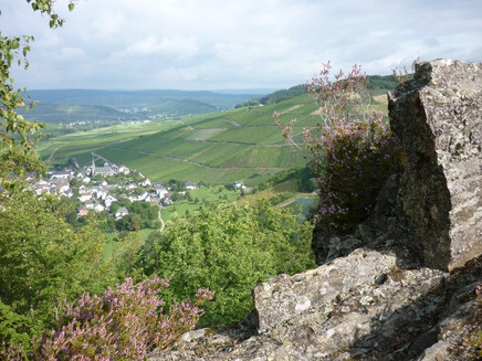
The path now continues above the Mühlgraben through the forest. After a few metres the hiking direction changes and the path takes a steep incline. After a short section you reach a wider path, which soon takes you to the Runder Hammer Felsen (Round Hammer Rock). A short detour to the lookout rock is always worthwhile. In the one direction you can see the houses of Thalveldenz with the castle on the rock spur and in the other direction, Veldenz with the adjacent vineyards. The Langer Hammer rock is not far away. Here, you again have a beautiful view.
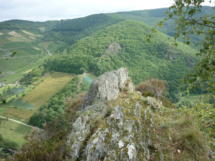
Climbing steeply the path takes you through a lower oak forest. After a short flat section, the next viewing point is reached. Exactly opposite to Veldenz Castle, the path has now reached the height of the castle. An imposing slate rock flanks the next viewing point. Once again, Veldenz Castle is in view, this time the hiker is already higher up than the keep. From here, you continue downhill to the main path. This path again ascends, first through the coniferous forest and later through deciduous forest. At the top you reach a large meadow with an unobstructed view in the direction of the Moselle mountains.
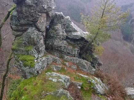
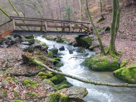
The first, really steep incline is done! You now continue for some time without major height differences through the forest. Through the low oak forest, a path leads through the steep cliff of slate rock. A dream of a path! After some ups and downs on the hillside, you reach a free-standing rock, which again offers an unobstructed view of the Hinterbachtal. From here, you continue only downhill, sometimes on a path and then on a track and at the end it gets really steep. Along a small side stream, the path finally reaches the valley floor of the Hinterbachtal. The Graf Georg Johannes Trail now continues along the rushing stream. The path leads the hiker on a curvy entwined track through the forest and over two footbridges specially built for the Moselsteig Side Trail. There is a shelter where you can take rest in the midst of untouched nature. The only sound to be heard is the rushing of the Hinterbach. The hiking trail continues via a track, past an imposing rock. There used to be mills in the valley of the Hinterbach. Only the building and the mill wheel of the Kaffeemühle (Coffee Mill) still exist. Shortly thereafter, you reach the Thielenmühle (refreshments available).
At the Thielenmühle the Side Trail crosses the Hinterbach for the last time. The path continues uphill. For quite a while the Graf Georg Johannes Trail follows the forest path. A small forest meadow provides variety, before you reach the "Heidenmauer" (Heathen Wall). A large rock and a wall of gathered slate are the remains of a Celtic refuge. Continue downhill along the stone wall. Further down, you reach the Kalmbach, where slate rocks again line the path. Hiking further downhill along the Kalmbach, you finally reach the first houses of Thalveldenz. From here, you can take a detour to Veldenz Castle. The impressive castle complex can only be viewed as part of guided tours.
A forest path takes you uphill again. After the ascent, the path becomes narrower and finally leads as a path through the steep slope. The rocky viewing points of the Rittersturz and Josephinenhöhe are definitely worth a detour. Veldenz, the Veldenz river valley and Veldenz Castle lie at the hiker's feet. You also have a wonderful view of the hiking trail covered. The following path with many turns takes the Side Trail hiker steeply downhill towards Veldenz. Past the Protestant church, you reach the village. The circle closes again on the main road for Side Trail hikers on the Graf Georg Johannes Trail.
Safety Guidelines
Please be careful when hiking on wet rocky sections. Some sections of the trail in the Hinterbachtal can be impassable during floods.
Tip
Must take provisions in backpack. This tour offers wonderful picnic sites (e.g. the meadow to the west of the Mühlheim forest or the Josephinenhöhe).
Getting there
B 53 between Bernkastel and Brauneberg, in Mülheim (Moselle) the K 88 branches off to Veldenz.
Parking
Small parking area in the Hollandstraße behind Tourist Information, large parking area at the outskirts of the town at the K 88 (from Mülheim), also motorhomes.
Public transit
Veldenz can only be reached Mondays to Fridays with the bus line 333 (Bernkastel-Neumagen). Bus stop Veldenz, village.
Literature
Literature (only available in German):
"Seitensprünge Band 2" - 17 Premium-Rundwanderungen von Bernkastel-Kues bis Koblenz von ideemedia
Authors: Ulrike Poller, Wolfgang Todt, Publisher: ideemedia, 160 pages, Format: 11,0 x 16,4 cm, ISBN: 978-3-942779-60-9, 12,95 €
Maps
Leisure Map Moselsteig Trail – Map 2: Trier - Zell (Moselle) (Stages 5 - 14), ISBN: 978-3-89637-420-2
Additional Information
Mosellandtouristik GmbH
Kordelweg 1
54470 Bernkastel-Kues
Phone: +49 (6531) / 97330
www.moselsteig.de
Tourist information office Bernkastel-Kues
Gestade 6
54470 Bernkastel-Kues
Phone: +49 (6531) / 500190
www.bernkastel.de
Pavings
- Asphalt Coating (3%)
- Hiking Trail (46%)
- Path (45%)
- Crushed Rock (6%)
Weather

This tour is presented by: Mosel. Faszination Urlaub, Author: Mosellandtouristik GmbH
