T 13 - Lorettaweg - on the tracks of a strong woman
- start: Trarbach ascent to the Grevenburg ruins
- destination: Trarbach, Brückenstraße - Departure from Grevenburg ruin
- medium
- 5,90 km
- 2 hours 15 minutes
- 280 m
- 384 m
- 104 m
- 80 / 100
- 60 / 100
A scenic route which Countess Loretta used to capture the Elector Balduin on a Moselle boat trip in 1328 and hold him in Starkenburg.
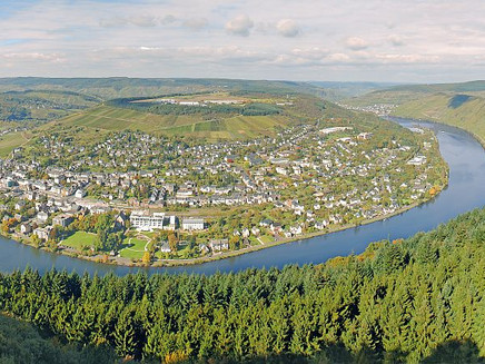
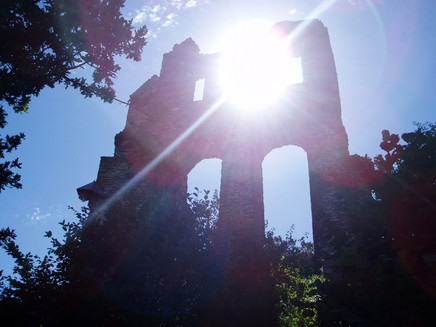
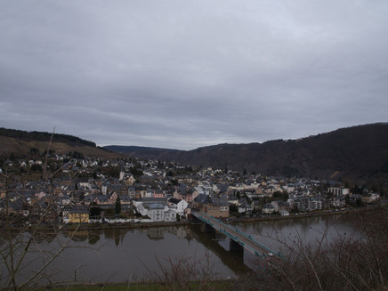
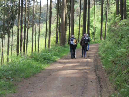
The climb begins in Brückenstraße at the entrance to the Grevenburg ruins. We pass the paths to the war memorial and the Grevenburg on the right side and continue straight ahead. Now it is slowly getting quieter - the everyday noises are left behind and we can fully concentrate on the hike. After crossing a driveway, the path continues over a few steps towards Starkenburg. The forest path leads us to the shelter "Starkenburger Pavillon". Here we can enjoy the fantastic view of the art nouveau town Traben-Trarbach. We also have a view of the village of Enkirch with the Moselle lock and over the heights of Mont Royals. Here the view learns to fly. The path leads behind the refuge past fields and meadows back towards Trarbach. At the "Bismarckhütte" hut, the trail descends through deciduous and fir woods to the Grevenburg ruins. Above the castle ruins, at the so-called "Himmelspforte", we have a wonderful view of the Grevenburg and the town of Traben-Trarbach. After a refreshment in the Burgschenke we take the forest serpentine path to the starting point at the Moselle bridge.
General information
Directions
This trail begins in Brückenstraße at the entrance to the Grevenburg ruins with a steep climb. Here you will also find the first sign with the crown for the "Loretta-Weg" The Loretta-Weg is a section of the Moselle adventure route.We leave the paths to the war memorial and Grevenburg, which branch off shortly after the start, to the right and continue straight uphill. Now it slowly becomes quieter - the everyday noises are left behind and you can concentrate fully on the ascent.After about 1 km, you cross a farm track and return to the Lorettaweg just opposite - here you can see the signs with the crown on the left again.
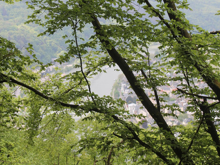
Our tour now leads us on a path that slowly narrows and climbs to our destination - the Starkenburg Pavilion (refuge). Here you can find the award for Loretta-Weg and Moselerlebnisroute.Now you should take your time and let your gaze fly - a wonderful view of the art nouveau town of Traben-Trarbach with the extensive Moselle promenade, the shelter in Traben, Enkirch with barrage, the high-altitude town of Starkenburg and the view over Mont Royal makes you forget all your exertions. After a rest, you can continue your journey in a more relaxed manner. The Loretta Trail leads to the right above the refuge on a rough track past the houses on the left. At the next turn-off - about 150 metres - there is a sign "Moselerlebnisroute" (Moselle adventure route). After about 800 metres the path runs through a small wood and shortly after that it goes down to the right for about 50 metres to the "Bismarckhütte". Here too it is worthwhile to enjoy the view over the landscape once again. Now the path leads us through deciduous and fir forest (about 1.5 km) over beautiful, soft forest soil downhill. Again, follow the signs "Loretta-Weg" and cross a wide path and go downhill on the narrow path opposite for about 200 metres. On the left is a beautiful viewpoint with a bench and a completely new view over Trarbach.
The narrow path leads on an asphalt road past the vineyards down to the Grevenburg ruins.At the car park (here again sign Loretta-Weg) the serpentine path leads through a beautiful forest downhill to the starting point in the bridge road.
Equipment
The path is well walkable in sturdy shoes.
Tip
Alternatively, you can walk back to the starting point behind the castle ruins over a few steps leading to the war memorial. There are several ways to get to Trarbach.
Getting there
by car to the district Trarbach
Parking
free parking at the Mosel bank Trarbach
Public transit
by train: DB to Bullay - from there Moselweinbahn to Traben (about 500 mtr. to the starting point)
Moselbahn bus line 333 from Bullay or Bernkastel-Kues (about 100 mtr. to the starting point)
Maps
Topographic map of trails 1:25.000
Hiking area Moselle region Traben-Trarbach Kröv
ISBN: 978-3-944-620-24-4
Traben-Trarbach hiking map 1:25.000
available at the Traben-Trarbach Tourist Information
Additional Information
Tourist-Information Traben-Trarbach
Am Bahnhof 5
56841 Traben-Trarbach
+49 - (0) 6541-83980
www.traben-trarbach.de
info@traben-trarbach.de
Pavings
- Street (4%)
- Path (49%)
- Hiking Trail (45%)
- Crushed Rock (3%)
Weather
This tour is presented by: Moselregion Traben-Trarbach Kröv, Author: Wiebke Pfitzmann
