Traumpfädchen Eifeltraum
- start: 56727 Mayen-Kürrenberg (Rhododendron parking lot/B 258)
- destination: 56727 Mayen-Kürrenberg (Rhododendron parking lot/B 258)
- easy
- 5,34 km
- 1 hour 45 minutes
- 186 m
- 494 m
- 394 m
- 60 / 100
- 10 / 100
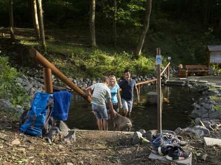
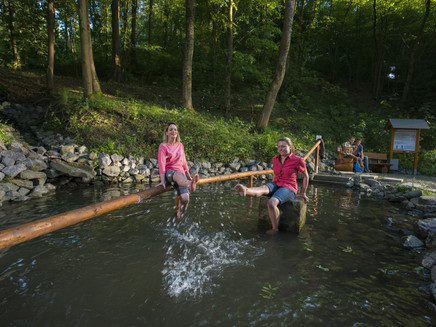
Varied forest sections with shady beeches, rustic oaks and delicate pines alternate with scenic field and meadow sections between Kürrenberg and the Nitztal. A little tip: a refreshing round in the natural Kneipp basin.
Highlights on the Traumpfädchen
- Varied forest sections
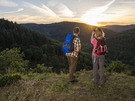
- Panoramic view over the Nitztal from the Bleiberg hut
- Refreshment in the natural Kneipp basin
- Farm shop in Kürrenberg
General information
Directions
The route starts deep in the forest, at the Rhododendron parking lot. The recommended direction is clockwise, so you first follow the wide forest path parallel to the B258 westwards. Even on this first section, the mood rises, thanks to the magnificent beech forest. After the right turn at the first intersection, the traffic noise fades away and you arrive at the Reining hut, in the quiet nature between Kürrenberg and the Nitztal.
After a short meadow section, the path dives into the varied forest, with leaves quietly rustling underfoot. You lose considerable height until you reach a forest road and an intersection. Here the logos point right and the leisurely descent through the forest continues. Deep eroded valleys cross the route, which soon swings gently uphill again.
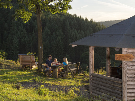
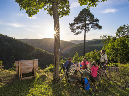
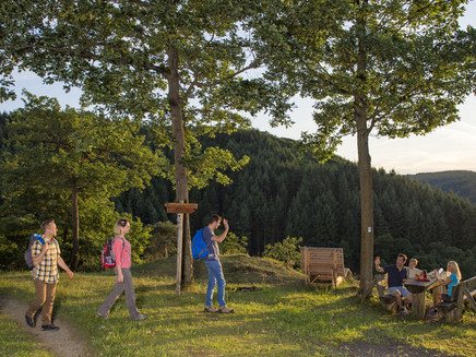
Now the forest becomes really exciting: low-growing oaks create a rustic atmosphere. Then delicate pines join in, stretching their crowns to bright heights. A spicy scent fills the air and golden-yellow broom bushes, as well as the rocks that repeatedly emerge, provide contrast to the greenery of the foliage. The highlight of this wonderful holiday mood is reached at the shelter at Bleiberg, where a rest area and a graceful dream lounger invite you to take a break. The view drifts carefree over the almost untouched Nitztal and the path name "Eifeltraum" perfectly describes the mood.
Further on, the diverse forest continues to fascinate and distracts from the climb back. And already the next highlight awaits: a refreshing round in the natural Kneipp basin! Refreshed in this way, the further ascent is not difficult and after some bends the forest stays behind and the route leads, for a change, through splendid meadows. Occasionally a woodland section interrupts the open landscape, making the views of the surroundings all the more charming. After a final climb, there is one last valley view from the forest edge before it goes back through the bright forest on a path to the starting point of this truly wonderfully relaxing circular hike.
Safety Guidelines
General safety instructions:
Safety instructions - safe hiking on the Traumpfädchen
Hikers want narrow paths, natural trails (over forest soil, grassy paths or along streams) and rocky ascents that lead to spectacular views. Of course, such paths must be walked with special care.
What you should observe during your hike:
- Wear weather-appropriate, functional clothing that protects you from cold and wet or heat and sun.
- Plan your hike with reasonable breaks and conserve your energy.
- Bring enough fluids. Refreshment options are not available everywhere.
- Please wear appropriate hiking boots that provide sufficient support even on slippery and steep or rocky and uneven paths.
- If you think certain sections of the path are not walkable for you, you should avoid or turn back. Especially in adverse weather conditions, natural paths can have muddy and slippery sections.
- In autumn, pay attention that the leaves lying on the ground can conceal unevenness, roots, stones or holes.
- You must expect such path impairments when undertaking a hike.
- Before your hike, inform yourself on the internet at https://www.traumpfade.info/traumpfaedchen/wege-status/ whether the Traumpfädchen you plan to hike is possibly closed, whether detours exist, whether path construction measures or logging or other disturbances are planned.
- Recommended hiking months: April to October.
Equipment
The Traumpfädchen routes are not suitable for prams or walkers.
Path closures can be found at: https://www.traumpfade.info/traumpfaedchen/wege-status/
Getting there
A 48 exit Mayen/Mendig - B 258 direction Nürburgring - past Mayen-Kürrenberg through a roundabout - then right to the hiking car park (56727 Mayen-Kürrenberg)
Parking
56727 Mayen-Kürrenberg, Rhododendron parking lot (on the B 258)
Public transit
Destination stop: Kürrenberg, community centre
Line 380 RegioBus: Kaisersesch - Düngenheim - Kehrig - Mayen - Kürrenberg
Destination stop: Kürrenberg, main street
Line 388 FreizeitBus: Mayen - Langenfeld - Arft - Herresbach - Kürrenberg - Mayen (April 1 to November 1)
Literature
- A beautiful day "traumpfädchen", Ulrike Poller & Wolfgang Todt, ISBN: 978-3-942779-49-4,
- Traumpfade & Traumpfädchen Vol. 2: The 19 best premium circular hikes in the Vordereifel, Ulrike Poller & Wolfgang Todt ISBN: 978-3-934342-61-3
Additional Information
Tourist Information of the city of Mayen, Tel.: 02651/903004, touristinfo@mayenzeit.de,https://www.mayen.de/kultur-tourismus/
Traumpfade project office, Tel.: 0261/108419, info@traumpfade.info, www.traumpfade.info
Traumpfade app
Traumpfade app for iOS: Download app on iTunes
Traumpfade app for Android: Download app on Google Play
Weather

This tour is presented by: Traumpfade im Rhein-Mosel-Eifel-Land, Author: Nicole Pfeifer
