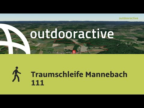
Traumschleife Mannebach 111
- start: Village square at the fire station in Mannebach, parking lot
- destination: Village square at the fire station in Mannebach, parking lot
- difficult
- 12,24 km
- 4 hours 10 minutes
- 332 m
- 395 m
- 237 m
- 80 / 100
- 80 / 100
The route leads over small paths through the Mannebachtal. Quiet and peaceful sections alternate with wonderful views. Special highlights are the green tunnel paths and the Lebensfluss in Fisch.
After crossing the Mannebach at the sports and recreation facility, you go past the caves of Hinkelsgret. The next highlight is already waiting for you: the descent to the "Schaufelstal", which you hike upstream to the western ridge of the Mannebachtal. Upstairs you can enjoy a magnificent view. The next part of the dream loop can be described as a highlight. You can expect a 1 km long section through a "tunnel path", with wonderful views of a raised bog and the village of Mannebach. The path continues to the Lebensfluss at Fisch. Beforehand, enjoy the wide view towards Hunsrück and the 435 m high Hosteberg with its Geheimrat-Brügman-Turm. After about 12 km of moderate difficulty, you reach the orchards on the "Bickel" and your starting point again.
Further starting points are possible at the Lebensfluss in Fisch and the sports and recreation facility Mannebachtal.


General information
Directions
You pass the sports and recreation facility Mannebachtal. After crossing the Mannebach, you go past the caves of Hinkelsgret, where the people of Mannebach hid from the Swedes during the Thirty Years' War. The next highlight is already waiting for you: the descent to the "Schaufelstal", a romantic side valley of the Mannebach, which you hike upstream to the western ridge of the Mannebachtal. Upstairs you can enjoy a magnificent view: into the Schaufelstal, the Moselle mountains near Trier, over the Vorderer Hochwald with the Saar mountains and to the Hosteberg. The next part of the dream loop can be described as a highlight. You can expect a 1 km long section through a "tunnel path", with wonderful views of a raised bog and the village of Mannebach.
The path continues along the trail below the ridge of the Saargau to the Lebensfluss (river of life) at Fisch. Here you can trace the various stages of human life from birth to death along a small river. A picnic at the Fischer Lebensfluss facility is recommended. For this, get cheese, Viez, sausage and other delicacies from the Viezomat at the Viezhof Hunsicker in Kapellenstraße 10a. Beforehand, enjoy the wide view towards Hunsrück and the 435 m high Hosteberg with its Geheimrat-Brügman-Turm. On clear days, you can see in the distance the highest peak of the Hunsrück, the 816-meter-high Erbeskopf. After about 12 km of moderate difficulty, you reach Mannebach again through the orchards on the "Bickel", through the Fischer and the adjoining Mannebachtal via the so-called "Fischer Pfädchen". Around the year 1800, the fishermen retrieved their church bells brought to safety in Mannebach at night via this path in a cloak-and-dagger action, after the people of Mannebach had refused to hand them over.
Further starting points are possible at the Lebensfluss in Fisch and the sports and recreation facility Mannebachtal.
Text and images kindly provided by Werner Weber, Mannebach!
Equipment
Please wear sturdy footwear. The premium hiking trail is not suitable for prams.
Tip
A picnic at the Fischer Lebensfluss facility is recommended. For this, get cheese, Viez, sausage and other delicacies from the Viezomat in Kapellenstraße 10a.
Getting there
From Trier via the B 51 towards Saarburg. After Konz-Könen via Tawern to Mannebach.
From Saarburg via the L 135 to Mannebach-Ort, sports and recreation facility Mannebachtal or Fisch-Lebensfluss.
Parking
Free parking is available at the sports and recreation facility Mannebach and in Hauptstraße (near the volunteer fire brigade).
Public transit
Information on current bus timetables to the stop "Nitteler Straße, Mannebach (Trier-S)" can be found at:www.vrt-info.de/busnetz.
Literature
The free brochure for the Traumschleife Mannebach 111 is available at the tourist information offices in Konz and Saarburg.
Maps
Leisure Map Moselsteig Trail – Map 1: Perl - Trier (Stages 1 - 4), ISBN: 978-3-89637-419-6
Additional Information
Saar-Obermosel-Touristik, Tourist Information Saarburg, Graf-Siegfried-Str. 32, 54439 Saarburg, Tel. 06581-995980
Saar-Obermosel-Touristik, Tourist Information Konz, Saarstr. 1, 54329 Konz, Tel. 06501-6018040
E-mail: info@saar-obermosel.de
Visit our website with exclusive tips and information about the Saar-Obermosel holiday region:
https://www.saar-obermosel.de/
https://www.facebook.com/saarobermosel
https://www.instagram.com/saarobermosel
Weather


This tour is presented by: Saar-Obermosel-Touristik e.V , Author: Saar-Obermosel-Touristik e.V.